
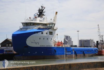
AURORA GALAXY
Cargo
Current Trip
| Time Travelled | 22 days |
|---|---|
| Remaining Time | --- |
| Distance Travelled | 3510.60 nm |
| Remaining Distance | --- |
| AVG Speed | 7.8 Knots |
| MAX Speed | 14 Knots |
| AVG Wind | 25.9 knots |
| MAX Wind | 36 knots |
| MIN Temp | 5.1°C / 41.18°F |
| MAX Temp | 17.6°C / 63.68°F |
| Draught | 4.9 m |
| Position Received | 1 m ago |
Current Position
| Longitude | 29.21442° |
|---|---|
| Latitude | 40.80279° |
| Status | Under way using engine |
| Speed | 7.8 Knots |
| Course | 329° |
| Area | Sea of Marmara |
| Station | T-AIS |
| Position Received | 1 m ago |
Info
Information
The current position of AURORA GALAXY is in Sea of Marmara with coordinates 40.80279° / 29.21442° as reported on 2026-01-09 08:15 by AIS to our vessel tracker app. The vessel's current speed is 7.8 Knots
The vessel AURORA GALAXY (IMO: 9748344, MMSI: 258159000) is a Cargo It's sailing under the flag of [NO] Norway.
In this page you can find informations about the vessels current position, last detected port calls, and current voyage information. If the vessels is not in coverage by AIS you will find the latest position.
The current position of AURORA GALAXY is detected by our AIS receivers and we are not responsible for the reliability of the data. The last position was recorded while the vessel was in Coverage by the Ais receivers of our vessel tracking app.
The current draught of AURORA GALAXY as reported by AIS is 4.9 meters
Weather
| Temperature | 5.1°C / 41.18°F |
|---|---|
| Wind Speed | 16 knots |
| Direction | 256° WSW |
| Pressure | 1012.4 hPa |
| Humidity | 63.3 % |
| Cloud Coverage | 92 % |
Featured Company
Last Port Calls
| Port | Arrival | Departure | Time In Port |
|---|---|---|---|
| 2025-12-04 19:16 | 2025-12-18 09:15 | 13 d | |
| 2025-12-02 11:03 | 2025-12-03 18:44 | 1 d | |
| 2025-11-24 08:45 | 2025-11-25 16:57 | 1 d | |
| 2025-11-20 05:28 | 2025-11-20 18:36 | 13 h | |
| 2025-11-12 16:02 | 2025-11-19 03:46 | 6 d | |
| 2025-11-11 20:32 | 2025-11-12 10:49 | 14 h | |
| 2025-11-06 12:21 |
Most Visited Ports (Last year)
| Port | Arrivals | |
|---|---|---|
| 18 | ||
| 12 | ||
| 8 | ||
| 7 | ||
| 6 | ||
| 4 |
Last Trips
| Origin | Departure | Destination | Arrival | Distance | |
|---|---|---|---|---|---|
| 2025-12-03 18:44 | 2025-12-04 19:16 | 247.68 nm | |||
| 2025-11-25 16:57 | 2025-12-02 11:03 | 333.57 nm | |||
| 2025-11-20 18:36 | 2025-11-24 08:45 | 153.58 nm | |||
| 2025-11-19 03:46 | 2025-11-20 05:28 | 246.82 nm | |||
| 2025-11-12 10:49 | 2025-11-12 16:02 | 47.42 nm | |||
| 2025-11-06 12:21 | 2025-11-11 20:32 | 629.77 nm |
Events
| Time | Event | Details | Position / Dest | Info |
|---|---|---|---|---|
| 2026-01-09 08:14 | START Moving | 2.99 nm, South West of TUZLA |
40.80081 / 29.21590
TR TUZ
|
Speed: 5.8 kn Course: 331.6° |
| 2026-01-06 13:34 | STOP Moving | 3.07 nm, South West of TUZLA |
40.79884 / 29.21594
TR TUZ
|
Speed: 0.3 kn Course: 336° |
| 2026-01-06 06:15 | IN Coverage |
40.70724 / 27.63030
Sea of Marmara
|
Speed: 9.9 kn Course: 68.8° |
|
| 2026-01-06 00:43 | OUT of Coverage |
40.27076 / 26.55080
Sea of Marmara
|
Speed: 13.7 kn Course: 47.3° |
|
| 2026-01-05 22:47 | Change Sea Area | Turkish part of the Sea of Marmara Turkish part of the Aegean Sea |
40.02230 / 26.18607
Sea of Marmara
|
Speed: 8.2 kn Course: 78.1° |
| 2026-01-05 20:53 | Detected in Sea | Turkish part of the Aegean Sea |
39.88327 / 25.90119
Aegean Sea
|
Speed: 8 kn Course: 45.6° |
| 2026-01-05 18:22 | START Moving | 20.61 nm, North of SIGRI |
39.55237 / 25.79278
TR TUZ
|
Speed: 3.3 kn Course: 61° |
| 2026-01-03 22:46 | STOP Moving | 21.15 nm, South West of BOZCAADA |
39.59165 / 25.74440
TR TUZ
|
Speed: 0.1 kn Course: 188° |
| 2026-01-03 16:32 | IN Coverage |
39.03469 / 25.33067
Aegean Sea
TR TUZ
|
Speed: 8.9 kn Course: 30.8° |
|
| 2026-01-03 14:41 | OUT of Coverage |
38.79876 / 25.17211
Aegean Sea
TR TUZ
|
Speed: 9.3 kn Course: 23° |