
AUTO WAY
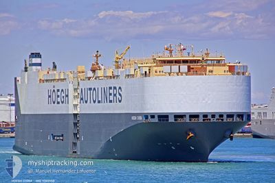
Vehicles Carrier
Current Trip
ES VGO
| Time Travelled | 14 h, 16 mins |
|---|---|
| Remaining Time | --- |
| Distance Travelled | 213.48 nm |
| Remaining Distance | --- |
| AVG Speed | 14.8 Knots |
| MAX Speed | 16.5 Knots |
| AVG Wind | 19.2 knots |
| MAX Wind | 22 knots |
| MIN Temp | 8.9°C / 48.02°F |
| MAX Temp | 13.4°C / 56.12°F |
| Draught | 8.8 m |
| Position Received | 2 m ago |
Current Position
| Longitude | -10.10551° |
|---|---|
| Latitude | 38.95599° |
| Status | Under way using engine |
| Speed | 16.2 Knots |
| Course | 178.9° |
| Area | North Atlantic Ocean |
| Station | T-AIS |
| Position Received | 2 m ago |
Info
Information
The current position of AUTO WAY is in North Atlantic Ocean with coordinates 38.95599° / -10.10551° as reported on 2025-12-22 09:22 by AIS to our vessel tracker app. The vessel's current speed is 16.2 Knots
The vessel AUTO WAY (IMO: 9303558, MMSI: 257824000) is a Vehicles Carrier that was built in 2006 ( 19 years old ). It's sailing under the flag of [NO] Norway.
In this page you can find informations about the vessels current position, last detected port calls, and current voyage information. If the vessels is not in coverage by AIS you will find the latest position.
The current position of AUTO WAY is detected by our AIS receivers and we are not responsible for the reliability of the data. The last position was recorded while the vessel was in Coverage by the Ais receivers of our vessel tracking app.
The current draught of AUTO WAY as reported by AIS is 8.8 meters
Weather
| Temperature | 13.4°C / 56.12°F |
|---|---|
| Wind Speed | 19 knots |
| Direction | 335° NNW |
| Pressure | 1014.1 hPa |
| Humidity | 63.6 % |
| Cloud Coverage | 64 % |
Featured Company
Last Port Calls
| Port | Arrival | Departure | Time In Port |
|---|---|---|---|
| 2025-12-21 06:16 | 2025-12-21 20:08 | 13 h | |
| 2025-12-16 15:51 | 2025-12-18 05:27 | 1 d | |
| 2025-12-13 01:36 | 2025-12-15 00:57 | 1 d | |
| 2025-12-10 06:08 | 2025-12-11 03:11 | 21 h | |
| 2025-11-26 00:01 | 2025-11-27 01:37 | 1 d | |
| 2025-11-23 22:48 | 2025-11-24 20:23 | 21 h | |
| 2025-11-20 09:23 | 2025-11-21 07:53 | 22 h | |
| 2025-11-17 11:09 | 2025-11-18 03:22 | 16 h | |
| 2025-11-13 22:46 | 2025-11-14 21:07 | 22 h | |
| 2025-11-09 19:11 | 2025-11-10 20:30 | 1 d |
Last Trips
| Origin | Departure | Destination | Arrival | Distance | |
|---|---|---|---|---|---|
| 2025-12-18 05:27 | 2025-12-21 06:16 | 776.85 nm | |||
| 2025-12-15 00:57 | 2025-12-16 15:51 | 548.20 nm | |||
| 2025-12-11 03:11 | 2025-12-13 01:36 | 402.80 nm | |||
| 2025-11-27 01:37 | 2025-12-10 06:08 | 3666.48 nm | |||
| 2025-11-24 20:23 | 2025-11-26 00:01 | 402.68 nm | |||
| 2025-11-21 07:53 | 2025-11-23 22:48 | 962.52 nm | |||
| 2025-11-18 03:22 | 2025-11-20 09:23 | 593.61 nm | |||
| 2025-11-14 21:07 | 2025-11-17 11:09 | 976.50 nm | |||
| 2025-11-10 20:30 | 2025-11-13 22:46 | 774.71 nm | |||
| 2025-11-07 23:36 | 2025-11-09 19:11 | 554.95 nm |
Events
| Time | Event | Details | Position / Dest | Info |
|---|---|---|---|---|
| 2025-12-22 09:10 | Change Sea Area | Portuguese part of the North Atlantic Ocean Spanish part of the North Atlantic Ocean |
39.00676 / -10.10616
North Atlantic Ocean
|
Speed: 16.2 kn Course: 180.2° |
| 2025-12-22 09:10 | Status Changed | Under way using engine Default |
39.00842 / -10.10615
ES VGO
|
Speed: 15 kn Course: 179° |
| 2025-12-22 09:10 | IN Coverage |
39.00676 / -10.10616
North Atlantic Ocean
|
Speed: 16.2 kn Course: 180.2° |
|
| 2025-12-21 20:08 | Status Changed | Default Under way using engine |
42.13957 / -8.97169
ES VGO
|
Speed: 11 kn Course: 253.5° |
| 2025-12-21 19:59 | OUT of Coverage |
42.15127 / -8.94022
North Atlantic Ocean
|
Speed: 11 kn Course: 253.5° |
|
| 2025-12-21 19:45 | Status Changed | Under way using engine Default |
42.16714 / -8.88322
ES VGO
|
Speed: 13.3 kn Course: 221° |
| 2025-12-21 19:44 | Status Changed | Default Under way using engine |
42.16989 / -8.87849
ES VGO
|
Speed: 13.6 kn Course: 220.7° |
| 2025-12-21 19:33 | Status Changed | Under way using engine Default |
42.20112 / -8.84279
ES VGO
|
Speed: 13.6 kn Course: 220° |
| 2025-12-21 19:32 | Status Changed | Default Under way using engine |
42.20581 / -8.83741
ES VGO
|
Speed: 13.8 kn Course: 238.2° |
| 2025-12-21 19:09 | START Moving | 0.67 nm, West of VIGO |
42.23731 / -8.75305
ES VGO
|
Speed: 3.5 kn Course: 265° |