
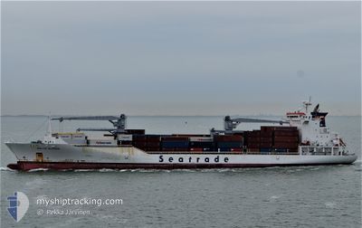
BALTIC KLIPPER
Reefer
Current Trip
| Time Travelled | 9 days |
|---|---|
| Remaining Time | 9 h, 13 mins |
| Distance Travelled | 3962.42 nm |
| Remaining Distance | 181.67 nm |
| AVG Speed | 18.8 Knots |
| MAX Speed | 20.4 Knots |
| AVG Wind | 14.7 knots |
| MAX Wind | 29 knots |
| MIN Temp | 9.2°C / 48.56°F |
| MAX Temp | 26°C / 78.8°F |
| Draught | 9.6 m |
| Position Received | 1 m ago |
Current Position
| Longitude | -0.40192° |
|---|---|
| Latitude | 50.26490° |
| Status | Under way using engine |
| Speed | 18.4 Knots |
| Course | 74.1° |
| Area | English Channel |
| Station | T-AIS |
| Position Received | 1 m ago |
Info
Information
The current position of BALTIC KLIPPER is in English Channel with coordinates 50.26490° / -0.40192° as reported on 2025-02-05 13:55 by AIS to our vessel tracker app. The vessel's current speed is 18.4 Knots and is heading at the port of VLISSINGEN. The estimated time of arrival as calculated by MyShipTracking vessel tracking app is 2025-02-05 23:09 LT
The vessel BALTIC KLIPPER (IMO: 9454759, MMSI: 636014655) is a Reefer that was built in 2010 ( 15 years old ). It's sailing under the flag of [LR] Liberia.
In this page you can find informations about the vessels current position, last detected port calls, and current voyage information. If the vessels is not in coverage by AIS you will find the latest position.
The current position of BALTIC KLIPPER is detected by our AIS receivers and we are not responsible for the reliability of the data. The last position was recorded while the vessel was in Coverage by the Ais receivers of our vessel tracking app.
The current draught of BALTIC KLIPPER as reported by AIS is 9.6 meters
Weather
| Temperature | 9.3°C / 48.74°F |
|---|---|
| Wind Speed | 8 knots |
| Direction | 307° NW |
| Pressure | 1038.9 hPa |
| Humidity | 75.7 % |
| Cloud Coverage | 100 % |
Featured Company
Last Port Calls
| Port | Arrival | Departure | Time In Port |
|---|---|---|---|
| 2025-01-26 04:09 | 2025-01-27 12:12 | 1 d | |
| 2025-01-24 09:43 | 2025-01-24 17:15 | 7 h | |
| 2025-01-21 02:12 | 2025-01-23 18:13 | 2 d | |
| 2025-01-19 09:31 | 2025-01-19 18:39 | 9 h | |
| 2025-01-17 23:19 | 2025-01-18 04:44 | 5 h | |
| 2025-01-17 02:52 | 2025-01-17 12:07 | 9 h | |
| 2025-01-16 03:54 | 2025-01-16 17:42 | 13 h | |
| 2025-01-04 07:42 | 2025-01-05 15:25 | 1 d | |
| 2025-01-01 23:13 | 2025-01-03 17:40 | 1 d | |
| 2024-12-22 02:14 | 2024-12-23 02:30 | 1 d |
Most Visited Ports (Last year)
| Port | Arrivals | |
|---|---|---|
| 11 | ||
| 11 | ||
| 11 | ||
| 10 | ||
| 10 | ||
| 10 |
Last Trips
| Origin | Departure | Destination | Arrival | Distance | |
|---|---|---|---|---|---|
| 2025-01-24 12:15 | 2025-01-26 00:09 | 650.88 nm | |||
| 2025-01-23 13:13 | 2025-01-24 04:43 | 282.33 nm | |||
| 2025-01-19 14:39 | 2025-01-20 21:12 | 618.54 nm | |||
| 2025-01-18 00:44 | 2025-01-19 05:31 | 494.41 nm | |||
| 2025-01-17 08:07 | 2025-01-17 19:19 | 197.43 nm | |||
| 2025-01-16 13:42 | 2025-01-16 22:52 | 152.11 nm | |||
| 2025-01-05 15:25 | 2025-01-15 23:54 | 3998.12 nm | |||
| 2025-01-03 18:40 | 2025-01-04 07:42 | 208.82 nm | |||
| 2024-12-22 22:30 | 2025-01-02 00:13 | 3998.01 nm | |||
| 2024-12-20 10:18 | 2024-12-21 22:14 | 652.39 nm |
Events
| Time | Event | Details | Position / Dest | Info |
|---|---|---|---|---|
| 2025-02-05 13:25 | Draught Changed | 9.6 9.7 |
50.22797 / -.63518
NLVLI
|
Speed: 19.4 kn Course: 74.7° |
| 2025-02-05 13:25 | ETA Changed | 2026/01/05 22:30 2025/02/05 07:30 |
50.22797 / -.63518
NLVLI
|
Speed: 19.4 kn Course: 74.7° |
| 2025-02-05 12:47 | Change Sea Area | United Kingdom part of the English Channel Guernsey part of the English Channel |
50.17322 / -.94817
English Channel
|
Speed: 19.6 kn Course: 75.9° |
| 2025-02-05 12:45 | Status Changed | Under way using engine Default |
50.17025 / -.96607
NLVLI
|
Speed: 19.6 kn Course: 75° |
| 2025-02-05 12:45 | IN Coverage |
50.17322 / -.94817
English Channel
|
Speed: 19.6 kn Course: 75.9° |
|
| 2025-02-05 09:19 | Status Changed | Default Under way using engine |
49.88887 / -2.59478
NLVLI
|
Speed: 17.7 kn Course: 75.9° |
| 2025-02-05 09:12 | OUT of Coverage |
49.88023 / -2.65086
English Channel
NLVLI
|
Speed: 17.7 kn Course: 75.9° |
|
| 2025-02-05 08:53 | Status Changed | Under way using engine Default |
49.85295 / -2.78361
NLVLI
|
Speed: 17.8 kn Course: 75° |
| 2025-02-05 07:59 | Status Changed | Default Under way using engine |
49.75326 / -3.16304
NLVLI
|
Speed: 17.6 kn Course: 64.8° |
| 2025-02-05 07:23 | Status Changed | Under way using engine Default |
49.67961 / -3.41441
NLVLI
|
Speed: 17.7 kn Course: 66° |