
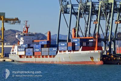
BARBARA P
Container Ship
Current Trip
| Time Travelled | 20 mins |
|---|---|
| Remaining Time | 14 h, 42 mins |
| Distance Travelled | 2.99 nm |
| Remaining Distance | 145.41 nm |
| AVG Speed | 16.1 Knots |
| MAX Speed | 16.1 Knots |
| AVG Wind | 10.4 knots |
| MAX Wind | 10.4 knots |
| MIN Temp | 17.7°C / 63.86°F |
| MAX Temp | 17.7°C / 63.86°F |
| Draught | 7.9 m |
| Position Received | Now |
Current Position
| Longitude | -16.14604° |
|---|---|
| Latitude | 28.49566° |
| Status | Under way using engine |
| Speed | 16.7 Knots |
| Course | 62.1° |
| Area | North Atlantic Ocean |
| Station | T-AIS |
| Position Received | Now |
Information
The current position of BARBARA P is in North Atlantic Ocean with coordinates 28.49566° / -16.14604° as reported on 2025-05-30 03:02 by AIS to our vessel tracker app. The vessel's current speed is 16.7 Knots and is heading at the port of ARRECIFE. The estimated time of arrival as calculated by MyShipTracking vessel tracking app is 2025-05-30 17:45 LT
The vessel BARBARA P (IMO: 9144720, MMSI: 255805600) is a Container Ship that was built in 1997 ( 28 years old ). It's sailing under the flag of [PT] Portugal.
In this page you can find informations about the vessels current position, last detected port calls, and current voyage information. If the vessels is not in coverage by AIS you will find the latest position.
The current position of BARBARA P is detected by our AIS receivers and we are not responsible for the reliability of the data. The last position was recorded while the vessel was in Coverage by the Ais receivers of our vessel tracking app.
The current draught of BARBARA P as reported by AIS is 7.9 meters
Weather
| Temperature | 17.7°C / 63.86°F |
|---|---|
| Wind Speed | 10 knots |
| Direction | 334° NNW |
| Pressure | 1019.3 hPa |
| Humidity | 83.9 % |
| Cloud Coverage | 84 % |
Featured Company
Last Port Calls
| Port | Arrival | Departure | Time In Port |
|---|---|---|---|
| 2025-05-29 10:37 | 2025-05-30 02:43 | 16 h | |
| 2025-05-28 05:40 | 2025-05-29 05:51 | 1 d | |
| 2025-05-24 09:55 | 2025-05-24 20:34 | 10 h | |
| 2025-05-23 08:23 | 2025-05-23 23:11 | 14 h | |
| 2025-05-21 05:24 | 2025-05-21 14:51 | 9 h | |
| 2025-05-20 04:36 | 2025-05-20 16:36 | 12 h | |
| 2025-05-16 07:05 | 2025-05-16 13:28 | 6 h | |
| 2025-05-15 06:32 | 2025-05-15 20:54 | 14 h | |
| 2025-05-14 05:48 | 2025-05-15 02:20 | 20 h | |
| 2025-05-10 10:56 | 2025-05-10 21:26 | 10 h |
Most Visited Ports (Last year)
| Port | Arrivals | |
|---|---|---|
| 51 | ||
| 45 | ||
| 26 | ||
| 26 | ||
| 25 |
Last Trips
| Origin | Departure | Destination | Arrival | Distance | |
|---|---|---|---|---|---|
| 2025-05-29 06:51 | 2025-05-29 11:37 | 54.37 nm | |||
| 2025-05-24 22:34 | 2025-05-28 06:40 | 1105.16 nm | |||
| 2025-05-24 01:11 | 2025-05-24 11:55 | 152.32 nm | |||
| 2025-05-21 16:51 | 2025-05-23 10:23 | 5.82 nm | |||
| 2025-05-20 18:36 | 2025-05-21 07:24 | 154.66 nm | |||
| 2025-05-16 14:28 | 2025-05-20 06:36 | 1007.04 nm | |||
| 2025-05-15 21:54 | 2025-05-16 08:05 | 149.28 nm | |||
| 2025-05-15 03:20 | 2025-05-15 07:32 | 54.86 nm | |||
| 2025-05-10 23:26 | 2025-05-14 06:48 | 1105.40 nm | |||
| 2025-05-10 02:37 | 2025-05-10 12:56 | 152.90 nm |
Events
| Time | Event | Details | Position / Dest | Info |
|---|---|---|---|---|
| 2025-05-30 02:56 | Draught Changed | 7.9 8.6 |
28.48324 / -16.17448
ES ACE
|
Speed: 16.5 kn Course: 68.7° |
| 2025-05-30 02:56 | ETA Changed | 2025/05/30 12:15 2025/05/30 15:30 |
28.48324 / -16.17448
ES ACE
|
Speed: 16.5 kn Course: 68.7° |
| 2025-05-30 02:43 | PORT DEPARTURE |
|
28.47857 / -16.23021
ES ACE
|
Speed: 8.2 kn Course: 142° |
| 2025-05-30 02:38 | START Moving |
28.48818 / -16.22426
[ES] TENERIFE
|
Speed: 3.3 kn Course: 222° |
|
| 2025-05-30 02:30 | Status Changed | Under way using engine Moored |
28.48910 / -16.22227
[ES] TENERIFE
|
Speed: Course: 262° |
| 2025-05-30 02:30 | Destination Changed | ES ACE ESSCT |
28.48910 / -16.22227
[ES] TENERIFE
|
Speed: Course: 262° |
| 2025-05-30 02:30 | ETA Changed | 2025/05/30 15:30 2025/05/29 11:30 |
28.48910 / -16.22227
[ES] TENERIFE
|
Speed: Course: 262° |
| 2025-05-29 13:05 | Status Changed | Moored Under way using engine |
28.48914 / -16.22228
[ES] TENERIFE
|
Speed: 0.1 kn Course: 263° |
| 2025-05-29 10:57 | STOP Moving |
28.48902 / -16.22234
[ES] TENERIFE
|
Speed: 0.3 kn Course: 263° |
|
| 2025-05-29 10:37 | PORT ARRIVAL |
|
28.48036 / -16.23027
[ES] TENERIFE
|
Speed: 5.7 kn Course: 336.1° |