
BEE
General Cargo
Current Trip
| Time Travelled | 4 days |
|---|---|
| Remaining Time | --- |
| Distance Travelled | 668.30 nm |
| Remaining Distance | --- |
| AVG Speed | 9 Knots |
| MAX Speed | 14 Knots |
| AVG Wind | 10.6 knots |
| MAX Wind | 21 knots |
| MIN Temp | -2°C / 28.4°F |
| MAX Temp | 12.1°C / 53.78°F |
| Draught | 4.1 m |
| Position Received | 2 d ago |
Current Position
| Longitude | 29.26186° |
|---|---|
| Latitude | 41.26042° |
| Status | Under way using engine |
| Speed | 10.1 Knots |
| Course | 87.7° |
| Area | Black Sea |
| Station | T-AIS |
| Position Received | 2 d ago |
Info
Information
The current position of BEE is in Black Sea with coordinates 41.26042° / 29.26186° as reported on 2026-01-02 19:49 by AIS to our vessel tracker app. The vessel's current speed is 10.1 Knots
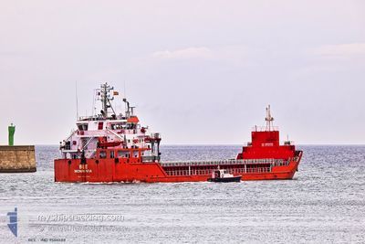
The vessel BEE (IMO: 9506588, MMSI: 636016745) is a General Cargo that was built in 2011 ( 15 years old ). It's sailing under the flag of [LR] Liberia.
In this page you can find informations about the vessels current position, last detected port calls, and current voyage information. If the vessels is not in coverage by AIS you will find the latest position.
The current position of BEE is detected by our AIS receivers and we are not responsible for the reliability of the data. The last position was recorded while the vessel was in Coverage by the Ais receivers of our vessel tracking app.
The current draught of BEE as reported by AIS is 4.1 meters
Weather
| Temperature | 12°C / 53.6°F |
|---|---|
| Wind Speed | 9 knots |
| Direction | 76° ENE |
| Pressure | 1022 hPa |
| Humidity | 65.5 % |
| Cloud Coverage | 98 % |
Featured Company
Last Port Calls
| Port | Arrival | Departure | Time In Port |
|---|---|---|---|
| 2025-12-29 11:41 | 2026-01-01 01:32 | 2 d | |
| 2025-12-25 06:02 | 2025-12-26 15:48 | 1 d | |
| 2025-12-03 10:34 | 2025-12-04 19:45 | 1 d | |
| 2025-12-01 04:06 | 2025-12-02 21:03 | 1 d | |
| 2025-11-22 15:35 | 2025-11-28 14:33 | 5 d | |
| 2025-11-04 11:21 | 2025-11-07 14:16 | 3 d | |
| 2025-11-02 00:20 |
Last Trips
| Origin | Departure | Destination | Arrival | Distance | |
|---|---|---|---|---|---|
| 2025-12-26 15:48 | 2025-12-29 11:41 | 283.95 nm | |||
| 2025-12-04 19:45 | 2025-12-25 06:02 | 3335.43 nm | |||
| 2025-12-02 21:03 | 2025-12-03 10:34 | 132.15 nm | |||
| 2025-11-28 14:33 | 2025-12-01 04:06 | 610.55 nm | |||
| 2025-11-07 14:16 | 2025-11-22 15:35 | 2931.59 nm | |||
| 2025-11-02 00:20 | 2025-11-04 11:21 | 532.26 nm |
Events
| Time | Event | Details | Position / Dest | Info |
|---|---|---|---|---|
| 2026-01-05 04:53 | STOP Moving | 1.89 nm, West of POTI |
42.16272 / 41.60779
GEPTI
|
Speed: 0.2 kn Course: 93° |
| 2026-01-02 19:53 | Status Changed | Default Under way using engine |
41.26089 / 29.27497
GEPTI
|
Speed: 10.1 kn Course: 87.7° |
| 2026-01-02 19:49 | OUT of Coverage |
41.26042 / 29.26186
Black Sea
GEPTI
|
Speed: 10.1 kn Course: 87.7° |
|
| 2026-01-02 19:47 | Status Changed | Under way using engine Default |
41.26009 / 29.25362
GEPTI
|
Speed: 10.2 kn Course: 70° |
| 2026-01-02 19:41 | Status Changed | Default Under way using engine |
41.25451 / 29.23190
GEPTI
|
Speed: 10.2 kn Course: 69.7° |
| 2026-01-02 19:19 | Change Sea Area | Turkish part of the Black Sea Turkish part of the Sea of Marmara |
41.23332 / 29.15539
Black Sea
GEPTI
|
Speed: 10.5 kn Course: 66.2° |
| 2026-01-02 16:01 | START Moving | 7.69 nm, South West of KARTAL |
40.78665 / 29.09052
GEPTI
|
Speed: 3.3 kn Course: 324° |
| 2026-01-02 14:32 | STOP Moving | 8.92 nm, South of MALTEPE |
40.77470 / 29.06546
GEPTI
|
Speed: 0.3 kn Course: 263° |
| 2026-01-02 14:19 | START Moving | 8.2 nm, South of MALTEPE |
40.78537 / 29.07339
GEPTI
|
Speed: 3.2 kn Course: 225° |
| 2026-01-02 13:39 | STOP Moving | 8.58 nm, South of MALTEPE |
40.78075 / 29.06555
GEPTI
|
Speed: 0.3 kn Course: 263° |