
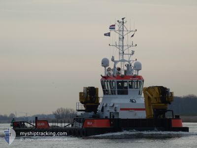
BELLA
Tug
Current Trip
| Time Travelled | 6 days |
|---|---|
| Remaining Time | --- |
| Distance Travelled | 226.76 nm |
| Remaining Distance | --- |
| AVG Speed | 7.2 Knots |
| MAX Speed | 7.2 Knots |
| AVG Wind | 10.2 knots |
| MAX Wind | 19.8 knots |
| MIN Temp | 18.7°C / 65.66°F |
| MAX Temp | 22.6°C / 72.68°F |
| Draught | 2 m |
| Position Received | 1 m ago |
Current Position
| Longitude | 54.53688° |
|---|---|
| Latitude | 24.70000° |
| Status | Under way using engine |
| Speed | |
| Course | 53° |
| Area | Persian Gulf |
| Station | T-AIS |
| Position Received | 1 m ago |
Info
Information
The current position of BELLA is in Persian Gulf with coordinates 24.70000° / 54.53688° as reported on 2025-02-11 22:44 by AIS to our vessel tracker app. The vessel's current speed is 0 Knots
The vessel BELLA (IMO: 9966207, MMSI: 246994000) is a Tug It's sailing under the flag of [NL] Netherlands.
In this page you can find informations about the vessels current position, last detected port calls, and current voyage information. If the vessels is not in coverage by AIS you will find the latest position.
The current position of BELLA is detected by our AIS receivers and we are not responsible for the reliability of the data. The last position was recorded while the vessel was in Coverage by the Ais receivers of our vessel tracking app.
The current draught of BELLA as reported by AIS is 2 meters
Weather
| Temperature | 20.9°C / 69.62°F |
|---|---|
| Wind Speed | 9 knots |
| Direction | 46° NE |
| Pressure | 1016.7 hPa |
| Humidity | 72.6 % |
| Cloud Coverage | 4 % |
Featured Company
Most Visited Ports (Last year)
| Port | Arrivals | |
|---|---|---|
| 3 |
Last Trips
| Origin | Departure | Destination | Arrival | Distance |
|---|
Events
| Time | Event | Details | Position / Dest | Info |
|---|---|---|---|---|
| 2025-02-11 17:35 | STOP Moving | 9.43 nm, South West of KHALIFA |
24.70185 / 54.53989
KHALIFA
|
Speed: 0.3 kn Course: 98° |
| 2025-02-11 17:29 | START Moving | 9.36 nm, South West of KHALIFA |
24.70257 / 54.54084
KHALIFA
|
Speed: 3.1 kn Course: 44° |
| 2025-02-11 16:46 | STOP Moving | 9.62 nm, South West of KHALIFA |
24.70000 / 54.53717
KHALIFA
|
Speed: 0.3 kn Course: 231° |
| 2025-02-11 16:43 | START Moving | 9.47 nm, South West of KHALIFA |
24.70054 / 54.54012
KHALIFA
|
Speed: 4.5 kn Course: 248° |
| 2025-02-11 16:39 | STOP Moving | 9.36 nm, South West of KHALIFA |
24.70206 / 54.54145
KHALIFA
|
Speed: 0.1 kn Course: 264° |
| 2025-02-11 16:21 | START Moving | 7.89 nm, South West of KHALIFA |
24.71854 / 54.56146
KHALIFA
|
Speed: 5.3 kn Course: 164.5° |
| 2025-02-11 12:39 | STOP Moving | 7.79 nm, South West of KHALIFA |
24.72024 / 54.56228
KHALIFA
|
Speed: 0.1 kn Course: 49° |
| 2025-02-11 12:07 | START Moving | 11.3 nm, South West of KHALIFA |
24.68858 / 54.50736
KHALIFA
|
Speed: 7.4 kn Course: 85.3° |
| 2025-02-11 12:00 | STOP Moving | 11.43 nm, South West of KHALIFA |
24.68815 / 54.50469
KHALIFA
|
Speed: 0.2 kn Course: 244° |
| 2025-02-11 11:22 | START Moving | 7.59 nm, South West of KHALIFA |
24.73347 / 54.55502
KHALIFA
|
Speed: 7 kn Course: 220.7° |