
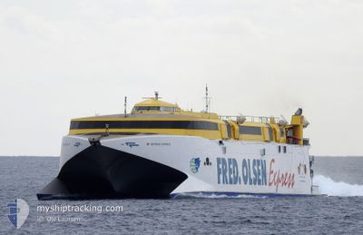
BENTAGO EXPRESS
High speed craft
Current Trip
| Trip Time | 1 h, 52 mins |
|---|---|
| Trip Distance | 65.42 nm |
| AVG Speed | 22.8 Knots |
| MAX Speed | 22.8 Knots |
| Draught | 3.8 m |
| AVG Wind | 5.7 knots |
| MAX Wind | 6.5 knots |
| MIN Temp | 18.1°C / 64.58°F |
| MAX Temp | 18.4°C / 65.12°F |
| Position Received | 4 h, 31 m ago |
Current Position
| Longitude | -16.85160° |
|---|---|
| Latitude | 27.97741° |
| Status | Under way using engine |
| Speed | 36.7 Knots |
| Course | 258.4° |
| Area | North Atlantic Ocean |
| Station | T-AIS |
| Position Received | 4 h, 31 m ago |
Info
Information
The current position of BENTAGO EXPRESS is in North Atlantic Ocean with coordinates 27.97741° / -16.85160° as reported on 2025-02-08 12:13 by AIS to our vessel tracker app. The vessel's current speed is 36.7 Knots and is currently inside the port of PUERTO DE LA ESTACA.
The vessel BENTAGO EXPRESS (IMO: 9213337, MMSI: 224689000) is a High speed craft that was built in 2000 ( 25 years old ). It's sailing under the flag of [ES] Spain.
In this page you can find informations about the vessels current position, last detected port calls, and current voyage information. If the vessels is not in coverage by AIS you will find the latest position.
The current position of BENTAGO EXPRESS is detected by our AIS receivers and we are not responsible for the reliability of the data. The last position was recorded while the vessel was in Coverage by the Ais receivers of our vessel tracking app.
The current draught of BENTAGO EXPRESS as reported by AIS is 3.8 meters
Weather
| Temperature | 18.5°C / 65.3°F |
|---|---|
| Wind Speed | 4 knots |
| Direction | 81° E |
| Pressure | 1022 hPa |
| Humidity | 68.7 % |
| Cloud Coverage | --- |
Featured Company
Last Port Calls
| Port | Arrival | Departure | Time In Port |
|---|---|---|---|
| 2025-02-08 13:51 | |||
| 2025-02-08 10:52 | 2025-02-08 11:59 | 1 h | |
| 2025-02-07 19:03 | 2025-02-08 09:03 | 14 h | |
| 2025-02-07 16:09 | 2025-02-07 17:05 | 56 m | |
| 2025-02-06 19:03 | 2025-02-07 14:11 | 19 h | |
| 2025-02-06 16:00 | 2025-02-06 17:00 | 1 h | |
| 2025-02-05 19:07 | 2025-02-06 14:03 | 18 h | |
| 2025-02-05 15:58 | 2025-02-05 17:04 | 1 h | |
| 2025-02-04 19:07 | 2025-02-05 14:03 | 18 h | |
| 2025-02-04 16:00 | 2025-02-04 17:03 | 1 h |
Most Visited Ports (Last year)
| Port | Arrivals | |
|---|---|---|
| 443 | ||
| 432 | ||
| 154 | ||
| 91 | ||
| 91 | ||
| 66 |
Last Trips
| Origin | Departure | Destination | Arrival | Distance | |
|---|---|---|---|---|---|
| 2025-02-08 11:59 | 2025-02-08 13:51 | 65.42 nm | |||
| 2025-02-08 09:03 | 2025-02-08 10:52 | 64.53 nm | |||
| 2025-02-07 17:05 | 2025-02-07 19:03 | 64.88 nm | |||
| 2025-02-07 14:11 | 2025-02-07 16:09 | 64.99 nm | |||
| 2025-02-06 17:00 | 2025-02-06 19:03 | 65.02 nm | |||
| 2025-02-06 14:03 | 2025-02-06 16:00 | 64.86 nm | |||
| 2025-02-05 17:04 | 2025-02-05 19:07 | 65.23 nm | |||
| 2025-02-05 14:03 | 2025-02-05 15:58 | 64.45 nm | |||
| 2025-02-04 17:03 | 2025-02-04 19:07 | 65.31 nm | |||
| 2025-02-04 14:03 | 2025-02-04 16:00 | 65.71 nm |
Events
| Time | Event | Details | Position / Dest | Info |
|---|---|---|---|---|
| 2025-02-08 13:59 | STOP Moving |
27.78352 / -17.90125
[ES] PUERTO DE LA ESTACA
|
Speed: Course: 189° |
|
| 2025-02-08 13:51 | PORT ARRIVAL |
|
27.77990 / -17.90084
[ES] PUERTO DE LA ESTACA
|
Speed: 8.5 kn Course: 262° |
| 2025-02-08 12:18 | Status Changed | Default Under way using engine |
27.96751 / -16.90484
VDE-CRT-VDE
|
Speed: 36.7 kn Course: 258.4° |
| 2025-02-08 12:13 | OUT of Coverage |
27.97741 / -16.85160
North Atlantic Ocean
|
Speed: 36.7 kn Course: 258.4° |
|
| 2025-02-08 11:59 | PORT DEPARTURE |
|
28.03447 / -16.72034
VDE-CRT-VDE
|
Speed: 16 kn Course: 202° |
| 2025-02-08 11:58 | Status Changed | Under way using engine Default |
28.04210 / -16.71651
[ES] LOS CRISTIANOS
|
Speed: 0.9 kn Course: 119° |
| 2025-02-08 11:58 | START Moving |
28.04210 / -16.71651
[ES] LOS CRISTIANOS
|
Speed: 16 kn Course: 202° |
|
| 2025-02-08 11:47 | IN Coverage |
28.04210 / -16.71651
North Atlantic Ocean
[ES] LOS CRISTIANOS
|
Speed: 16 kn Course: 202.6° |
|
| 2025-02-08 10:59 | Status Changed | Default Under way using engine |
28.04744 / -16.71823
[ES] LOS CRISTIANOS
|
Speed: 7.5 kn Course: 21° |
| 2025-02-08 10:53 | OUT of Coverage |
28.04293 / -16.71752
North Atlantic Ocean
[ES] LOS CRISTIANOS
|
Speed: 7.5 kn Course: 22.8° |