

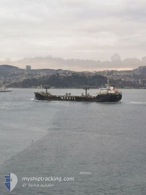
BLAIR MCKEIL
General Cargo

Current Trip
| Time Travelled | 1 day |
|---|---|
| Remaining Time | --- |
| Distance Travelled | 517.31 nm |
| Remaining Distance | --- |
| AVG Speed | 10.4 Knots |
| MAX Speed | 13.5 Knots |
| AVG Wind | 10.8 knots |
| MAX Wind | 19 knots |
| MIN Temp | 10.2°C / 50.36°F |
| MAX Temp | 28°C / 82.4°F |
| Draught | 6 m |
| Position Received | 2 m ago |
Current Position
| Longitude | -79.19509° |
|---|---|
| Latitude | 43.11644° |
| Status | Under way using engine |
| Speed | |
| Course | 6° |
| Area | Gulf of St-Lawrence |
| Station | T-AIS |
| Position Received | 2 m ago |
Information
The current position of BLAIR MCKEIL is in Gulf of St-Lawrence with coordinates 43.11644° / -79.19509° as reported on 2025-06-05 19:38 by AIS to our vessel tracker app. The vessel's current speed is 0 Knots and is heading at the port of VALLEYFIELD. The estimated time of arrival as calculated by MyShipTracking vessel tracking app is 2025-06-07 13:00 LT
The vessel BLAIR MCKEIL (IMO: 9546045, MMSI: 316040355) is a General Cargo that was built in 2010 ( 15 years old ). It's sailing under the flag of [CA] Canada.
In this page you can find informations about the vessels current position, last detected port calls, and current voyage information. If the vessels is not in coverage by AIS you will find the latest position.
The current position of BLAIR MCKEIL is detected by our AIS receivers and we are not responsible for the reliability of the data. The last position was recorded while the vessel was in Coverage by the Ais receivers of our vessel tracking app.
The current draught of BLAIR MCKEIL as reported by AIS is 6 meters
Weather
| Temperature | 19.8°C / 67.64°F |
|---|---|
| Wind Speed | 8 knots |
| Direction | 23° NNE |
| Pressure | 1016.9 hPa |
| Humidity | 73 % |
| Cloud Coverage | 100 % |


Featured Company
Last Port Calls
| Port | Arrival | Departure | Time In Port |
|---|---|---|---|
| 2025-06-01 02:56 | 2025-06-03 18:04 | 2 d | |
| 2025-06-01 00:32 | 2025-06-01 02:11 | 1 h | |
| 2025-05-29 06:50 | 2025-05-29 18:11 | 11 h | |
| 2025-05-28 01:31 | 2025-05-28 02:16 | 44 m | |
| 2025-05-25 02:04 | 2025-05-28 00:12 | 2 d | |
| 2025-05-25 00:24 | 2025-05-25 01:35 | 1 h | |
| 2025-05-23 21:58 | 2025-05-24 00:47 | 2 h | |
| 2025-05-23 00:16 | 2025-05-23 13:59 | 13 h | |
| 2025-05-22 00:12 | 2025-05-22 17:20 | 17 h | |
| 2025-05-20 03:54 | 2025-05-21 20:15 | 1 d |
Most Visited Ports (Last year)
| Port | Arrivals | |
|---|---|---|
| 22 | ||
| 15 | ||
| 14 | ||
| 13 | ||
| 5 | ||
| 4 |
Last Trips
| Origin | Departure | Destination | Arrival | Distance | |
|---|---|---|---|---|---|
| 2025-06-01 02:11 | 2025-06-01 02:56 | 1.79 nm | |||
| 2025-05-29 18:11 | 2025-06-01 00:32 | 401.59 nm | |||
| 2025-05-28 02:16 | 2025-05-29 06:50 | 377.89 nm | |||
| 2025-05-28 00:12 | 2025-05-28 01:31 | 2.43 nm | |||
| 2025-05-25 01:35 | 2025-05-25 02:04 | 0.51 nm | |||
| 2025-05-24 00:47 | 2025-05-25 00:24 | 283.61 nm | |||
| 2025-05-23 13:59 | 2025-05-23 21:58 | 91.63 nm | |||
| 2025-05-22 17:20 | 2025-05-23 00:16 | 87.13 nm | |||
| 2025-05-21 20:15 | 2025-05-22 00:12 | 41.21 nm | |||
| 2025-05-19 04:52 | 2025-05-20 03:54 | 283.98 nm |
Events
| Time | Event | Details | Position / Dest | Info |
|---|---|---|---|---|
| 2025-06-05 19:04 | STOP Moving | 5.84 nm, South East of DALHOUSIE |
43.11649 / -79.19524
CAVLF
|
Speed: 0.3 kn Course: 11° |
| 2025-06-05 16:55 | START Moving | 1.32 nm, North of PORT COLBORNE |
42.90317 / -79.24506
CAVLF
|
Speed: 3.5 kn Course: 7° |
| 2025-06-05 16:41 | STOP Moving | 1.03 nm, North of PORT COLBORNE |
42.89843 / -79.24613
CAVLF
|
Speed: 0.1 kn Course: 9° |
| 2025-06-05 09:49 | Status Changed | Under way using engine Default |
42.24637 / -80.74360
CAVLF
|
Speed: 12.7 kn Course: 71° |
| 2025-06-05 09:40 | IN Coverage |
42.24893 / -80.73381
Gulf of St-Lawrence
CAVLF
|
Speed: 12.7 kn Course: 70.6° |
|
| 2025-06-05 05:12 | Status Changed | Default Under way using engine |
41.92965 / -81.99037
CAVLF
|
Speed: 12.8 kn Course: 71.3° |
| 2025-06-05 05:06 | OUT of Coverage |
41.92276 / -82.01746
Gulf of St-Lawrence
CAVLF
|
Speed: 12.8 kn Course: 71.3° |
|
| 2025-06-05 05:03 | Status Changed | Under way using engine Default |
41.91833 / -82.03492
CAVLF
|
Speed: 12.8 kn Course: 71° |
| 2025-06-05 05:00 | Status Changed | Default Under way using engine |
41.91549 / -82.04618
CAVLF
|
Speed: 12.8 kn Course: 71.4° |
| 2025-06-05 04:53 | Status Changed | Under way using engine Default |
41.90728 / -82.07880
CAVLF
|
Speed: 12.8 kn Course: 71° |