
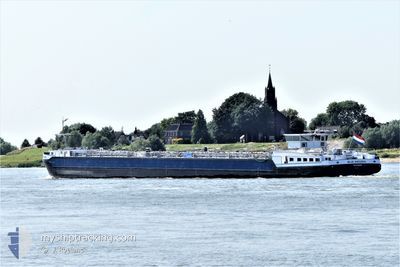
BLUE ANOUSKA
Tanker
Current Trip
| Time Travelled | 5 days |
|---|---|
| Remaining Time | --- |
| Distance Travelled | 12.07 nm |
| Remaining Distance | --- |
| AVG Speed | 7.9 Knots |
| MAX Speed | 9.4 Knots |
| AVG Wind | 3.4 knots |
| MAX Wind | 14.6 knots |
| MIN Temp | 4.3°C / 39.74°F |
| MAX Temp | 5.9°C / 42.62°F |
| Draught | 1.8 m |
| Position Received | 12 h, 51 m ago |
Current Position
| Longitude | 5.68646° |
|---|---|
| Latitude | 50.79621° |
| Status | Under way using engine |
| Speed | 9.1 Knots |
| Course | 335.2° |
| Area | North Sea |
| Station | T-AIS |
| Position Received | 12 h, 51 m ago |
Info
Information
The current position of BLUE ANOUSKA is in North Sea with coordinates 50.79621° / 5.68646° as reported on 2025-02-07 14:29 by AIS to our vessel tracker app. The vessel's current speed is 9.1 Knots
The vessel BLUE ANOUSKA (MMSI: 244723788) is a Tanker It's sailing under the flag of [NL] Netherlands.
In this page you can find informations about the vessels current position, last detected port calls, and current voyage information. If the vessels is not in coverage by AIS you will find the latest position.
The current position of BLUE ANOUSKA is detected by our AIS receivers and we are not responsible for the reliability of the data. The last position was recorded while the vessel was in Coverage by the Ais receivers of our vessel tracking app.
The current draught of BLUE ANOUSKA as reported by AIS is 1.8 meters
Weather
| Temperature | 4.4°C / 39.92°F |
|---|---|
| Wind Speed | 15 knots |
| Direction | 96° E |
| Pressure | 1023.2 hPa |
| Humidity | 69.8 % |
| Cloud Coverage | 100 % |
Featured Company
Last Port Calls
| Port | Arrival | Departure | Time In Port |
|---|---|---|---|
| 2025-02-02 12:34 | 2025-02-02 12:48 | 14 m | |
| 2025-02-02 03:40 | 2025-02-02 03:49 | 8 m | |
| 2025-01-31 16:36 | 2025-02-01 18:38 | 1 d | |
| 2025-01-31 07:55 | 2025-01-31 14:21 | 6 h | |
| 2025-01-29 11:28 | 2025-01-31 05:23 | 1 d | |
| 2025-01-28 21:25 | 2025-01-29 11:04 | 13 h | |
| 2025-01-27 21:56 | 2025-01-28 13:10 | 15 h | |
| 2025-01-25 23:34 | 2025-01-26 20:13 | 20 h | |
| 2025-01-25 12:54 | 2025-01-25 14:08 | 1 h | |
| 2025-01-25 09:33 | 2025-01-25 11:32 | 1 h |
Most Visited Ports (Last year)
| Port | Arrivals | |
|---|---|---|
| 41 | ||
| 28 | ||
| 20 | ||
| 20 | ||
| 17 | ||
| 16 |
Last Trips
| Origin | Departure | Destination | Arrival | Distance | |
|---|---|---|---|---|---|
| 2025-02-02 04:49 | 2025-02-02 13:34 | 40.80 nm | |||
| 2025-02-01 19:38 | 2025-02-02 04:40 | 66.92 nm | |||
| 2025-01-31 15:21 | 2025-01-31 17:36 | 21.38 nm | |||
| 2025-01-31 06:23 | 2025-01-31 08:55 | 18.18 nm | |||
| 2025-01-29 12:04 | 2025-01-29 12:28 | 2.50 nm | |||
| 2025-01-28 14:10 | 2025-01-28 22:25 | 53.56 nm | |||
| 2025-01-26 21:13 | 2025-01-27 22:56 | 53.45 nm | |||
| 2025-01-25 15:08 | 2025-01-26 00:34 | 71.39 nm | |||
| 2025-01-25 12:32 | 2025-01-25 13:54 | 10.02 nm | |||
| 2025-01-23 12:04 | 2025-01-25 10:33 | 46.08 nm |
Events
| Time | Event | Details | Position / Dest | Info |
|---|---|---|---|---|
| 2025-02-07 14:29 | OUT of Coverage |
50.79621 / 5.68646
North Sea
|
Speed: 9.1 kn Course: 335.2° |
|
| 2025-02-07 14:28 | IN Coverage |
50.79422 / 5.68775
North Sea
|
Speed: 9.2 kn Course: 343.6° |
|
| 2025-02-02 14:26 | OUT of Coverage |
50.78736 / 5.68904
North Sea
|
Speed: 8.7 kn Course: 180.2° |
|
| 2025-02-02 12:48 | PORT DEPARTURE |
|
50.93461 / 5.50214
WANDRE PETROLEUM PR
|
Speed: 6.6 kn Course: 112.9° |
| 2025-02-02 12:48 | START Moving |
50.93508 / 5.50031
[BE] GENK
|
Speed: 6.6 kn Course: 112.9° |
|
| 2025-02-02 12:34 | STOP Moving |
50.93632 / 5.49144
[BE] GENK
|
Speed: 0.1 kn Course: 511° |
|
| 2025-02-02 12:34 | PORT ARRIVAL |
|
50.93632 / 5.49144
[BE] GENK
|
Speed: 1.2 kn Course: 511° |
| 2025-02-02 12:11 | Status Changed | Under way using engine Default |
50.93724 / 5.45118
WANDRE PETROLEUM PR
|
Speed: 8 kn Course: 99° |
| 2025-02-02 12:09 | Status Changed | Default Under way using engine |
50.93778 / 5.44332
WANDRE PETROLEUM PR
|
Speed: 7.9 kn Course: 100.3° |
| 2025-02-02 12:09 | START Moving | 2.22 nm, West of GENK |
50.93796 / 5.44159
WANDRE PETROLEUM PR
|
Speed: 7.9 kn Course: 100.3° |