

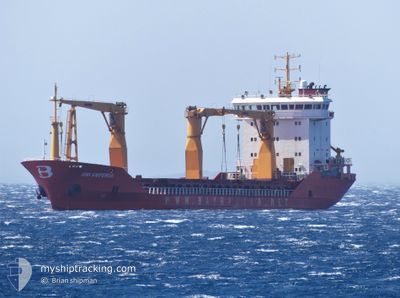
BMI EMPEROR
General Cargo

Current Trip
| Time Travelled | 10 days |
|---|---|
| Remaining Time | --- |
| Distance Travelled | 870.09 nm |
| Remaining Distance | --- |
| AVG Speed | 8.9 Knots |
| MAX Speed | 12.5 Knots |
| AVG Wind | 9.3 knots |
| MAX Wind | 30 knots |
| MIN Temp | 16.1°C / 60.98°F |
| MAX Temp | 25.1°C / 77.18°F |
| Draught | 7 m |
| Position Received | Now |
Current Position
| Longitude | 35.00336° |
|---|---|
| Latitude | 32.89012° |
| Status | At anchor |
| Speed | |
| Course | 270° |
| Area | Mediterranean Sea - Eastern Basin |
| Station | T-AIS |
| Position Received | Now |
Information
The current position of BMI EMPEROR is in Mediterranean Sea - Eastern Basin with coordinates 32.89012° / 35.00336° as reported on 2025-06-07 22:13 by AIS to our vessel tracker app. The vessel's current speed is 0 Knots
The vessel BMI EMPEROR (IMO: 9310331, MMSI: 636023224) is a General Cargo that was built in 2005 ( 20 years old ). It's sailing under the flag of [LR] Liberia.
In this page you can find informations about the vessels current position, last detected port calls, and current voyage information. If the vessels is not in coverage by AIS you will find the latest position.
The current position of BMI EMPEROR is detected by our AIS receivers and we are not responsible for the reliability of the data. The last position was recorded while the vessel was in Coverage by the Ais receivers of our vessel tracking app.
The current draught of BMI EMPEROR as reported by AIS is 7 meters
Weather
| Temperature | 23.8°C / 74.84°F |
|---|---|
| Wind Speed | 3 knots |
| Direction | 252° WSW |
| Pressure | 1010.4 hPa |
| Humidity | 72.3 % |
| Cloud Coverage | --- |


Featured Company
Last Port Calls
| Port | Arrival | Departure | Time In Port |
|---|---|---|---|
| 2025-05-28 17:34 | 2025-05-28 18:52 | 1 h | |
| 2025-05-23 01:18 | 2025-05-26 15:06 | 3 d | |
| 2025-04-28 11:18 | 2025-04-30 03:52 | 1 d | |
| 2025-04-19 23:12 | 2025-04-20 00:40 | 1 h |
Last Trips
| Origin | Departure | Destination | Arrival | Distance | |
|---|---|---|---|---|---|
| 2025-05-26 15:06 | 2025-05-28 17:34 | 470.28 nm | |||
| 2025-04-30 03:52 | 2025-05-23 01:18 | 1443.20 nm | |||
| 2025-04-20 00:40 | 2025-04-28 11:18 | 862.69 nm | |||
| 2025-03-24 14:42 | 2025-04-19 23:12 | 1886.84 nm |
Events
| Time | Event | Details | Position / Dest | Info |
|---|---|---|---|---|
| 2025-06-07 11:16 | Status Changed | At anchor Default |
32.88990 / 35.00339
ILHFA
|
Speed: Course: 285° |
| 2025-06-07 11:13 | Status Changed | Default At anchor |
32.88990 / 35.00344
ILHFA
|
Speed: Course: 281° |
| 2025-06-06 16:04 | Status Changed | At anchor Default |
32.88887 / 35.00234
ILHFA
|
Speed: Course: 342° |
| 2025-06-06 16:01 | Status Changed | Default At anchor |
32.88891 / 35.00237
ILHFA
|
Speed: Course: 340° |
| 2025-06-06 10:52 | Status Changed | At anchor Default |
32.88965 / 35.00333
ILHFA
|
Speed: Course: 287° |
| 2025-06-06 10:49 | Status Changed | Default At anchor |
32.88965 / 35.00336
ILHFA
|
Speed: Course: 286° |
| 2025-06-03 17:40 | Status Changed | At anchor Default |
32.88953 / 35.00329
ILHFA
|
Speed: 0.1 kn Course: 296° |
| 2025-06-03 17:37 | Status Changed | Default At anchor |
32.88949 / 35.00320
ILHFA
|
Speed: 0.1 kn Course: 295° |
| 2025-06-03 17:04 | Status Changed | At anchor Default |
32.88951 / 35.00328
ILHFA
|
Speed: 0.1 kn Course: 287° |
| 2025-06-03 17:01 | Status Changed | Default At anchor |
32.88957 / 35.00324
ILHFA
|
Speed: Course: 285° |