

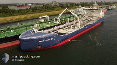
BORIS SOKOLOV
Tanker
Current Trip
FOR ORDERS
| Time Travelled | 7 days |
|---|---|
| Remaining Time | --- |
| Distance Travelled | 1954.52 nm |
| Remaining Distance | --- |
| AVG Speed | 11.3 Knots |
| MAX Speed | 13.9 Knots |
| AVG Wind | 8.2 knots |
| MAX Wind | 24 knots |
| MIN Temp | -6.7°C / 19.94°F |
| MAX Temp | 10.1°C / 50.18°F |
| Draught | 12 m |
| Position Received | 1 m ago |
Current Position
| Longitude | 3.99770° |
|---|---|
| Latitude | 61.96672° |
| Status | Under way using engine |
| Speed | 11.4 Knots |
| Course | 179.4° |
| Area | Norwegian Sea |
| Station | T-AIS |
| Position Received | 1 m ago |
Information
The current position of BORIS SOKOLOV is in Norwegian Sea with coordinates 61.96672° / 3.99770° as reported on 2025-06-10 02:21 by AIS to our vessel tracker app. The vessel's current speed is 11.4 Knots
The vessel BORIS SOKOLOV (IMO: 9817315, MMSI: 209387000) is a Tanker It's sailing under the flag of [CY] Cyprus.
In this page you can find informations about the vessels current position, last detected port calls, and current voyage information. If the vessels is not in coverage by AIS you will find the latest position.
The current position of BORIS SOKOLOV is detected by our AIS receivers and we are not responsible for the reliability of the data. The last position was recorded while the vessel was in Coverage by the Ais receivers of our vessel tracking app.
The current draught of BORIS SOKOLOV as reported by AIS is 12 meters
Weather
| Temperature | 9.7°C / 49.46°F |
|---|---|
| Wind Speed | 6 knots |
| Direction | 121° ESE |
| Pressure | 1009.4 hPa |
| Humidity | 74.6 % |
| Cloud Coverage | 100 % |
Featured Company
Last Port Calls
| Port | Arrival | Departure | Time In Port |
|---|---|---|---|
| 2025-06-03 02:53 | |||
| 2025-05-19 20:02 | 2025-05-22 02:44 | 2 d | |
| 2025-05-09 10:42 | 2025-05-10 10:43 | 1 d | |
| 2025-04-26 22:26 | 2025-04-27 08:17 | 9 h | |
| 2025-04-25 13:35 | 2025-04-26 22:15 | 1 d | |
| 2025-04-14 08:54 | 2025-04-16 22:30 | 2 d |
Most Visited Ports (Last year)
| Port | Arrivals | |
|---|---|---|
| 15 | ||
| 14 | ||
| 1 |
Last Trips
| Origin | Departure | Destination | Arrival | Distance | |
|---|---|---|---|---|---|
| 2025-05-10 10:43 | 2025-05-19 20:02 | 2647.96 nm | |||
| 2025-04-27 08:17 | 2025-05-09 10:42 | 2630.37 nm | |||
| 2025-04-26 22:15 | 2025-04-26 22:26 | 1.93 nm | |||
| 2025-04-16 22:30 | 2025-04-25 13:35 | 2600.59 nm | |||
| 2025-03-30 17:46 | 2025-04-14 08:54 | 2690.93 nm |
Events
| Time | Event | Details | Position / Dest | Info |
|---|---|---|---|---|
| 2025-06-09 16:21 | Status Changed | Under way using engine Default |
63.68780 / 4.81783
FOR ORDERS
|
Speed: 12 kn Course: 208° |
| 2025-06-09 15:59 | Status Changed | Default Under way using engine |
63.75241 / 4.89676
FOR ORDERS
|
Speed: 11.9 kn Course: 208.1° |
| 2025-06-09 15:47 | Status Changed | Under way using engine Default |
63.78836 / 4.94017
FOR ORDERS
|
Speed: 11.9 kn Course: 207° |
| 2025-06-09 15:30 | IN Coverage |
63.78836 / 4.94017
Norwegian Sea
FOR ORDERS
|
Speed: 11.9 kn Course: 207.6° |
|
| 2025-06-08 22:26 | Status Changed | Default Under way using engine |
66.84367 / 8.25652
FOR ORDERS
|
Speed: 11.3 kn Course: 203.8° |
| 2025-06-08 22:12 | Status Changed | Under way using engine Default |
66.88392 / 8.30219
FOR ORDERS
|
Speed: 11.5 kn Course: 205° |
| 2025-06-08 22:12 | IN Coverage |
66.88392 / 8.30219
Norwegian Sea
FOR ORDERS
|
Speed: 11.3 kn Course: 203.8° |
|
| 2025-06-08 22:12 | OUT of Coverage |
66.88392 / 8.30219
Norwegian Sea
FOR ORDERS
|
Speed: 11.3 kn Course: 203.8° |
|
| 2025-06-08 20:10 | Status Changed | Default Under way using engine |
67.23331 / 8.68207
FOR ORDERS
|
Speed: 11 kn Course: 199.9° |
| 2025-06-08 19:59 | OUT of Coverage |
67.26557 / 8.71218
Norwegian Sea
FOR ORDERS
|
Speed: 11 kn Course: 199.9° |