
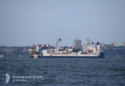
CABLE ENTERPRISE
Deck Cargo Pontoon
Current Trip
CVOW OWF USA
| Time Travelled | 2 days |
|---|---|
| Remaining Time | --- |
| Distance Travelled | 32.56 nm |
| Remaining Distance | --- |
| AVG Speed | 6.3 Knots |
| MAX Speed | 7.2 Knots |
| AVG Wind | 10.2 knots |
| MAX Wind | 12.7 knots |
| MIN Temp | 3.9°C / 39.02°F |
| MAX Temp | 7.1°C / 44.78°F |
| Draught | 5 m |
| Position Received | 2 h, 31 m ago |
Current Position
| Longitude | -75.64812° |
|---|---|
| Latitude | 36.80540° |
| Status | Restricted manoeuverability |
| Speed | 0.5 Knots |
| Course | 85° |
| Area | North Atlantic Ocean |
| Station | T-AIS |
| Position Received | 2 h, 31 m ago |
Info
Information
The current position of CABLE ENTERPRISE is in North Atlantic Ocean with coordinates 36.80540° / -75.64812° as reported on 2025-02-11 17:17 by AIS to our vessel tracker app. The vessel's current speed is 0.5 Knots
The vessel CABLE ENTERPRISE (IMO: 8645806, MMSI: 235093018) is a Deck Cargo Pontoon that was built in 2001 ( 24 years old ). It's sailing under the flag of [GB] United Kingdom.
In this page you can find informations about the vessels current position, last detected port calls, and current voyage information. If the vessels is not in coverage by AIS you will find the latest position.
The current position of CABLE ENTERPRISE is detected by our AIS receivers and we are not responsible for the reliability of the data. The last position was recorded while the vessel was in Coverage by the Ais receivers of our vessel tracking app.
The current draught of CABLE ENTERPRISE as reported by AIS is 5 meters
Weather
| Temperature | 3.9°C / 39.02°F |
|---|---|
| Wind Speed | 12 knots |
| Direction | 81° E |
| Pressure | 1028 hPa |
| Humidity | 75.6 % |
| Cloud Coverage | 100 % |
Featured Company
Last Port Calls
| Port | Arrival | Departure | Time In Port |
|---|---|---|---|
| 2025-01-25 11:32 | 2025-02-08 15:43 | 14 d | |
| 2024-12-31 08:55 | 2025-01-01 09:07 | 1 d | |
| 2024-12-06 15:40 | 2024-12-09 21:37 | 3 d | |
| 2024-12-02 16:17 |
Events
| Time | Event | Details | Position / Dest | Info |
|---|---|---|---|---|
| 2025-02-11 17:17 | OUT of Coverage |
36.80540 / -75.64812
North Atlantic Ocean
|
Speed: 0.5 kn Course: 354.5° |
|
| 2025-02-11 17:17 | IN Coverage |
36.80540 / -75.64812
North Atlantic Ocean
|
Speed: 0.5 kn Course: 354.5° |
|
| 2025-02-09 01:09 | OUT of Coverage |
36.80853 / -75.76347
North Atlantic Ocean
CVOW OWF USA
|
Speed: 6.6 kn Course: 98.9° |
|
| 2025-02-08 23:49 | ETA Changed | 2025/02/09 02:30 2025/02/08 21:30 |
36.89692 / -75.91140
CVOW OWF USA
|
Speed: 6.6 kn Course: 132.9° |
| 2025-02-08 20:43 | PORT DEPARTURE |
|
37.00423 / -76.26668
CVOW OWF USA
|
Speed: 6.3 kn Course: 81° |
| 2025-02-08 19:16 | ETA Changed | 2025/02/08 21:30 2025/02/08 20:00 |
36.88293 / -76.33495
[US] NORFOLK
|
Speed: 6.7 kn Course: 354° |
| 2025-02-08 19:00 | START Moving |
36.86165 / -76.31755
[US] NORFOLK
|
Speed: 3.3 kn Course: 310° |
|
| 2025-02-08 18:12 | Status Changed | Under way using engine Moored |
36.86413 / -76.31245
[US] NORFOLK
|
Speed: Course: 48° |
| 2025-02-08 16:49 | Draught Changed | 5 4.9 |
36.86415 / -76.31248
[US] NORFOLK
|
Speed: Course: 48° |
| 2025-02-08 16:49 | Destination Changed | CVOW OWF USA NORFOLK USA |
36.86415 / -76.31248
[US] NORFOLK
|
Speed: Course: 48° |