
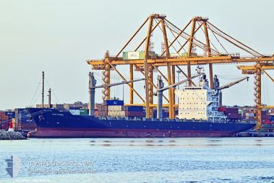
CALYPSO
Container Ship
Current Trip
| Time Travelled | 45 days |
|---|---|
| Remaining Time | --- |
| Distance Travelled | 2114.05 nm |
| Remaining Distance | 18.49 nm |
| AVG Speed | 11.3 Knots |
| MAX Speed | 16.4 Knots |
| AVG Wind | 7.2 knots |
| MAX Wind | 19 knots |
| MIN Temp | 10.8°C / 51.44°F |
| MAX Temp | 28.7°C / 83.66°F |
| Draught | 9.6 m |
| Position Received | 2025-11-16 02:26 |
Current Position
| Longitude | -14.75357° |
|---|---|
| Latitude | 9.24185° |
| Status | Under way using engine |
| Speed | 12.3 Knots |
| Course | 90° |
| Area | North Atlantic Ocean |
| Station | T-AIS |
| Position Received | 2025-11-16 02:26 |
Info
Information
The current position of CALYPSO is in North Atlantic Ocean with coordinates 9.24185° / -14.75357° as reported on 2025-11-16 02:26 by AIS to our vessel tracker app. The vessel's current speed is 12.3 Knots and is heading at the port of CONAKRY.
The vessel CALYPSO (IMO: 9550371, MMSI: 636019574) is a Container Ship that was built in 2010 ( 15 years old ). It's sailing under the flag of [LR] Liberia.
In this page you can find informations about the vessels current position, last detected port calls, and current voyage information. If the vessels is not in coverage by AIS you will find the latest position.
The current position of CALYPSO is detected by our AIS receivers and we are not responsible for the reliability of the data. The last position was recorded while the vessel was in Coverage by the Ais receivers of our vessel tracking app.
The current draught of CALYPSO as reported by AIS is 9.6 meters
Weather
| Temperature | 27.2°C / 80.96°F |
|---|---|
| Wind Speed | 13 knots |
| Direction | 250° WSW |
| Pressure | 1011 hPa |
| Humidity | 73.3 % |
| Cloud Coverage | 96 % |
Featured Company
Last Port Calls
| Port | Arrival | Departure | Time In Port |
|---|---|---|---|
| 2025-11-07 17:59 | 2025-11-08 14:28 | 20 h | |
| 2025-10-24 21:55 | 2025-10-25 23:41 | 1 d |
Most Visited Ports (Last year)
| Port | Arrivals | |
|---|---|---|
| 9 | ||
| 8 | ||
| 7 | ||
| 5 | ||
| 5 | ||
| 3 |
Last Trips
| Origin | Departure | Destination | Arrival | Distance | |
|---|---|---|---|---|---|
| 2025-10-25 23:41 | 2025-11-07 17:59 | 2311.49 nm | |||
| 2025-09-13 00:51 | 2025-10-24 21:55 | 1500.47 nm |
Events
| Time | Event | Details | Position / Dest | Info |
|---|---|---|---|---|
| 2025-12-19 16:16 | STOP Moving | 15.58 nm, South of KASSA |
9.22640 / -13.82070
CONAKRY
|
Speed: 0.1 kn Course: 199° |
| 2025-12-19 13:12 | START Moving | 5.33 nm, South East of KASSA |
9.40485 / -13.69010
CONAKRY
|
Speed: 3.6 kn Course: 207° |
| 2025-12-19 10:33 | STOP Moving | 5.07 nm, South East of KASSA |
9.40922 / -13.69163
CONAKRY
|
Speed: 0.3 kn Course: 94° |
| 2025-12-19 07:20 | START Moving | 15.66 nm, South of KASSA |
9.22652 / -13.82562
CONAKRY
|
Speed: 3.4 kn Course: 37° |
| 2025-12-14 14:44 | STOP Moving | 15.77 nm, South of KASSA |
9.22467 / -13.82593
CONAKRY
|
Speed: Course: 198° |
| 2025-12-14 11:39 | START Moving | 5.52 nm, South East of KASSA |
9.39775 / -13.69478
CONAKRY
|
Speed: 6.7 kn Course: 211° |
| 2025-12-14 08:29 | STOP Moving | 5.25 nm, South East of KASSA |
9.40367 / -13.69408
CONAKRY
|
Speed: 0.2 kn Course: 66° |
| 2025-12-14 05:51 | START Moving | 16.2 nm, South of KASSA |
9.22145 / -13.83840
CONAKRY
|
Speed: 3.1 kn Course: 114° |