

CAPT EUGENE
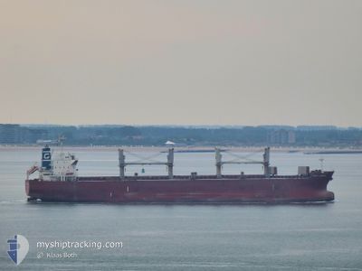
Bulk Carrier

Current Trip
PANAMA CANAL
| Time Travelled | 13 days |
|---|---|
| Remaining Time | --- |
| Distance Travelled | 1374.70 nm |
| Remaining Distance | --- |
| AVG Speed | 11.9 Knots |
| MAX Speed | 14.5 Knots |
| AVG Wind | 8.8 knots |
| MAX Wind | 16 knots |
| MIN Temp | 21.1°C / 69.98°F |
| MAX Temp | 34°C / 93.2°F |
| Draught | 12.2 m |
| Position Received | 4 d ago |
Current Position
| Longitude | -90.01429° |
|---|---|
| Latitude | 29.78743° |
| Status | Under way using engine |
| Speed | 13.6 Knots |
| Course | 210.8° |
| Area | Gulf of Mexico |
| Station | T-AIS |
| Position Received | 4 d ago |
Information
The current position of CAPT EUGENE is in Gulf of Mexico with coordinates 29.78743° / -90.01429° as reported on 2025-05-29 02:03 by AIS to our vessel tracker app. The vessel's current speed is 13.6 Knots
The vessel CAPT EUGENE (IMO: 9478767, MMSI: 352644000) is a Bulk Carrier that was built in 2010 ( 15 years old ). It's sailing under the flag of [PA] Panama.
In this page you can find informations about the vessels current position, last detected port calls, and current voyage information. If the vessels is not in coverage by AIS you will find the latest position.
The current position of CAPT EUGENE is detected by our AIS receivers and we are not responsible for the reliability of the data. The last position was recorded while the vessel was in Coverage by the Ais receivers of our vessel tracking app.
The current draught of CAPT EUGENE as reported by AIS is 12.2 meters
Weather
| Temperature | 28.5°C / 83.3°F |
|---|---|
| Wind Speed | 3 knots |
| Direction | 42° NE |
| Pressure | 1009.6 hPa |
| Humidity | 75.4 % |
| Cloud Coverage | 92 % |


Featured Company
Last Port Calls
| Port | Arrival | Departure | Time In Port |
|---|---|---|---|
| 2025-05-18 14:19 | 2025-05-19 16:40 | 1 d | |
| 2025-05-08 21:52 | 2025-05-15 23:07 | 7 d | |
| 2025-04-22 10:48 | 2025-04-29 20:00 | 7 d | |
| 2025-04-12 18:14 | 2025-04-19 16:16 | 6 d | |
| 2025-04-04 09:48 |
Most Visited Ports (Last year)
| Port | Arrivals | |
|---|---|---|
| 3 | ||
| 2 | ||
| 2 | ||
| 2 | ||
| 1 | ||
| 1 |
Last Trips
| Origin | Departure | Destination | Arrival | Distance | |
|---|---|---|---|---|---|
| 2025-05-15 23:07 | 2025-05-18 14:19 | 716.97 nm | |||
| 2025-04-29 20:00 | 2025-05-08 21:52 | 771.39 nm | |||
| 2025-04-19 16:16 | 2025-04-22 10:48 | 687.31 nm | |||
| 2025-04-04 09:48 | 2025-04-12 18:14 | 687.53 nm |
Events
| Time | Event | Details | Position / Dest | Info |
|---|---|---|---|---|
| 2025-05-29 02:09 | Status Changed | Default Under way using engine |
29.76728 / -90.02537
PANAMA CANAL
|
Speed: 13.6 kn Course: 210.8° |
| 2025-05-29 02:03 | OUT of Coverage |
29.78743 / -90.01429
Gulf of Mexico
PANAMA CANAL
|
Speed: 13.6 kn Course: 210.8° |
|
| 2025-05-28 23:40 | Draught Changed | 12.2 10.1 |
29.95544 / -90.15299
PANAMA CANAL
|
Speed: 13.2 kn Course: 66.1° |
| 2025-05-28 23:40 | Destination Changed | PANAMA CANAL USMSY |
29.95544 / -90.15299
PANAMA CANAL
|
Speed: 13.2 kn Course: 66.1° |
| 2025-05-28 23:40 | ETA Changed | 2025/06/02 21:00 2025/05/18 11:00 |
29.95544 / -90.15299
PANAMA CANAL
|
Speed: 13.2 kn Course: 66.1° |
| 2025-05-28 23:34 | Status Changed | Under way using engine Default |
29.93719 / -90.17437
USMSY
|
Speed: 13.2 kn Course: 51° |
| 2025-05-28 23:16 | Status Changed | Default Under way using engine |
29.94683 / -90.22185
USMSY
|
Speed: 13.7 kn Course: 121.7° |
| 2025-05-28 23:04 | IN Coverage |
29.97190 / -90.26178
Gulf of Mexico
|
Speed: 13.9 kn Course: 92.1° |
|
| 2025-05-28 23:04 | Status Changed | Under way using engine Default |
29.97192 / -90.26477
USMSY
|
Speed: 13.7 kn Course: 64° |
| 2025-05-28 21:21 | START Moving | 6.22 nm, East of LUTCHER |
30.05195 / -90.57742
USMSY
|
Speed: 5.1 kn Course: 85° |