
CAPTAIN AMIR
General Cargo
Current Trip
| Time Travelled | 5 days |
|---|---|
| Remaining Time | 3 h, 14 mins |
| Distance Travelled | 235.06 nm |
| Remaining Distance | 212.10 nm |
| AVG Speed | 9.7 Knots |
| MAX Speed | 11.3 Knots |
| AVG Wind | 15.3 knots |
| MAX Wind | 27 knots |
| MIN Temp | -3.7°C / 25.34°F |
| MAX Temp | 13.2°C / 55.76°F |
| Draught | 6.6 m |
| Position Received | 14 d ago |
Current Position
| Longitude | 28.68128° |
|---|---|
| Latitude | 44.12950° |
| Status | Moored |
| Speed | 9.8 Knots |
| Course | 353° |
| Area | Black Sea |
| Station | T-AIS |
| Position Received | 14 d ago |
Info
Information
The current position of CAPTAIN AMIR is in Black Sea with coordinates 44.12950° / 28.68128° as reported on 2025-12-21 14:23 by AIS to our vessel tracker app. The vessel's current speed is 9.8 Knots and is heading at the port of CONSTANTA. The estimated time of arrival as calculated by MyShipTracking vessel tracking app is 2026-01-04 22:51 LT
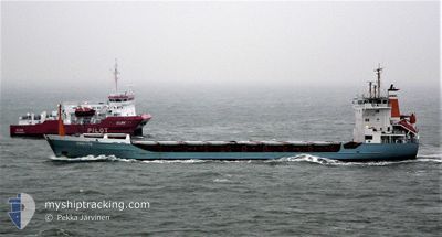
The vessel CAPTAIN AMIR (IMO: 8913071, MMSI: 667001723) is a General Cargo that was built in 1991 ( 35 years old ). It's sailing under the flag of [SL] Sierra Leone.
In this page you can find informations about the vessels current position, last detected port calls, and current voyage information. If the vessels is not in coverage by AIS you will find the latest position.
The current position of CAPTAIN AMIR is detected by our AIS receivers and we are not responsible for the reliability of the data. The last position was recorded while the vessel was in Coverage by the Ais receivers of our vessel tracking app.
The current draught of CAPTAIN AMIR as reported by AIS is 6.6 meters
Weather
| Temperature | 10.3°C / 50.54°F |
|---|---|
| Wind Speed | 15 knots |
| Direction | 160° SSE |
| Pressure | 1017.2 hPa |
| Humidity | 78.4 % |
| Cloud Coverage | 12 % |
Featured Company
Last Port Calls
| Port | Arrival | Departure | Time In Port |
|---|---|---|---|
| 2025-12-26 01:20 | 2025-12-30 16:32 | 4 d | |
| 2025-12-17 20:26 | 2025-12-22 23:34 | 5 d | |
| 2025-12-14 06:12 | 2025-12-16 17:45 | 2 d | |
| 2025-12-11 05:05 | 2025-12-12 20:30 | 1 d | |
| 2025-11-29 15:49 | 2025-12-04 16:20 | 5 d | |
| 2025-11-27 01:32 | 2025-11-28 14:53 | 1 d | |
| 2025-11-13 16:20 | 2025-11-20 23:24 | 7 d | |
| 2025-11-09 23:18 | 2025-11-11 18:12 | 1 d | |
| 2025-11-05 23:52 | 2025-11-08 09:39 | 2 d | |
| 2025-11-04 14:28 |
Last Trips
| Origin | Departure | Destination | Arrival | Distance | |
|---|---|---|---|---|---|
| 2025-12-22 23:34 | 2025-12-26 01:20 | 394.08 nm | |||
| 2025-12-16 17:45 | 2025-12-17 20:26 | 228.71 nm | |||
| 2025-12-12 20:30 | 2025-12-14 06:12 | 83.79 nm | |||
| 2025-12-04 16:20 | 2025-12-11 05:05 | 265.58 nm | |||
| 2025-11-28 14:53 | 2025-11-29 15:49 | 263.29 nm | |||
| 2025-11-20 23:24 | 2025-11-27 01:32 | 253.05 nm | |||
| 2025-11-11 18:12 | 2025-11-13 16:20 | 214.02 nm | |||
| 2025-11-08 09:39 | 2025-11-09 23:18 | 162.80 nm | |||
| 2025-11-04 14:28 | 2025-11-05 23:52 | 238.43 nm |
Events
| Time | Event | Details | Position / Dest | Info |
|---|---|---|---|---|
| 2026-01-02 13:03 | STOP Moving | 1.59 nm, West of BARTIN |
41.67525 / 32.20104
CONSTANTA
|
Speed: 0.1 kn Course: 184° |
| 2026-01-02 12:40 | START Moving | 1.36 nm, West of BARTIN |
41.67724 / 32.20560
CONSTANTA
|
Speed: 5.2 kn Course: 210° |
| 2026-01-02 12:05 | STOP Moving | 1.27 nm, West of BARTIN |
41.68046 / 32.20648
CONSTANTA
|
Speed: 0.1 kn Course: 177° |
| 2026-01-01 20:12 | START Moving | 4.41 nm, South of SINOP |
41.94935 / 35.13094
CONSTANTA
|
Speed: 3.1 kn Course: 338° |
| 2025-12-30 21:04 | STOP Moving | 4.43 nm, South of SINOP |
41.94878 / 35.13467
CONSTANTA
|
Speed: 0.1 kn Course: 341° |
| 2025-12-30 13:32 | PORT DEPARTURE |
|
41.31659 / 36.36001
CONSTANTA
|
Speed: 6.6 kn Course: 348° |
| 2025-12-30 13:28 | START Moving |
41.30825 / 36.36172
[TR] SAMSUN
|
Speed: 6.6 kn Course: 348° |
|
| 2025-12-30 04:00 | STOP Moving |
41.30108 / 36.36406
[TR] SAMSUN
|
Speed: 0.2 kn Course: 247° |
|
| 2025-12-30 02:47 | START Moving |
41.30097 / 36.36414
[TR] SAMSUN
|
Speed: 3.5 kn Course: 249° |
|
| 2025-12-25 23:21 | STOP Moving |
41.29978 / 36.36233
[TR] SAMSUN
|
Speed: 0.1 kn Course: 341° |