

CECILIA PAYNE
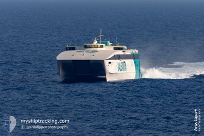
High speed craft

Current Trip
| Trip Time | 36 mins |
|---|---|
| Trip Distance | 16.63 nm |
| AVG Speed | 18.8 Knots |
| MAX Speed | 18.8 Knots |
| Draught | 3.3 m |
| AVG Wind | 8 knots |
| MAX Wind | 17 knots |
| MIN Temp | 16°C / 60.8°F |
| MAX Temp | 18.1°C / 64.58°F |
| Position Received | Now |
Current Position
| Longitude | -5.43910° |
|---|---|
| Latitude | 36.12924° |
| Status | Under way using engine |
| Speed | |
| Course | 56° |
| Area | Strait of Gibraltar |
| Station | T-AIS |
| Position Received | Now |
Information
The current position of CECILIA PAYNE is in Strait of Gibraltar with coordinates 36.12924° / -5.43910° as reported on 2025-06-04 07:29 by AIS to our vessel tracker app. The vessel's current speed is 0 Knots and is currently inside the port of ALGECIRAS.
The vessel CECILIA PAYNE (IMO: 9188881, MMSI: 209122000) is a High speed craft that was built in 1999 ( 26 years old ). It's sailing under the flag of [CY] Cyprus.
In this page you can find informations about the vessels current position, last detected port calls, and current voyage information. If the vessels is not in coverage by AIS you will find the latest position.
The current position of CECILIA PAYNE is detected by our AIS receivers and we are not responsible for the reliability of the data. The last position was recorded while the vessel was in Coverage by the Ais receivers of our vessel tracking app.
The current draught of CECILIA PAYNE as reported by AIS is 3.3 meters
Weather
| Temperature | 16.2°C / 61.16°F |
|---|---|
| Wind Speed | 6 knots |
| Direction | 274° W |
| Pressure | 1017.5 hPa |
| Humidity | 73.2 % |
| Cloud Coverage | 10 % |


Featured Company
Last Port Calls
| Port | Arrival | Departure | Time In Port |
|---|---|---|---|
| 2025-06-04 09:10 | |||
| 2025-06-04 07:54 | 2025-06-04 08:34 | 40 m | |
| 2025-06-03 22:57 | 2025-06-04 07:14 | 8 h | |
| 2025-06-03 21:40 | 2025-06-03 22:34 | 54 m | |
| 2025-06-03 18:23 | 2025-06-03 20:53 | 2 h | |
| 2025-06-03 17:22 | 2025-06-03 17:54 | 32 m | |
| 2025-06-03 15:51 | 2025-06-03 16:44 | 53 m | |
| 2025-06-03 14:11 | 2025-06-03 14:57 | 46 m | |
| 2025-06-03 12:35 | 2025-06-03 13:30 | 55 m | |
| 2025-06-03 11:07 | 2025-06-03 11:48 | 40 m |
Last Trips
| Origin | Departure | Destination | Arrival | Distance | |
|---|---|---|---|---|---|
| 2025-06-04 08:34 | 2025-06-04 09:10 | 16.63 nm | |||
| 2025-06-04 07:14 | 2025-06-04 07:54 | 17.33 nm | |||
| 2025-06-03 22:34 | 2025-06-03 22:57 | 10.75 nm | |||
| 2025-06-03 20:53 | 2025-06-03 21:40 | 17.26 nm | |||
| 2025-06-03 17:54 | 2025-06-03 18:23 | 14.04 nm | |||
| 2025-06-03 16:44 | 2025-06-03 17:22 | 16.55 nm | |||
| 2025-06-03 14:57 | 2025-06-03 15:51 | 16.39 nm | |||
| 2025-06-03 13:30 | 2025-06-03 14:11 | 16.90 nm | |||
| 2025-06-03 11:48 | 2025-06-03 12:35 | 17.59 nm | |||
| 2025-06-03 10:23 | 2025-06-03 11:07 | 16.79 nm |
Events
| Time | Event | Details | Position / Dest | Info |
|---|---|---|---|---|
| 2025-06-04 07:22 | STOP Moving |
36.12924 / -5.43911
[ES] ALGECIRAS
|
Speed: Course: 57° |
|
| 2025-06-04 07:10 | ETA Changed | 2025/06/04 08:30 2025/06/04 07:00 |
36.14787 / -5.43030
[ES] ALGECIRAS
|
Speed: 10.4 kn Course: 219° |
| 2025-06-04 07:10 | PORT ARRIVAL |
|
36.14806 / -5.43011
[ES] ALGECIRAS
|
Speed: 11 kn Course: 227.6° |
| 2025-06-04 07:04 | Change Sea Area | Spanish part of the Strait of Gibraltar Gibraltarian part of the Strait of Gibraltar |
36.13841 / -5.40358
Strait of Gibraltar
ALG-CEU-ALG
|
Speed: 23.9 kn Course: 302.8° |
| 2025-06-04 06:56 | Status Changed | Under way using engine Default |
36.08036 / -5.36076
ALG-CEU-ALG
|
Speed: 29.8 kn Course: 345° |
| 2025-06-04 06:46 | IN Coverage |
36.09620 / -5.36877
Strait of Gibraltar
ALG-CEU-ALG
|
Speed: 31.4 kn Course: 337.1° |
|
| 2025-06-04 06:35 | START Moving | 0.9 nm, North of CEUTA |
35.90854 / -5.31353
ALG-CEU-ALG
|
Speed: 29.3 kn Course: 344° |
| 2025-06-04 06:34 | PORT DEPARTURE |
|
35.90854 / -5.31353
ALG-CEU-ALG
|
Speed: 0.9 kn Course: 115° |
| 2025-06-04 06:05 | STOP Moving |
35.89418 / -5.32044
[ES] CEUTA
|
Speed: Course: 131° |
|
| 2025-06-04 05:32 | OUT of Coverage |
36.02978 / -5.33894
Strait of Gibraltar
[ES] CEUTA
|
Speed: 31.4 kn Course: 158.6° |