
CETI
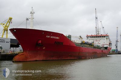
Oil/Chemical Tanker
Current Trip
| Time Travelled | 3 days |
|---|---|
| Remaining Time | --- |
| Distance Travelled | 631.95 nm |
| Remaining Distance | 1134.15 nm |
| AVG Speed | 9.1 Knots |
| MAX Speed | 11.4 Knots |
| AVG Wind | 8.3 knots |
| MAX Wind | 22.9 knots |
| MIN Temp | 13.1°C / 55.58°F |
| MAX Temp | 21.6°C / 70.88°F |
| Draught | 8.3 m |
| Position Received | Now |
Current Position
| Longitude | 28.77883° |
|---|---|
| Latitude | 40.96231° |
| Status | At anchor |
| Speed | |
| Course | 140° |
| Area | Sea of Marmara |
| Station | T-AIS |
| Position Received | Now |
Information
The current position of CETI is in Sea of Marmara with coordinates 40.96231° / 28.77883° as reported on 2025-05-20 05:37 by AIS to our vessel tracker app. The vessel's current speed is 0 Knots and is heading at the port of RAVENNA. The estimated time of arrival as calculated by MyShipTracking vessel tracking app is 2025-05-25 06:00 LT
The vessel CETI (IMO: 9427988, MMSI: 248058000) is a Oil/Chemical Tanker that was built in 2009 ( 16 years old ). It's sailing under the flag of [MT] Malta.
In this page you can find informations about the vessels current position, last detected port calls, and current voyage information. If the vessels is not in coverage by AIS you will find the latest position.
The current position of CETI is detected by our AIS receivers and we are not responsible for the reliability of the data. The last position was recorded while the vessel was in Coverage by the Ais receivers of our vessel tracking app.
The current draught of CETI as reported by AIS is 8.3 meters
Weather
| Temperature | 15.6°C / 60.08°F |
|---|---|
| Wind Speed | 3 knots |
| Direction | 315° NW |
| Pressure | 1017.4 hPa |
| Humidity | 68.9 % |
| Cloud Coverage | 38 % |
Featured Company
Last Port Calls
| Port | Arrival | Departure | Time In Port |
|---|---|---|---|
| 2025-05-15 02:38 | 2025-05-16 14:18 | 1 d | |
| 2025-05-04 10:22 | 2025-05-05 09:12 | 22 h | |
| 2025-04-26 04:46 | 2025-04-27 03:42 | 22 h | |
| 2025-04-20 12:16 | 2025-04-20 13:36 | 1 h | |
| 2025-04-16 13:45 | 2025-04-17 16:15 | 1 d | |
| 2025-03-20 22:05 | 2025-03-21 20:06 | 22 h | |
| 2025-03-19 10:42 | 2025-03-20 10:42 | 1 d | |
| 2025-03-09 09:41 | 2025-03-10 15:33 | 1 d |
Last Trips
| Origin | Departure | Destination | Arrival | Distance | |
|---|---|---|---|---|---|
| 2025-05-05 12:12 | 2025-05-15 06:38 | 813.61 nm | |||
| 2025-04-27 05:42 | 2025-05-04 13:22 | 1503.78 nm | |||
| 2025-04-20 16:36 | 2025-04-26 06:46 | 1272.97 nm | |||
| 2025-04-17 20:15 | 2025-04-20 15:16 | 603.36 nm | |||
| 2025-03-21 21:06 | 2025-04-16 17:45 | 2203.45 nm | |||
| 2025-03-20 11:42 | 2025-03-20 23:05 | 109.14 nm | |||
| 2025-03-10 19:33 | 2025-03-19 11:42 | 1935.61 nm | |||
| 2025-02-26 21:52 | 2025-03-09 13:41 | 704.88 nm |
Events
| Time | Event | Details | Position / Dest | Info |
|---|---|---|---|---|
| 2025-05-20 03:51 | Status Changed | At anchor Under way using engine |
40.96226 / 28.77935
ITRAN
|
Speed: 0.1 kn Course: 114° |
| 2025-05-20 03:39 | STOP Moving | 2.14 nm, West of YESILKOY |
40.96213 / 28.77940
ITRAN
|
Speed: 0.2 kn Course: 116° |
| 2025-05-19 23:56 | Change Sea Area | Turkish part of the Sea of Marmara Turkish part of the Black Sea |
41.23172 / 29.12964
Sea of Marmara
ITRAN
|
Speed: 9 kn Course: 197.9° |
| 2025-05-19 22:44 | START Moving | 6.64 nm, North West of RUMELI FENERI |
41.28632 / 28.98569
ITRAN
|
Speed: 3.2 kn Course: 15° |
| 2025-05-19 22:27 | Status Changed | Under way using engine At anchor |
41.28363 / 28.98677
ITRAN
|
Speed: 0.4 kn Course: 214° |
| 2025-05-19 14:53 | Status Changed | At anchor Default |
41.28337 / 28.98790
ITRAN
|
Speed: Course: 253° |
| 2025-05-19 14:47 | Status Changed | Default At anchor |
41.28336 / 28.98781
ITRAN
|
Speed: Course: 257° |
| 2025-05-19 06:17 | Status Changed | At anchor Under way using engine |
41.28223 / 28.98677
ITRAN
|
Speed: 0.3 kn Course: 321° |
| 2025-05-19 06:01 | STOP Moving | 6.5 nm, North West of RUMELI FENERI |
41.28225 / 28.98645
ITRAN
|
Speed: 0.2 kn Course: 353° |
| 2025-05-19 03:19 | Status Changed | Under way using engine Default |
41.49966 / 29.32346
ITRAN
|
Speed: 10.4 kn Course: 230° |