
CHILA
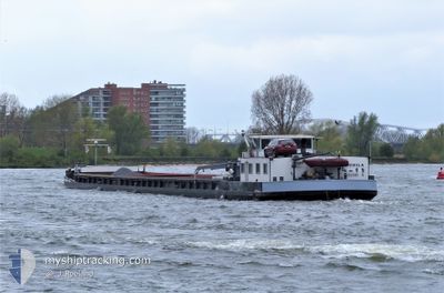
Cargo
Current Trip
| Time Travelled | 24 days |
|---|---|
| Remaining Time | --- |
| Distance Travelled | 129.95 nm |
| Remaining Distance | --- |
| AVG Speed | 6.5 Knots |
| MAX Speed | 9.6 Knots |
| AVG Wind | 10.9 knots |
| MAX Wind | 16 knots |
| MIN Temp | -0.2°C / 31.64°F |
| MAX Temp | 12°C / 53.6°F |
| Draught | 0 m |
| Position Received | 4 d ago |
Current Position
| Longitude | 5.81672° |
|---|---|
| Latitude | 51.06922° |
| Status | Under way using engine |
| Speed | 8.2 Knots |
| Course | 28.4° |
| Area | North Sea |
| Station | T-AIS |
| Position Received | 4 d ago |
Info
Information
The current position of CHILA is in North Sea with coordinates 51.06922° / 5.81672° as reported on 2026-01-05 15:32 by AIS to our vessel tracker app. The vessel's current speed is 8.2 Knots and is heading at the port of PANNERDEN. The estimated time of arrival as calculated by MyShipTracking vessel tracking app is 2026-01-03 15:53 LT
The vessel CHILA (MMSI: 244710964) is a Cargo It's sailing under the flag of [NL] Netherlands.
In this page you can find informations about the vessels current position, last detected port calls, and current voyage information. If the vessels is not in coverage by AIS you will find the latest position.
The current position of CHILA is detected by our AIS receivers and we are not responsible for the reliability of the data. The last position was recorded while the vessel was in Coverage by the Ais receivers of our vessel tracking app.
Weather
| Temperature | -0.2°C / 31.64°F |
|---|---|
| Wind Speed | 9 knots |
| Direction | 223° SW |
| Pressure | 1010.9 hPa |
| Humidity | 94.8 % |
| Cloud Coverage | 75 % |
Featured Company
Last Port Calls
| Port | Arrival | Departure | Time In Port |
|---|---|---|---|
| 2025-12-17 10:52 | 2025-12-17 11:45 | 52 m | |
| 2025-12-08 10:07 | 2025-12-08 16:29 | 6 h | |
| 2025-11-30 20:07 | 2025-12-01 15:05 | 18 h | |
| 2025-11-23 16:30 | 2025-11-24 14:44 | 22 h | |
| 2025-11-14 14:06 | 2025-11-17 06:50 | 2 d | |
| 2025-11-10 15:21 | 2025-11-11 15:42 | 1 d |
Last Trips
| Origin | Departure | Destination | Arrival | Distance | |
|---|---|---|---|---|---|
| 2025-12-08 16:29 | 2025-12-17 10:52 | 289.93 nm | |||
| 2025-12-01 15:05 | 2025-12-08 10:07 | 117.69 nm | |||
| 2025-11-24 14:44 | 2025-11-30 20:07 | 121.28 nm | |||
| 2025-11-17 06:50 | 2025-11-23 16:30 | 159.62 nm | |||
| 2025-11-11 15:42 | 2025-11-14 14:06 | 127.94 nm | |||
| 2025-10-29 12:49 | 2025-11-10 15:21 | 111.39 nm |
Events
| Time | Event | Details | Position / Dest | Info |
|---|---|---|---|---|
| 2026-01-05 15:34 | Status Changed | Default Under way using engine |
51.07346 / 5.82038
PANNERDENSCH KANAAL
|
Speed: 8.2 kn Course: 28.4° |
| 2026-01-05 15:32 | OUT of Coverage |
51.06922 / 5.81672
North Sea
|
Speed: 8.2 kn Course: 28.4° |
|
| 2026-01-05 15:16 | START Moving | 1.51 nm, South West of BARGE TERMINAL BORN |
51.03684 / 5.79931
PANNERDENSCH KANAAL
|
Speed: 6.6 kn Course: 15° |
| 2026-01-05 14:58 | STOP Moving | 1.65 nm, South of BARGE TERMINAL BORN |
51.03455 / 5.79814
PANNERDENSCH KANAAL
|
Speed: 0.2 kn Course: 17° |
| 2026-01-05 14:55 | START Moving | 1.73 nm, South of BARGE TERMINAL BORN |
51.03328 / 5.79748
PANNERDENSCH KANAAL
|
Speed: 3.1 kn Course: 18° |
| 2026-01-05 14:47 | STOP Moving | 1.86 nm, South of BARGE TERMINAL BORN |
51.03136 / 5.79627
PANNERDENSCH KANAAL
|
Speed: 0.3 kn Course: 18° |
| 2026-01-05 14:14 | IN Coverage |
50.98389 / 5.76288
North Sea
|
Speed: 7.8 kn Course: 25.3° |
|
| 2026-01-05 12:51 | OUT of Coverage |
50.82513 / 5.69801
North Sea
|
Speed: 8.4 kn Course: 359.1° |
|
| 2026-01-05 12:38 | START Moving | 0.43 nm, West of WAOLENWIERT |
50.79577 / 5.69104
PANNERDENSCH KANAAL
|
Speed: 6.2 kn Course: 2.5° |
| 2026-01-05 12:12 | STOP Moving | 0.46 nm, South West of WAOLENWIERT |
50.79392 / 5.69107
PANNERDENSCH KANAAL
|
Speed: 0.2 kn Course: 2° |