
CHIPOLBROK PACIFIC
Cargo
Current Trip
| Time Travelled | 9 days |
|---|---|
| Remaining Time | 6 days |
| Distance Travelled | 2144.80 nm |
| Remaining Distance | 2417.26 nm |
| AVG Speed | 13.2 Knots |
| MAX Speed | 16.4 Knots |
| AVG Wind | 20.4 knots |
| MAX Wind | 31 knots |
| MIN Temp | 4.2°C / 39.56°F |
| MAX Temp | 24.7°C / 76.46°F |
| Draught | 7 m |
| Position Received | 27 d ago |
Current Position
| Longitude | 128.90637° |
|---|---|
| Latitude | 34.80799° |
| Status | Under way using engine |
| Speed | 14 Knots |
| Course | 148.3° |
| Area | Japan Sea |
| Station | T-AIS |
| Position Received | 27 d ago |
Info
Information
The current position of CHIPOLBROK PACIFIC is in Japan Sea with coordinates 34.80799° / 128.90637° as reported on 2025-01-14 10:53 by AIS to our vessel tracker app. The vessel's current speed is 14 Knots and is heading at the port of TIANJIN. The estimated time of arrival as calculated by MyShipTracking vessel tracking app is 2025-02-18 00:18 LT
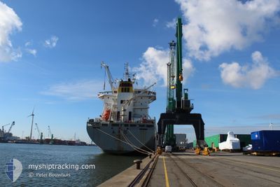
The vessel CHIPOLBROK PACIFIC (IMO: 9710177, MMSI: 477713800) is a Cargo It's sailing under the flag of [HK] Hong Kong.
In this page you can find informations about the vessels current position, last detected port calls, and current voyage information. If the vessels is not in coverage by AIS you will find the latest position.
The current position of CHIPOLBROK PACIFIC is detected by our AIS receivers and we are not responsible for the reliability of the data. The last position was recorded while the vessel was in Coverage by the Ais receivers of our vessel tracking app.
The current draught of CHIPOLBROK PACIFIC as reported by AIS is 7 meters
Weather
| Temperature | 24.7°C / 76.46°F |
|---|---|
| Wind Speed | 11 knots |
| Direction | 3° N |
| Pressure | 1011.9 hPa |
| Humidity | 89.2 % |
| Cloud Coverage | 100 % |
Featured Company
Last Port Calls
| Port | Arrival | Departure | Time In Port |
|---|---|---|---|
| 2025-01-25 04:23 | 2025-02-01 22:33 | 7 d | |
| 2025-01-20 19:09 | 2025-01-22 07:53 | 1 d | |
| 2025-01-12 21:02 | 2025-01-14 08:28 | 1 d | |
| 2024-12-22 06:24 | 2024-12-31 10:12 | 9 d | |
| 2024-12-14 20:48 | 2024-12-16 17:42 | 1 d | |
| 2024-12-04 08:39 | 2024-12-07 00:00 | 2 d |
Last Trips
| Origin | Departure | Destination | Arrival | Distance | |
|---|---|---|---|---|---|
| 2025-01-22 15:53 | 2025-01-25 12:23 | 786.76 nm | |||
| 2025-01-14 17:28 | 2025-01-21 03:09 | 772.58 nm | |||
| 2024-12-31 17:12 | 2025-01-13 06:02 | 1969.15 nm | |||
| 2024-12-17 01:42 | 2024-12-22 13:24 | 1038.51 nm | |||
| 2024-12-07 05:30 | 2024-12-15 04:48 | 2512.27 nm | |||
| 2024-11-21 13:12 | 2024-12-04 14:09 | 3576.39 nm |
Events
| Time | Event | Details | Position / Dest | Info |
|---|---|---|---|---|
| 2025-02-05 03:25 | START Moving |
32.08243 / 121.63294
TIANJIN
|
Speed: 3.3 kn Course: 95° |
|
| 2025-02-03 07:41 | STOP Moving |
32.08202 / 121.62909
TIANJIN
|
Speed: 0.2 kn Course: 107° |
|
| 2025-02-03 01:29 | START Moving |
31.57075 / 122.56398
TIANJIN
|
Speed: 3.2 kn Course: 356° |
|
| 2025-02-02 08:25 | STOP Moving |
31.56764 / 122.56499
TIANJIN
|
Speed: 0.3 kn Course: 331° |
|
| 2025-02-01 22:33 | PORT DEPARTURE |
|
31.62258 / 121.25569
TIANJIN
|
Speed: 3.6 kn Course: 67° |
| 2025-02-01 22:24 | START Moving |
31.63123 / 121.24102
[CN] TAICANG
|
Speed: 3.6 kn Course: 67° |