
CINDY
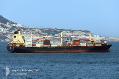
Container Ship
Current Trip
| Time Travelled | 7 days |
|---|---|
| Remaining Time | --- |
| Distance Travelled | 736.57 nm |
| Remaining Distance | --- |
| AVG Speed | 13.3 Knots |
| MAX Speed | 14.7 Knots |
| AVG Wind | 7.7 knots |
| MAX Wind | 15 knots |
| MIN Temp | 26.5°C / 79.7°F |
| MAX Temp | 29.3°C / 84.74°F |
| Draught | 7.4 m |
| Position Received | 2024-12-09 09:57 |
Current Position
| Longitude | -5.98293° |
|---|---|
| Latitude | 35.81998° |
| Status | Under way using engine |
| Speed | 15.1 Knots |
| Course | 213.6° |
| Area | North Atlantic Ocean |
| Station | T-AIS |
| Position Received | 2024-12-09 09:57 |
Info
Information
The current position of CINDY is in North Atlantic Ocean with coordinates 35.81998° / -5.98293° as reported on 2024-12-09 09:57 by AIS to our vessel tracker app. The vessel's current speed is 15.1 Knots
The vessel CINDY (IMO: 9304734, MMSI: 636020455) is a Container Ship that was built in 2004 ( 21 years old ). It's sailing under the flag of [LR] Liberia.
In this page you can find informations about the vessels current position, last detected port calls, and current voyage information. If the vessels is not in coverage by AIS you will find the latest position.
The current position of CINDY is detected by our AIS receivers and we are not responsible for the reliability of the data. The last position was recorded while the vessel was in Coverage by the Ais receivers of our vessel tracking app.
The current draught of CINDY as reported by AIS is 7.4 meters
Weather
| Temperature | 27.3°C / 81.14°F |
|---|---|
| Wind Speed | 13 knots |
| Direction | 250° WSW |
| Pressure | 1011.4 hPa |
| Humidity | 85.4 % |
| Cloud Coverage | 86 % |
Featured Company
Most Visited Ports (Last year)
| Port | Arrivals | |
|---|---|---|
| 17 | ||
| 4 | ||
| 4 | ||
| 4 | ||
| 2 |
Last Trips
| Origin | Departure | Destination | Arrival | Distance | |
|---|---|---|---|---|---|
| 2025-01-22 00:57 | 2025-01-27 05:25 | 823.25 nm | |||
| 2025-01-08 12:19 | 2025-01-20 20:53 | 928.54 nm | |||
| 2024-12-23 11:32 | 2025-01-06 11:44 | 1772.08 nm | |||
| 2024-12-16 09:37 | 2024-12-22 10:11 | 1828.81 nm | |||
| 2024-11-21 09:32 | 2024-12-15 13:20 | 5901.00 nm |
Events
| Time | Event | Details | Position / Dest | Info |
|---|---|---|---|---|
| 2025-01-30 22:53 | STOP Moving | 4.12 nm, South East of TEMA |
5.56743 / .04415
GHTEM
|
Speed: 0.3 kn Course: -1° |
| 2025-01-28 16:41 | PORT DEPARTURE |
|
4.03558 / 9.66260
GHTEM
|
Speed: 6.5 kn Course: -1° |
| 2025-01-28 16:37 | START Moving |
4.04030 / 9.66975
[CM] DOUALA
|
Speed: 6.5 kn Course: -1° |
|
| 2025-01-27 04:33 | STOP Moving |
4.04208 / 9.67788
[CM] DOUALA
|
Speed: Course: 56° |
|
| 2025-01-27 04:25 | PORT ARRIVAL |
|
4.04263 / 9.67725
[CM] DOUALA
|
Speed: 1.4 kn Course: 77° |
| 2025-01-27 01:45 | START Moving | 18.03 nm, South West of DOUALA |
3.85718 / 9.46307
GHTEM
|
Speed: 4.5 kn Course: 65° |