
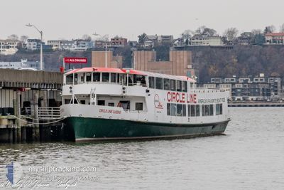
CIRCLE LINE QUEENS
Passenger
Current Trip
| Trip Time | 14 days |
|---|---|
| Trip Distance | 11.34 nm |
| AVG Speed | 12.2 Knots |
| MAX Speed | 17.7 Knots |
| Draught | 0 m |
| AVG Wind | 9.9 knots |
| MAX Wind | 12.5 knots |
| MIN Temp | -2.2°C / 28.04°F |
| MAX Temp | 7°C / 44.6°F |
| Position Received | 1 h, 17 m ago |
Current Position
| Longitude | -74.02556° |
|---|---|
| Latitude | 40.71360° |
| Status | Moored |
| Speed | 12.9 Knots |
| Course | 212.4° |
| Area | North Atlantic Ocean |
| Station | T-AIS |
| Position Received | 1 h, 17 m ago |
Info
Information
The current position of CIRCLE LINE QUEENS is in North Atlantic Ocean with coordinates 40.71360° / -74.02556° as reported on 2025-12-20 16:50 by AIS to our vessel tracker app. The vessel's current speed is 12.9 Knots and is currently inside the port of NEW YORK.
The vessel CIRCLE LINE QUEENS (MMSI: 367402210) is a Passenger It's sailing under the flag of [US] USA.
In this page you can find informations about the vessels current position, last detected port calls, and current voyage information. If the vessels is not in coverage by AIS you will find the latest position.
The current position of CIRCLE LINE QUEENS is detected by our AIS receivers and we are not responsible for the reliability of the data. The last position was recorded while the vessel was in Coverage by the Ais receivers of our vessel tracking app.
Weather
| Temperature | 1.5°C / 34.7°F |
|---|---|
| Wind Speed | 6 knots |
| Direction | 312° NW |
| Pressure | 1022.9 hPa |
| Humidity | 41.7 % |
| Cloud Coverage | 48 % |
Featured Company
Last Port Calls
| Port | Arrival | Departure | Time In Port |
|---|---|---|---|
| 2025-12-12 11:45 | |||
| 2025-11-27 13:48 | 2025-11-27 15:07 | 1 h | |
| 2025-11-27 10:21 | 2025-11-27 11:35 | 1 h | |
| 2025-11-26 10:18 | 2025-11-26 11:52 | 1 h | |
| 2025-11-24 19:39 | 2025-11-25 11:50 | 16 h | |
| 2025-11-24 14:29 | 2025-11-24 14:46 | 16 m | |
| 2025-11-10 15:50 | 2025-11-24 11:02 | 13 d | |
| 2025-11-10 14:45 | 2025-11-10 15:29 | 44 m | |
| 2025-11-10 12:32 | 2025-11-10 14:40 | 2 h | |
| 2025-11-10 11:12 | 2025-11-10 12:06 | 54 m |
Most Visited Ports (Last year)
| Port | Arrivals | |
|---|---|---|
| 237 |
Last Trips
| Origin | Departure | Destination | Arrival | Distance | |
|---|---|---|---|---|---|
| 2025-11-27 15:07 | 2025-12-12 11:45 | 11.34 nm | |||
| 2025-11-27 11:35 | 2025-11-27 13:48 | 6.47 nm | |||
| 2025-11-26 11:52 | 2025-11-27 10:21 | 18.41 nm | |||
| 2025-11-25 11:50 | 2025-11-26 10:18 | 5.12 nm | |||
| 2025-11-24 14:46 | 2025-11-24 19:39 | 10.20 nm | |||
| 2025-11-24 11:02 | 2025-11-24 14:29 | 11.66 nm | |||
| 2025-11-10 15:29 | 2025-11-10 15:50 | 1.67 nm | |||
| 2025-11-10 14:40 | 2025-11-10 14:45 | 2.05 nm | |||
| 2025-11-10 12:06 | 2025-11-10 12:32 | 2.10 nm | |||
| 2025-11-10 11:07 | 2025-11-10 11:12 | 0.95 nm |
Events
| Time | Event | Details | Position / Dest | Info |
|---|---|---|---|---|
| 2025-12-20 16:50 | OUT of Coverage |
40.71360 / -74.02556
North Atlantic Ocean
[US] NEW YORK
|
Speed: 12.9 kn Course: 212.4° |
|
| 2025-12-20 16:46 | IN Coverage |
40.71716 / -74.02338
North Atlantic Ocean
[US] NEW YORK
|
Speed: 11.7 kn Course: 238.9° |
|
| 2025-12-20 15:26 | OUT of Coverage |
40.71434 / -74.02568
North Atlantic Ocean
[US] NEW YORK
|
Speed: 14.5 kn Course: 198.2° |
|
| 2025-12-20 14:47 | IN Coverage |
40.72508 / -74.01807
North Atlantic Ocean
[US] NEW YORK
|
Speed: 14 kn Course: 184° |
|
| 2025-12-19 22:50 | OUT of Coverage |
40.72299 / -74.02260
North Atlantic Ocean
[US] NEW YORK
|
Speed: 14.9 kn Course: 8.7° |
|
| 2025-12-19 22:47 | IN Coverage |
40.72225 / -74.02276
North Atlantic Ocean
[US] NEW YORK
|
Speed: 14.9 kn Course: 9.2° |
|
| 2025-12-19 21:20 | OUT of Coverage |
40.71366 / -74.02494
North Atlantic Ocean
[US] NEW YORK
|
Speed: 13.1 kn Course: 220.6° |
|
| 2025-12-19 21:18 | IN Coverage |
40.71449 / -74.02028
North Atlantic Ocean
[US] NEW YORK
|
Speed: 10.6 kn Course: 308.6° |
|
| 2025-12-19 19:48 | OUT of Coverage |
40.71614 / -74.02412
North Atlantic Ocean
[US] NEW YORK
|
Speed: 12.9 kn Course: 214.4° |
|
| 2025-12-19 19:45 | IN Coverage |
40.71126 / -74.02033
North Atlantic Ocean
[US] NEW YORK
|
Speed: 10.2 kn Course: 7.9° |