
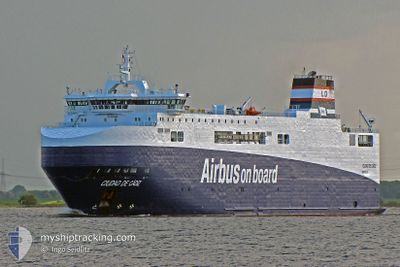
CIUDAD DE CADIZ
Ro-Ro Cargo
Current Trip
| Time Travelled | 1 day |
|---|---|
| Remaining Time | --- |
| Distance Travelled | 718.96 nm |
| Remaining Distance | --- |
| AVG Speed | 16.3 Knots |
| MAX Speed | 17.4 Knots |
| AVG Wind | 9.5 knots |
| MAX Wind | 22 knots |
| MIN Temp | 11.7°C / 53.06°F |
| MAX Temp | 15.9°C / 60.62°F |
| Draught | 4.9 m |
| Position Received | 1 d ago |
Current Position
| Longitude | 13.19273° |
|---|---|
| Latitude | 40.31155° |
| Status | Under way using engine |
| Speed | 16.7 Knots |
| Course | 242.7° |
| Area | Tyrrhenian Sea |
| Station | T-AIS |
| Position Received | 1 d ago |
Info
Information
The current position of CIUDAD DE CADIZ is in Tyrrhenian Sea with coordinates 40.31155° / 13.19273° as reported on 2025-02-07 03:23 by AIS to our vessel tracker app. The vessel's current speed is 16.7 Knots and is heading at the port of VIANA DO CASTELO. The estimated time of arrival as calculated by MyShipTracking vessel tracking app is 2025-02-11 19:00 LT
The vessel CIUDAD DE CADIZ (IMO: 9383560, MMSI: 228025700) is a Ro-Ro Cargo that was built in 2008 ( 17 years old ). It's sailing under the flag of [FR] France.
In this page you can find informations about the vessels current position, last detected port calls, and current voyage information. If the vessels is not in coverage by AIS you will find the latest position.
The current position of CIUDAD DE CADIZ is detected by our AIS receivers and we are not responsible for the reliability of the data. The last position was recorded while the vessel was in Coverage by the Ais receivers of our vessel tracking app.
The current draught of CIUDAD DE CADIZ as reported by AIS is 4.9 meters
Weather
| Temperature | 15.9°C / 60.62°F |
|---|---|
| Wind Speed | 6 knots |
| Direction | 123° ESE |
| Pressure | 1023.9 hPa |
| Humidity | 68.3 % |
| Cloud Coverage | 7 % |
Featured Company
Last Port Calls
| Port | Arrival | Departure | Time In Port |
|---|---|---|---|
| 2025-02-06 19:08 | 2025-02-06 23:40 | 4 h | |
| 2025-01-30 07:45 | 2025-02-01 11:16 | 2 d | |
| 2025-01-22 18:40 | 2025-01-22 22:47 | 4 h | |
| 2025-01-21 17:17 | 2025-01-21 23:32 | 6 h | |
| 2025-01-14 10:10 | 2025-01-15 19:26 | 1 d | |
| 2025-01-08 18:38 | 2025-01-08 22:43 | 4 h | |
| 2025-01-07 17:05 | 2025-01-07 23:11 | 6 h | |
| 2024-12-19 18:45 | 2024-12-31 15:23 | 11 d | |
| 2024-12-18 05:59 | 2024-12-19 16:34 | 1 d | |
| 2024-12-06 17:54 | 2024-12-18 03:21 | 11 d |
Last Trips
| Origin | Departure | Destination | Arrival | Distance | |
|---|---|---|---|---|---|
| 2025-02-01 12:16 | 2025-02-06 20:08 | 2014.20 nm | |||
| 2025-01-22 23:47 | 2025-01-30 08:45 | 2165.58 nm | |||
| 2025-01-22 00:32 | 2025-01-22 19:40 | 306.88 nm | |||
| 2025-01-15 20:26 | 2025-01-21 18:17 | 1841.34 nm | |||
| 2025-01-08 23:43 | 2025-01-14 11:10 | 1978.02 nm | |||
| 2025-01-08 00:11 | 2025-01-08 19:38 | 305.82 nm | |||
| 2024-12-31 16:23 | 2025-01-07 18:05 | 1867.02 nm | |||
| 2024-12-19 17:34 | 2024-12-19 19:45 | 24.28 nm | |||
| 2024-12-18 04:21 | 2024-12-18 06:59 | 25.66 nm | |||
| 2024-12-06 17:02 | 2024-12-06 18:54 | 24.08 nm |
Events
| Time | Event | Details | Position / Dest | Info |
|---|---|---|---|---|
| 2025-02-07 03:27 | Status Changed | Default Under way using engine |
40.30300 / 13.17105
VIANA DO CASTELO
|
Speed: 16.7 kn Course: 242.7° |
| 2025-02-07 03:23 | OUT of Coverage |
40.31155 / 13.19273
Tyrrhenian Sea
VIANA DO CASTELO
|
Speed: 16.7 kn Course: 242.7° |
|
| 2025-02-06 23:40 | PORT DEPARTURE |
|
40.82697 / 14.27795
VIANA DO CASTELO
|
Speed: 6.7 kn Course: 179° |
| 2025-02-06 23:33 | START Moving |
40.83823 / 14.27850
[IT] NAPOLI
|
Speed: 5.3 kn Course: 236° |
|
| 2025-02-06 22:44 | Destination Changed | VIANA DO CASTELO NAPOLI |
40.84122 / 14.28043
[IT] NAPOLI
|
Speed: Course: 200° |
| 2025-02-06 22:44 | ETA Changed | 2025/02/11 19:00 2025/02/06 19:00 |
40.84122 / 14.28043
[IT] NAPOLI
|
Speed: Course: 200° |
| 2025-02-06 19:26 | STOP Moving |
40.84008 / 14.27965
[IT] NAPOLI
|
Speed: 0.3 kn Course: 209° |
|
| 2025-02-06 19:08 | PORT ARRIVAL |
|
40.82803 / 14.28222
[IT] NAPOLI
|
Speed: 6.7 kn Course: 333.6° |
| 2025-02-06 14:26 | Change Sea Area | Italian part of the Tyrrhenian Sea Algerian part of the Mediterranean Sea - Western Basin |
40.25603 / 13.18378
Tyrrhenian Sea
NAPOLI
|
Speed: 14.8 kn Course: 95.7° |
| 2025-02-06 14:26 | Status Changed | Under way using engine Default |
40.25603 / 13.18378
NAPOLI
|
Speed: 15.4 kn Course: 67° |