
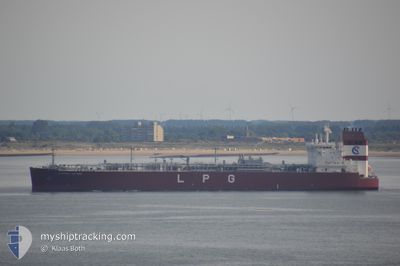
CLIPPER JUPITER
Tanker
Current Trip
BE ANR > US UFG
| Time Travelled | 4 days |
|---|---|
| Remaining Time | --- |
| Distance Travelled | 1533.94 nm |
| Remaining Distance | --- |
| AVG Speed | 14.4 Knots |
| MAX Speed | 16.6 Knots |
| AVG Wind | 12.3 knots |
| MAX Wind | 24.7 knots |
| MIN Temp | 10.9°C / 51.62°F |
| MAX Temp | 19.6°C / 67.28°F |
| Draught | 8 m |
| Position Received | 3 d ago |
Current Position
| Longitude | -4.12566° |
|---|---|
| Latitude | 49.64881° |
| Status | Under way using engine |
| Speed | 15.3 Knots |
| Course | 245.3° |
| Area | English Channel |
| Station | T-AIS |
| Position Received | 3 d ago |
Information
The current position of CLIPPER JUPITER is in English Channel with coordinates 49.64881° / -4.12566° as reported on 2025-06-05 21:09 by AIS to our vessel tracker app. The vessel's current speed is 15.3 Knots
The vessel CLIPPER JUPITER (IMO: 9699505, MMSI: 257694000) is a Tanker It's sailing under the flag of [NO] Norway.
In this page you can find informations about the vessels current position, last detected port calls, and current voyage information. If the vessels is not in coverage by AIS you will find the latest position.
The current position of CLIPPER JUPITER is detected by our AIS receivers and we are not responsible for the reliability of the data. The last position was recorded while the vessel was in Coverage by the Ais receivers of our vessel tracking app.
The current draught of CLIPPER JUPITER as reported by AIS is 8 meters
Weather
| Temperature | 18.1°C / 64.58°F |
|---|---|
| Wind Speed | 5 knots |
| Direction | 313° NW |
| Pressure | 1027.4 hPa |
| Humidity | 89.3 % |
| Cloud Coverage | 4 % |
Featured Company
Most Visited Ports (Last year)
| Port | Arrivals | |
|---|---|---|
| 5 | ||
| 4 | ||
| 4 | ||
| 3 | ||
| 3 | ||
| 2 |
Last Trips
| Origin | Departure | Destination | Arrival | Distance | |
|---|---|---|---|---|---|
| 2025-06-02 23:44 | 2025-06-03 01:57 | 24.91 nm | |||
| 2025-05-17 11:08 | 2025-06-01 10:37 | 3636.10 nm | |||
| 2025-04-25 14:46 | 2025-05-16 09:32 | 4158.30 nm | |||
| 2025-04-22 11:27 | 2025-04-24 18:18 | 126.41 nm |
Events
| Time | Event | Details | Position / Dest | Info |
|---|---|---|---|---|
| 2025-06-05 21:17 | Status Changed | Default Under way using engine |
49.63399 / -4.17373
BE ANR > US UFG
|
Speed: 15.3 kn Course: 245.3° |
| 2025-06-05 21:09 | OUT of Coverage |
49.64881 / -4.12566
English Channel
BE ANR > US UFG
|
Speed: 15.3 kn Course: 245.3° |
|
| 2025-06-05 19:01 | Status Changed | Under way using engine Default |
49.88972 / -3.35663
BE ANR > US UFG
|
Speed: 15.5 kn Course: 243° |
| 2025-06-05 18:49 | Status Changed | Default Under way using engine |
49.91256 / -3.28369
BE ANR > US UFG
|
Speed: 15.4 kn Course: 244.9° |
| 2025-06-05 18:27 | Status Changed | Under way using engine Default |
49.95357 / -3.15189
BE ANR > US UFG
|
Speed: 15.2 kn Course: 246° |
| 2025-06-05 18:09 | IN Coverage |
49.95134 / -3.15896
English Channel
BE ANR > US UFG
|
Speed: 15.2 kn Course: 244.3° |
|
| 2025-06-05 13:09 | Status Changed | Default Under way using engine |
50.30125 / -1.36098
BE ANR > US UFG
|
Speed: 14.3 kn Course: 268.5° |
| 2025-06-05 13:03 | OUT of Coverage |
50.30183 / -1.32490
English Channel
BE ANR > US UFG
|
Speed: 14.3 kn Course: 268.5° |
|
| 2025-06-05 13:02 | Status Changed | Under way using engine Default |
50.30189 / -1.32177
BE ANR > US UFG
|
Speed: 14.4 kn Course: 269° |
| 2025-06-05 12:33 | Status Changed | Default Under way using engine |
50.32423 / -1.13561
BE ANR > US UFG
|
Speed: 15.4 kn Course: 255.9° |