
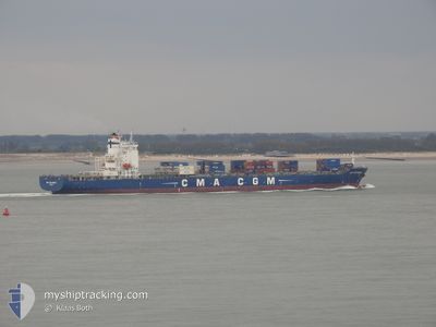
CMA CGM AMERICA
Container Ship
Current Trip
| Time Travelled | 1 day |
|---|---|
| Remaining Time | 1 h, 33 mins |
| Distance Travelled | 718.24 nm |
| Remaining Distance | 15.59 nm |
| AVG Speed | 9.8 Knots |
| MAX Speed | 19.9 Knots |
| AVG Wind | 19.5 knots |
| MAX Wind | 29.7 knots |
| MIN Temp | 9.2°C / 48.56°F |
| MAX Temp | 14.9°C / 58.82°F |
| Draught | 11.6 m |
| Position Received | Now |
Current Position
| Longitude | -9.46150° |
|---|---|
| Latitude | 38.63379° |
| Status | Under way using engine |
| Speed | 5.7 Knots |
| Course | 179.2° |
| Area | North Atlantic Ocean |
| Station | T-AIS |
| Position Received | Now |
Info
Information
The current position of CMA CGM AMERICA is in North Atlantic Ocean with coordinates 38.63379° / -9.46150° as reported on 2025-02-15 11:33 by AIS to our vessel tracker app. The vessel's current speed is 5.7 Knots and is heading at the port of LISBOA. The estimated time of arrival as calculated by MyShipTracking vessel tracking app is 2025-02-15 13:07 LT
The vessel CMA CGM AMERICA (IMO: 9295971, MMSI: 215651000) is a Container Ship that was built in 2006 ( 19 years old ). It's sailing under the flag of [MT] Malta.
In this page you can find informations about the vessels current position, last detected port calls, and current voyage information. If the vessels is not in coverage by AIS you will find the latest position.
The current position of CMA CGM AMERICA is detected by our AIS receivers and we are not responsible for the reliability of the data. The last position was recorded while the vessel was in Coverage by the Ais receivers of our vessel tracking app.
The current draught of CMA CGM AMERICA as reported by AIS is 11.6 meters
Weather
| Temperature | 14.4°C / 57.92°F |
|---|---|
| Wind Speed | 22 knots |
| Direction | 150° SSE |
| Pressure | 1010.1 hPa |
| Humidity | 86.9 % |
| Cloud Coverage | 99 % |
Featured Company
Last Port Calls
| Port | Arrival | Departure | Time In Port |
|---|---|---|---|
| 2025-02-12 13:33 | 2025-02-13 16:34 | 1 d | |
| 2025-02-09 23:11 | 2025-02-11 06:39 | 1 d | |
| 2025-02-07 05:28 | 2025-02-07 22:42 | 17 h | |
| 2025-02-05 09:06 | 2025-02-06 00:43 | 15 h | |
| 2025-02-03 09:31 | 2025-02-04 22:51 | 1 d | |
| 2025-01-25 05:39 | 2025-01-25 23:50 | 18 h | |
| 2025-01-24 07:18 | 2025-01-24 22:59 | 15 h | |
| 2025-01-21 18:39 | 2025-01-22 07:22 | 12 h | |
| 2025-01-20 20:43 | 2025-01-21 09:14 | 12 h | |
| 2025-01-14 21:19 | 2025-01-15 14:41 | 17 h |
Most Visited Ports (Last year)
| Port | Arrivals | |
|---|---|---|
| 17 | ||
| 10 | ||
| 9 | ||
| 9 | ||
| 8 | ||
| 8 |
Last Trips
| Origin | Departure | Destination | Arrival | Distance | |
|---|---|---|---|---|---|
| 2025-02-11 06:39 | 2025-02-12 13:33 | 476.02 nm | |||
| 2025-02-07 22:42 | 2025-02-09 23:11 | 267.82 nm | |||
| 2025-02-06 00:43 | 2025-02-07 05:28 | 172.24 nm | |||
| 2025-02-04 22:51 | 2025-02-05 09:06 | 130.38 nm | |||
| 2025-01-25 23:50 | 2025-02-03 09:31 | 3730.39 nm | |||
| 2025-01-24 22:59 | 2025-01-25 05:39 | 109.26 nm | |||
| 2025-01-22 07:22 | 2025-01-24 07:18 | 756.50 nm | |||
| 2025-01-21 09:14 | 2025-01-21 18:39 | 144.12 nm | |||
| 2025-01-15 14:41 | 2025-01-20 20:43 | 1783.54 nm | |||
| 2025-01-03 10:43 | 2025-01-14 21:19 | 4228.37 nm |
Events
| Time | Event | Details | Position / Dest | Info |
|---|---|---|---|---|
| 2025-02-15 10:09 | START Moving | 3.91 nm, South West of CASCAIS |
38.64689 / -9.47639
PTLIS
|
Speed: 3.1 kn Course: 179° |
| 2025-02-15 09:15 | STOP Moving | 4.54 nm, South West of CASCAIS |
38.62771 / -9.46706
PTLIS
|
Speed: 0.2 kn Course: 207° |
| 2025-02-15 06:09 | Status Changed | Under way using engine Default |
38.59432 / -9.68249
PTLIS
|
Speed: 9.8 kn Course: 173° |
| 2025-02-15 05:54 | Status Changed | Default Under way using engine |
38.63537 / -9.68609
PTLIS
|
Speed: 9.6 kn Course: 174.6° |
| 2025-02-15 05:38 | ETA Changed | 2025/02/15 08:30 2025/02/15 07:00 |
38.68093 / -9.68994
PTLIS
|
Speed: 9.8 kn Course: 173° |
| 2025-02-15 04:09 | Draught Changed | 11.6 11.5 |
39.05535 / -9.72353
PTLIS
|
Speed: 17.3 kn Course: 175.7° |
| 2025-02-15 03:08 | ETA Changed | 2025/02/15 07:00 2025/02/15 06:00 |
39.34426 / -9.75585
PTLIS
|
Speed: 16.9 kn Course: 173.8° |
| 2025-02-15 02:55 | Change Sea Area | Portuguese part of the North Atlantic Ocean French part of the Bay of Biscay |
39.40448 / -9.76176
North Atlantic Ocean
PTLIS
|
Speed: 17.4 kn Course: 174.8° |
| 2025-02-15 02:53 | Status Changed | Under way using engine Default |
39.41271 / -9.76234
PTLIS
|
Speed: 17.9 kn Course: 176° |
| 2025-02-15 02:43 | IN Coverage |
39.40448 / -9.76176
North Atlantic Ocean
PTLIS
|
Speed: 17.4 kn Course: 174.8° |