

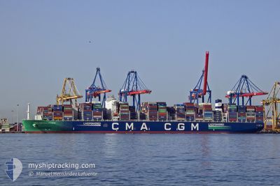
CMA CGM GALAPAGOS
Cargo A

Current Trip
| Time Travelled | 4 days |
|---|---|
| Remaining Time | --- |
| Distance Travelled | 1948.12 nm |
| Remaining Distance | --- |
| AVG Speed | 19 Knots |
| MAX Speed | 23.1 Knots |
| AVG Wind | 12.1 knots |
| MAX Wind | 22.6 knots |
| MIN Temp | 5.8°C / 42.44°F |
| MAX Temp | 19.8°C / 67.64°F |
| Draught | 14.9 m |
| Position Received | 2 d ago |
Current Position
| Longitude | 142.39666° |
|---|---|
| Latitude | 41.62656° |
| Status | Under way using engine |
| Speed | 20 Knots |
| Course | 103.2° |
| Area | North Pacific Ocean |
| Station | T-AIS |
| Position Received | 2 d ago |
Information
The current position of CMA CGM GALAPAGOS is in North Pacific Ocean with coordinates 41.62656° / 142.39666° as reported on 2025-06-08 09:45 by AIS to our vessel tracker app. The vessel's current speed is 20 Knots and is heading at the port of MANZANILLO. The estimated time of arrival as calculated by MyShipTracking vessel tracking app is 2025-06-21 09:00 LT
The vessel CMA CGM GALAPAGOS (IMO: 9894997, MMSI: 228410700) is a Cargo A It's sailing under the flag of [FR] France.
In this page you can find informations about the vessels current position, last detected port calls, and current voyage information. If the vessels is not in coverage by AIS you will find the latest position.
The current position of CMA CGM GALAPAGOS is detected by our AIS receivers and we are not responsible for the reliability of the data. The last position was recorded while the vessel was in Coverage by the Ais receivers of our vessel tracking app.
The current draught of CMA CGM GALAPAGOS as reported by AIS is 14.9 meters
Weather
| Temperature | 5.8°C / 42.44°F |
|---|---|
| Wind Speed | 15 knots |
| Direction | 247° WSW |
| Pressure | 1006.9 hPa |
| Humidity | 97.6 % |
| Cloud Coverage | 100 % |


Featured Company
Last Port Calls
| Port | Arrival | Departure | Time In Port |
|---|---|---|---|
| 2025-06-06 08:34 | 2025-06-07 01:34 | 17 h | |
| 2025-06-03 19:14 | 2025-06-04 12:45 | 17 h | |
| 2025-05-30 21:14 | 2025-05-31 22:06 | 1 d | |
| 2025-05-28 11:54 | 2025-05-29 09:58 | 22 h | |
| 2025-05-25 11:22 | 2025-05-26 09:02 | 21 h | |
| 2025-05-16 19:54 | 2025-05-18 09:06 | 1 d | |
| 2025-05-15 01:14 | 2025-05-15 15:14 | 13 h | |
| 2025-04-29 15:02 | 2025-05-01 04:01 | 1 d | |
| 2025-04-22 14:21 | 2025-04-27 18:53 | 5 d | |
| 2025-04-06 01:33 | 2025-04-07 04:18 | 1 d |
Most Visited Ports (Last year)
| Port | Arrivals | |
|---|---|---|
| 5 | ||
| 3 | ||
| 2 | ||
| 2 | ||
| 2 | ||
| 2 |
Last Trips
| Origin | Departure | Destination | Arrival | Distance | |
|---|---|---|---|---|---|
| 2025-06-04 12:45 | 2025-06-06 08:34 | 112.06 nm | |||
| 2025-05-31 22:06 | 2025-06-03 19:14 | 552.92 nm | |||
| 2025-05-29 09:58 | 2025-05-30 21:14 | 470.94 nm | |||
| 2025-05-26 09:02 | 2025-05-28 11:54 | 788.95 nm | |||
| 2025-05-18 09:06 | 2025-05-25 11:22 | 987.08 nm | |||
| 2025-05-15 15:14 | 2025-05-16 19:54 | 372.16 nm | |||
| 2025-05-01 04:01 | 2025-05-15 01:14 | 6049.58 nm | |||
| 2025-04-27 18:53 | 2025-04-29 15:02 | 410.57 nm | |||
| 2025-04-07 04:18 | 2025-04-22 14:21 | 6474.94 nm | |||
| 2025-03-31 06:02 | 2025-04-06 01:33 | 1627.13 nm |
Events
| Time | Event | Details | Position / Dest | Info |
|---|---|---|---|---|
| 2025-06-08 09:51 | Status Changed | Default Under way using engine |
41.61953 / 142.43697
MXZLO
|
Speed: 20 kn Course: 103.2° |
| 2025-06-08 09:45 | OUT of Coverage |
41.62656 / 142.39666
North Pacific Ocean
MXZLO
|
Speed: 20 kn Course: 103.2° |
|
| 2025-06-08 09:29 | Status Changed | Under way using engine Default |
41.64314 / 142.28436
MXZLO
|
Speed: 19.8 kn Course: 97° |
| 2025-06-08 09:26 | Status Changed | Default Under way using engine |
41.64570 / 142.26245
MXZLO
|
Speed: 20 kn Course: 90.3° |
| 2025-06-08 07:17 | Change Sea Area | Japanese part of the North Pacific Ocean Japanese part of the Japan Sea |
41.64040 / 141.29057
North Pacific Ocean
MXZLO
|
Speed: 21.4 kn Course: 88.3° |
| 2025-06-08 05:07 | Status Changed | Under way using engine Default |
41.37741 / 140.34420
MXZLO
|
Speed: 22.4 kn Course: 44° |
| 2025-06-08 04:39 | Status Changed | Default Under way using engine |
41.27409 / 140.17113
MXZLO
|
Speed: 19.7 kn Course: 57.1° |
| 2025-06-08 04:33 | Status Changed | Under way using engine Default |
41.25845 / 140.13896
MXZLO
|
Speed: 19.4 kn Course: 57° |
| 2025-06-08 04:31 | Status Changed | Default Under way using engine |
41.24992 / 140.12151
MXZLO
|
Speed: 19.2 kn Course: 56.7° |
| 2025-06-08 04:24 | Status Changed | Under way using engine Default |
41.23036 / 140.08235
MXZLO
|
Speed: 19.3 kn Course: 57° |