
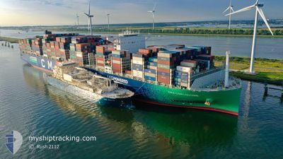
CMA CGM LOUVRE
Cargo A
Current Trip
| Time Travelled | 11 h, 10 mins |
|---|---|
| Remaining Time | 1 h, 10 mins |
| Distance Travelled | 115.77 nm |
| Remaining Distance | 18.82 nm |
| AVG Speed | 11 Knots |
| MAX Speed | 15.1 Knots |
| AVG Wind | 14.6 knots |
| MAX Wind | 20.8 knots |
| MIN Temp | 6.8°C / 44.24°F |
| MAX Temp | 9.8°C / 49.64°F |
| Draught | 15.1 m |
| Position Received | 1 m ago |
Current Position
| Longitude | 3.71711° |
|---|---|
| Latitude | 52.01446° |
| Status | Under way using engine |
| Speed | 8.1 Knots |
| Course | 75.2° |
| Area | North Sea |
| Station | T-AIS |
| Position Received | 1 m ago |
Info
Information
The current position of CMA CGM LOUVRE is in North Sea with coordinates 52.01446° / 3.71711° as reported on 2025-02-05 08:32 by AIS to our vessel tracker app. The vessel's current speed is 8.1 Knots and is heading at the port of ROTTERDAM. The estimated time of arrival as calculated by MyShipTracking vessel tracking app is 2025-02-05 09:43 LT
The vessel CMA CGM LOUVRE (IMO: 9839143, MMSI: 228394900) is a Cargo A It's sailing under the flag of [FR] France.
In this page you can find informations about the vessels current position, last detected port calls, and current voyage information. If the vessels is not in coverage by AIS you will find the latest position.
The current position of CMA CGM LOUVRE is detected by our AIS receivers and we are not responsible for the reliability of the data. The last position was recorded while the vessel was in Coverage by the Ais receivers of our vessel tracking app.
The current draught of CMA CGM LOUVRE as reported by AIS is 15.1 meters
Weather
| Temperature | 6.8°C / 44.24°F |
|---|---|
| Wind Speed | 11 knots |
| Direction | 287° WNW |
| Pressure | 1034.8 hPa |
| Humidity | 88.9 % |
| Cloud Coverage | 6 % |
Featured Company
Last Trips
| Origin | Departure | Destination | Arrival | Distance | |
|---|---|---|---|---|---|
| 2025-01-04 02:33 | 2025-02-02 12:32 | 11969.31 nm | |||
| 2024-12-30 02:34 | 2025-01-02 07:30 | 1474.14 nm | |||
| 2024-12-21 23:37 | 2024-12-28 10:29 | 900.96 nm | |||
| 2024-12-13 11:44 | 2024-12-19 23:20 | 2432.79 nm | |||
| 2024-11-14 14:46 | 2024-12-10 11:40 | 11509.60 nm |
Events
| Time | Event | Details | Position / Dest | Info |
|---|---|---|---|---|
| 2025-02-05 07:35 | START Moving | 16.29 nm, North West of BROUWERSDAM |
51.93862 / 3.51542
NLRTM
|
Speed: 3.2 kn Course: 28° |
| 2025-02-05 06:31 | ETA Changed | 2025/02/05 08:30 2025/02/05 05:00 |
51.93236 / 3.50069
NLRTM
|
Speed: 0.4 kn Course: 51° |
| 2025-02-05 06:15 | STOP Moving | 16.36 nm, North West of BROUWERSDAM |
51.93190 / 3.50302
NLRTM
|
Speed: 0.3 kn Course: 47° |
| 2025-02-05 02:43 | Change Sea Area | Dutch part of the North Sea Belgian part of the North Sea |
51.77287 / 2.70640
North Sea
NLRTM
|
Speed: 14.5 kn Course: 66.5° |
| 2025-02-05 01:13 | Detected in Sea | Belgian part of the North Sea |
51.52899 / 2.26907
North Sea
NLRTM
|
Speed: 14.3 kn Course: 39.8° |
| 2025-02-05 00:25 | Change Sea Area | French part of the North Sea United Kingdom part of the North Sea |
51.38660 / 2.06866
North Sea
NLRTM
|
Speed: 14 kn Course: 43.7° |
| 2025-02-04 22:46 | Change Sea Area | United Kingdom part of the North Sea French part of the North Sea |
51.09513 / 1.69735
North Sea
NLRTM
|
Speed: 12.8 kn Course: 10° |
| 2025-02-04 21:23 | PORT DEPARTURE |
|
51.04695 / 2.14966
NLRTM
|
Speed: 9.7 kn Course: 300° |
| 2025-02-04 20:58 | START Moving |
51.00659 / 2.18025
[FR] DUNKERQUE
|
Speed: 3.1 kn Course: 341° |
|
| 2025-02-04 20:45 | Status Changed | Under way using engine Moored |
51.00467 / 2.18340
[FR] DUNKERQUE
|
Speed: Course: 344° |