

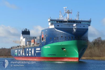
CMA CGM TIVOLI
Cargo A

Current Trip
| Time Travelled | 2 days |
|---|---|
| Remaining Time | 16 h, 37 mins |
| Distance Travelled | 781.75 nm |
| Remaining Distance | 218.30 nm |
| AVG Speed | 12.2 Knots |
| MAX Speed | 13.7 Knots |
| AVG Wind | 10.9 knots |
| MAX Wind | 17.9 knots |
| MIN Temp | 11°C / 51.8°F |
| MAX Temp | 15.3°C / 59.54°F |
| Draught | 9.5 m |
| Position Received | 1 h, 11 m ago |
Current Position
| Longitude | 7.61154° |
|---|---|
| Latitude | 55.99812° |
| Status | Under way using engine |
| Speed | 11.6 Knots |
| Course | 188° |
| Area | North Sea |
| Station | T-AIS |
| Position Received | 1 h, 11 m ago |
Information
The current position of CMA CGM TIVOLI is in North Sea with coordinates 55.99812° / 7.61154° as reported on 2025-06-08 13:17 by AIS to our vessel tracker app. The vessel's current speed is 11.6 Knots and is heading at the port of HAMBURG. The estimated time of arrival as calculated by MyShipTracking vessel tracking app is 2025-06-09 09:05 LT
The vessel CMA CGM TIVOLI (IMO: 9961312, MMSI: 256883000) is a Cargo A It's sailing under the flag of [MT] Malta.
In this page you can find informations about the vessels current position, last detected port calls, and current voyage information. If the vessels is not in coverage by AIS you will find the latest position.
The current position of CMA CGM TIVOLI is detected by our AIS receivers and we are not responsible for the reliability of the data. The last position was recorded while the vessel was in Coverage by the Ais receivers of our vessel tracking app.
The current draught of CMA CGM TIVOLI as reported by AIS is 9.5 meters
Weather
| Temperature | 12.4°C / 54.32°F |
|---|---|
| Wind Speed | 17 knots |
| Direction | 308° NW |
| Pressure | 1007.2 hPa |
| Humidity | 82.5 % |
| Cloud Coverage | 74 % |


Featured Company
Last Port Calls
| Port | Arrival | Departure | Time In Port |
|---|---|---|---|
| 2025-06-04 18:45 | 2025-06-06 03:45 | 1 d | |
| 2025-05-31 19:30 | 2025-06-01 20:09 | 1 d | |
| 2025-05-31 06:46 | 2025-05-31 15:46 | 8 h | |
| 2025-05-29 06:31 | 2025-05-29 06:35 | 3 m | |
| 2025-05-27 22:40 | 2025-05-28 11:28 | 12 h | |
| 2025-05-22 21:53 | 2025-05-27 12:49 | 4 d | |
| 2025-05-18 00:33 | 2025-05-19 16:25 | 1 d | |
| 2025-05-14 07:24 | 2025-05-14 18:47 | 11 h | |
| 2025-05-12 00:41 | 2025-05-12 00:46 | 4 m | |
| 2025-05-10 07:10 | 2025-05-11 07:03 | 23 h |
Most Visited Ports (Last year)
| Port | Arrivals | |
|---|---|---|
| 15 | ||
| 14 | ||
| 13 | ||
| 12 | ||
| 12 | ||
| 8 |
Last Trips
| Origin | Departure | Destination | Arrival | Distance | |
|---|---|---|---|---|---|
| 2025-06-01 20:09 | 2025-06-04 18:45 | 572.98 nm | |||
| 2025-05-31 15:46 | 2025-05-31 19:30 | 46.89 nm | |||
| 2025-05-29 06:35 | 2025-05-31 06:46 | 633.79 nm | |||
| 2025-05-28 11:28 | 2025-05-29 06:31 | 128.56 nm | |||
| 2025-05-27 12:49 | 2025-05-27 22:40 | 116.49 nm | |||
| 2025-05-19 16:25 | 2025-05-22 21:53 | 1071.35 nm | |||
| 2025-05-14 18:47 | 2025-05-18 00:33 | 585.79 nm | |||
| 2025-05-12 00:46 | 2025-05-14 07:24 | 492.03 nm | |||
| 2025-05-11 07:03 | 2025-05-12 00:41 | 131.07 nm | |||
| 2025-05-09 20:19 | 2025-05-10 07:10 | 135.14 nm |
Events
| Time | Event | Details | Position / Dest | Info |
|---|---|---|---|---|
| 2025-06-08 13:17 | OUT of Coverage |
55.99812 / 7.61154
North Sea
HAMBURG VIA SKAW
|
Speed: 11.6 kn Course: 188° |
|
| 2025-06-08 09:45 | Draught Changed | 9.5 10 |
56.60550 / 7.72492
HAMBURG VIA SKAW
|
Speed: 12.4 kn Course: 215.8° |
| 2025-06-08 06:16 | Detected in Sea | Danish part of the North Sea |
57.15545 / 8.47073
North Sea
HAMBURG VIA SKAW
|
Speed: 11 kn Course: 223.8° |
| 2025-06-08 06:16 | IN Coverage |
57.15545 / 8.47073
North Sea
HAMBURG VIA SKAW
|
Speed: 11 kn Course: 223.8° |
|
| 2025-06-08 03:39 | OUT of Coverage |
57.50648 / 9.10597
Skaggerak
HAMBURG VIA SKAW
|
Speed: 11.4 kn Course: 226.6° |
|
| 2025-06-07 21:58 | Change Sea Area | Danish part of the Skaggerak Danish part of the Kattegat |
57.80182 / 10.93583
Skaggerak
HAMBURG VIA SKAW
|
Speed: 12 kn Course: 323.4° |
| 2025-06-07 20:40 | Change Sea Area | Danish part of the Kattegat Swedish part of the Kattegat |
57.61050 / 11.24580
Kattegat
HAMBURG VIA SKAW
|
Speed: 11.8 kn Course: 318.6° |
| 2025-06-07 17:19 | Change Sea Area | Swedish part of the Kattegat Danish part of the Kattegat |
57.01058 / 11.74882
Kattegat
HAMBURG VIA SKAW
|
Speed: 12.2 kn Course: 341.3° |
| 2025-06-07 15:34 | IN Coverage |
56.68255 / 11.86128
Kattegat
HAMBURG VIA SKAW
|
Speed: 12.7 kn Course: 43.9° |
|
| 2025-06-07 12:17 | OUT of Coverage |
56.10898 / 11.17626
Kattegat
HAMBURG VIA SKAW
|
Speed: 12.7 kn Course: 39.1° |