
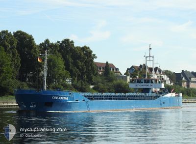
COE KAETHE
General Cargo
Current Trip
| Trip Time | 19 h, 30 mins |
|---|---|
| Trip Distance | 108.25 nm |
| AVG Speed | 5.7 Knots |
| MAX Speed | 8.5 Knots |
| Draught | 3.3 m |
| AVG Wind | 8.6 knots |
| MAX Wind | 16.1 knots |
| MIN Temp | -3.9°C / 24.98°F |
| MAX Temp | 0.1°C / 32.18°F |
| Position Received | 2 d ago |
Current Position
| Longitude | 12.51927° |
|---|---|
| Latitude | 58.48999° |
| Status | Under way using engine |
| Speed | 7.6 Knots |
| Course | 39.9° |
| Area | Kattegat |
| Station | T-AIS |
| Position Received | 2 d ago |
Info
Information
The current position of COE KAETHE is in Kattegat with coordinates 58.48999° / 12.51927° as reported on 2025-02-13 19:45 by AIS to our vessel tracker app. The vessel's current speed is 7.6 Knots and is currently inside the port of LIDKOPING.
The vessel COE KAETHE (IMO: 7924401, MMSI: 374395000) is a General Cargo that was built in 1980 ( 45 years old ). It's sailing under the flag of [PA] Panama.
In this page you can find informations about the vessels current position, last detected port calls, and current voyage information. If the vessels is not in coverage by AIS you will find the latest position.
The current position of COE KAETHE is detected by our AIS receivers and we are not responsible for the reliability of the data. The last position was recorded while the vessel was in Coverage by the Ais receivers of our vessel tracking app.
The current draught of COE KAETHE as reported by AIS is 3.3 meters
Weather
| Temperature | -5.5°C / 22.1°F |
|---|---|
| Wind Speed | 5 knots |
| Direction | 286° WNW |
| Pressure | 1028.1 hPa |
| Humidity | 57.5 % |
| Cloud Coverage | --- |
Featured Company
Last Port Calls
| Port | Arrival | Departure | Time In Port |
|---|---|---|---|
| 2025-02-14 02:21 | |||
| 2025-02-13 06:10 | 2025-02-13 06:51 | 40 m | |
| 2025-02-10 01:17 | 2025-02-10 19:14 | 17 h | |
| 2025-02-06 17:34 | 2025-02-07 12:46 | 19 h | |
| 2025-02-03 00:31 | 2025-02-04 16:12 | 1 d | |
| 2025-01-30 23:29 | |||
| 2025-01-25 10:53 | 2025-01-26 16:23 | 1 d | |
| 2025-01-22 11:00 | 2025-01-24 16:33 | 2 d | |
| 2025-01-21 06:25 | 2025-01-21 19:27 | 13 h | |
| 2025-01-19 18:40 | 2025-01-20 21:37 | 1 d |
Last Trips
| Origin | Departure | Destination | Arrival | Distance | |
|---|---|---|---|---|---|
| 2025-02-13 06:51 | 2025-02-14 02:21 | 108.25 nm | |||
| 2025-02-10 19:14 | 2025-02-13 06:10 | 467.69 nm | |||
| 2025-02-07 12:46 | 2025-02-10 01:17 | 425.70 nm | |||
| 2025-02-04 16:12 | 2025-02-06 17:34 | 379.02 nm | |||
| 2025-01-30 23:29 | 2025-02-03 00:31 | 91.85 nm | |||
| 2025-01-24 16:33 | 2025-01-25 10:53 | 131.25 nm | |||
| 2025-01-21 19:27 | 2025-01-22 11:00 | 121.64 nm | |||
| 2025-01-20 21:37 | 2025-01-21 06:25 | 71.72 nm | |||
| 2025-01-17 21:13 | 2025-01-19 18:40 | 234.23 nm | |||
| 2025-01-12 09:06 | 2025-01-15 10:58 | 379.60 nm |
Events
| Time | Event | Details | Position / Dest | Info |
|---|---|---|---|---|
| 2025-02-14 01:33 | STOP Moving |
58.50867 / 13.16645
[SE] LIDKOPING
|
Speed: Course: 67° |
|
| 2025-02-14 01:21 | PORT ARRIVAL |
|
58.50991 / 13.16544
[SE] LIDKOPING
|
Speed: 3.5 kn Course: 206° |
| 2025-02-13 19:53 | Status Changed | Default Under way using engine |
58.50358 / 12.53981
SELDK
|
Speed: 7.6 kn Course: 39.9° |
| 2025-02-13 19:45 | OUT of Coverage |
58.48999 / 12.51927
Kattegat
SELDK
|
Speed: 7.6 kn Course: 39.9° |
|
| 2025-02-13 18:29 | START Moving | 0.45 nm, South West of VANERSBORG |
58.37870 / 12.30896
SELDK
|
Speed: 3.2 kn Course: 17° |
| 2025-02-13 18:13 | STOP Moving | 0.56 nm, South West of VANERSBORG |
58.37672 / 12.30838
SELDK
|
Speed: 0.2 kn Course: 7° |
| 2025-02-13 17:35 | START Moving | 2.74 nm, South of VANERSBORG |
58.34218 / 12.35030
SELDK
|
Speed: 3.3 kn Course: 337° |
| 2025-02-13 17:18 | STOP Moving | 2.86 nm, South of VANERSBORG |
58.34036 / 12.35163
SELDK
|
Speed: 0.2 kn Course: 337° |
| 2025-02-13 16:05 | START Moving | 7.29 nm, South of VANERSBORG |
58.26626 / 12.26677
SELDK
|
Speed: 3.1 kn Course: 45° |
| 2025-02-13 14:43 | STOP Moving | 7.48 nm, South of VANERSBORG |
58.26500 / 12.25262
SELDK
|
Speed: 0.3 kn Course: 88° |