
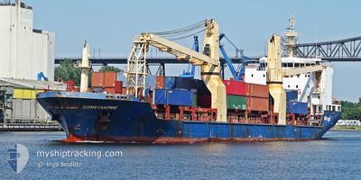
CONSTANTINE
General Cargo
Current Trip
DZORA
| Time Travelled | 1 day |
|---|---|
| Remaining Time | --- |
| Distance Travelled | 521.27 nm |
| Remaining Distance | --- |
| AVG Speed | 12 Knots |
| MAX Speed | 12.9 Knots |
| AVG Wind | 18.6 knots |
| MAX Wind | 27.8 knots |
| MIN Temp | 8.5°C / 47.3°F |
| MAX Temp | 13.1°C / 55.58°F |
| Draught | 6.4 m |
| Position Received | 2 h, 53 m ago |
Current Position
| Longitude | -10.05068° |
|---|---|
| Latitude | 38.48895° |
| Status | Under way using engine |
| Speed | 12.4 Knots |
| Course | 171.5° |
| Area | North Atlantic Ocean |
| Station | T-AIS |
| Position Received | 2 h, 53 m ago |
Info
Information
The current position of CONSTANTINE is in North Atlantic Ocean with coordinates 38.48895° / -10.05068° as reported on 2025-12-26 09:10 by AIS to our vessel tracker app. The vessel's current speed is 12.4 Knots
The vessel CONSTANTINE (IMO: 9626716, MMSI: 605086014) is a General Cargo that was built in 2012 ( 13 years old ). It's sailing under the flag of [DZ] Algeria.
In this page you can find informations about the vessels current position, last detected port calls, and current voyage information. If the vessels is not in coverage by AIS you will find the latest position.
The current position of CONSTANTINE is detected by our AIS receivers and we are not responsible for the reliability of the data. The last position was recorded while the vessel was in Coverage by the Ais receivers of our vessel tracking app.
The current draught of CONSTANTINE as reported by AIS is 6.4 meters
Weather
| Temperature | 13.4°C / 56.12°F |
|---|---|
| Wind Speed | 5 knots |
| Direction | 300° WNW |
| Pressure | 1014.7 hPa |
| Humidity | 51 % |
| Cloud Coverage | 100 % |
Featured Company
Last Port Calls
| Port | Arrival | Departure | Time In Port |
|---|---|---|---|
| 2025-12-22 14:01 | 2025-12-24 17:04 | 2 d | |
| 2025-12-14 18:17 | 2025-12-19 18:12 | 4 d | |
| 2025-11-23 23:44 | 2025-11-26 21:09 | 2 d | |
| 2025-11-09 09:27 | 2025-11-11 15:21 | 2 d | |
| 2025-10-28 19:37 | 2025-11-05 22:53 | 8 d | |
| 2025-10-13 08:23 | 2025-10-22 19:43 | 9 d | |
| 2025-10-07 14:04 |
Last Trips
| Origin | Departure | Destination | Arrival | Distance | |
|---|---|---|---|---|---|
| 2025-12-19 18:12 | 2025-12-22 14:01 | 760.35 nm | |||
| 2025-11-26 21:09 | 2025-12-14 18:17 | 1889.43 nm | |||
| 2025-11-11 15:21 | 2025-11-23 23:44 | 1059.87 nm | |||
| 2025-11-05 22:53 | 2025-11-09 09:27 | 781.77 nm | |||
| 2025-10-22 19:43 | 2025-10-28 19:37 | 411.73 nm | |||
| 2025-10-07 14:04 | 2025-10-13 08:23 | 1470.30 nm |
Events
| Time | Event | Details | Position / Dest | Info |
|---|---|---|---|---|
| 2025-12-26 09:18 | Status Changed | Default Under way using engine |
38.46273 / -10.04637
DZORA
|
Speed: 12.4 kn Course: 171.5° |
| 2025-12-26 09:10 | OUT of Coverage |
38.48895 / -10.05068
North Atlantic Ocean
DZORA
|
Speed: 12.4 kn Course: 171.5° |
|
| 2025-12-26 08:03 | Status Changed | Under way using engine Default |
38.71520 / -10.10734
DZORA
|
Speed: 11 kn Course: 180° |
| 2025-12-26 07:42 | Status Changed | Default Under way using engine |
38.78500 / -10.10500
DZORA
|
Speed: 12 kn Course: 178.7° |
| 2025-12-26 06:41 | ETA Changed | 2025/12/28 10:00 2025/12/28 15:00 |
38.99645 / -10.10503
DZORA
|
Speed: 12.4 kn Course: 180.9° |
| 2025-12-26 06:21 | Change Sea Area | Portuguese part of the North Atlantic Ocean Spanish part of the North Atlantic Ocean |
39.06583 / -10.10678
North Atlantic Ocean
DZORA
|
Speed: 12 kn Course: 180° |
| 2025-12-26 06:21 | Status Changed | Under way using engine Default |
39.06583 / -10.10678
DZORA
|
Speed: 12 kn Course: 179° |
| 2025-12-26 06:06 | IN Coverage |
39.06583 / -10.10678
North Atlantic Ocean
DZORA
|
Speed: 12 kn Course: 180° |
|
| 2025-12-25 04:30 | Status Changed | Default Under way using engine |
43.79666 / -8.96667
DZORA
|
Speed: 11.4 kn Course: 248.8° |
| 2025-12-25 04:27 | OUT of Coverage |
43.80035 / -8.95640
North Atlantic Ocean
DZORA
|
Speed: 11.4 kn Course: 248.8° |