
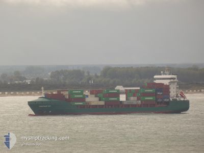
CONTSHIP IVY
General Cargo
Current Trip
EGDAM
| Time Travelled | 16 h, 43 mins |
|---|---|
| Remaining Time | --- |
| Distance Travelled | 77.21 nm |
| Remaining Distance | --- |
| AVG Speed | 12.6 Knots |
| MAX Speed | 13.2 Knots |
| AVG Wind | 8.2 knots |
| MAX Wind | 9.7 knots |
| MIN Temp | 14°C / 57.2°F |
| MAX Temp | 14.6°C / 58.28°F |
| Draught | 7.3 m |
| Position Received | 2 d ago |
Current Position
| Longitude | 32.15837° |
|---|---|
| Latitude | 31.51949° |
| Status | Under way using engine |
| Speed | 2.6 Knots |
| Course | 310° |
| Area | Mediterranean Sea - Eastern Basin |
| Station | T-AIS |
| Position Received | 2 d ago |
Info
Information
The current position of CONTSHIP IVY is in Mediterranean Sea - Eastern Basin with coordinates 31.51949° / 32.15837° as reported on 2025-02-06 08:51 by AIS to our vessel tracker app. The vessel's current speed is 2.6 Knots
The vessel CONTSHIP IVY (IMO: 9371402, MMSI: 212267000) is a General Cargo that was built in 2007 ( 18 years old ). It's sailing under the flag of [CY] Cyprus.
In this page you can find informations about the vessels current position, last detected port calls, and current voyage information. If the vessels is not in coverage by AIS you will find the latest position.
The current position of CONTSHIP IVY is detected by our AIS receivers and we are not responsible for the reliability of the data. The last position was recorded while the vessel was in Coverage by the Ais receivers of our vessel tracking app.
The current draught of CONTSHIP IVY as reported by AIS is 7.3 meters
Weather
| Temperature | 12.5°C / 54.5°F |
|---|---|
| Wind Speed | 8 knots |
| Direction | 331° NNW |
| Pressure | 1019.5 hPa |
| Humidity | 55.8 % |
| Cloud Coverage | 11 % |
Featured Company
Last Port Calls
| Port | Arrival | Departure | Time In Port |
|---|---|---|---|
| 2025-02-07 11:46 | 2025-02-08 15:37 | 1 d | |
| 2025-02-04 23:45 | 2025-02-05 15:29 | 15 h | |
| 2025-02-03 14:16 | 2025-02-04 05:59 | 15 h | |
| 2025-01-31 13:20 | 2025-02-02 00:11 | 1 d | |
| 2025-01-26 15:04 | 2025-01-27 17:45 | 1 d | |
| 2025-01-25 23:09 | 2025-01-26 09:56 | 10 h | |
| 2025-01-24 19:21 | 2025-01-25 00:29 | 5 h | |
| 2025-01-21 06:12 | 2025-01-23 04:53 | 1 d | |
| 2025-01-15 12:40 | 2025-01-16 18:00 | 1 d | |
| 2025-01-14 19:36 | 2025-01-15 05:33 | 9 h |
Last Trips
| Origin | Departure | Destination | Arrival | Distance | |
|---|---|---|---|---|---|
| 2025-02-05 17:29 | 2025-02-07 13:46 | 58.57 nm | |||
| 2025-02-04 07:59 | 2025-02-05 01:45 | 213.66 nm | |||
| 2025-02-02 02:11 | 2025-02-03 16:16 | 538.19 nm | |||
| 2025-01-27 19:45 | 2025-01-31 15:20 | 590.75 nm | |||
| 2025-01-26 11:56 | 2025-01-26 17:04 | 58.50 nm | |||
| 2025-01-25 02:29 | 2025-01-26 01:09 | 213.63 nm | |||
| 2025-01-23 06:53 | 2025-01-24 21:21 | 537.17 nm | |||
| 2025-01-16 20:00 | 2025-01-21 08:12 | 585.27 nm | |||
| 2025-01-15 07:33 | 2025-01-15 14:40 | 56.65 nm | |||
| 2025-01-14 02:18 | 2025-01-14 21:36 | 214.78 nm |
Events
| Time | Event | Details | Position / Dest | Info |
|---|---|---|---|---|
| 2025-02-08 15:37 | PORT DEPARTURE |
|
31.49380 / 31.75983
EGDAM
|
Speed: 6.2 kn Course: 10° |
| 2025-02-08 15:26 | START Moving |
31.47153 / 31.75492
[EG] DAMIETTA
|
Speed: 5.9 kn Course: 8° |
|
| 2025-02-07 12:22 | STOP Moving |
31.45747 / 31.76256
[EG] DAMIETTA
|
Speed: 0.2 kn Course: 135° |
|
| 2025-02-07 11:46 | PORT ARRIVAL |
|
31.48821 / 31.75811
[EG] DAMIETTA
|
Speed: 5.9 kn Course: 194° |
| 2025-02-07 10:06 | START Moving | 12.92 nm, North East of DAMIETTA |
31.65290 / 31.88704
EGDAM
|
Speed: 3.9 kn Course: 244° |
| 2025-02-06 15:40 | STOP Moving | 14.88 nm, North East of DAMIETTA |
31.62981 / 31.97796
EGDAM
|
Speed: 0.2 kn Course: 315° |
| 2025-02-06 11:33 | START Moving | 17.16 nm, North East of DAMIETTA |
31.57710 / 32.06747
EGDAM
|
Speed: 3.2 kn Course: 314° |
| 2025-02-06 08:52 | Status Changed | Default Under way using engine |
31.51971 / 32.15801
EGDAM
|
Speed: 2.6 kn Course: 310° |
| 2025-02-06 08:51 | Status Changed | Under way using engine Default |
31.51949 / 32.15837
EGDAM
|
Speed: 1.9 kn Course: 320° |
| 2025-02-06 08:51 | OUT of Coverage |
31.51949 / 32.15837
Mediterranean Sea - Eastern Basin
|
Speed: 2.6 kn Course: 303.1° |