
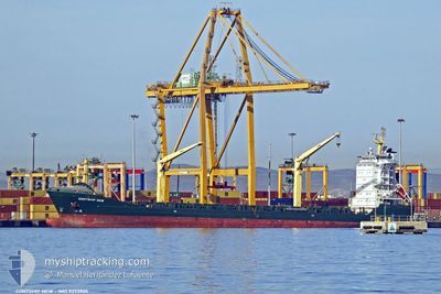
CONTSHIP NEW
General Cargo
Current Trip
NOUAKCHOTT
| Time Travelled | 4 days |
|---|---|
| Remaining Time | --- |
| Distance Travelled | 209.75 nm |
| Remaining Distance | --- |
| AVG Speed | 11.2 Knots |
| MAX Speed | 12.2 Knots |
| AVG Wind | 16.5 knots |
| MAX Wind | 21.8 knots |
| MIN Temp | 16.2°C / 61.16°F |
| MAX Temp | 19.6°C / 67.28°F |
| Draught | 7.5 m |
| Position Received | 4 d ago |
Current Position
| Longitude | -17.39220° |
|---|---|
| Latitude | 20.02335° |
| Status | Under way using engine |
| Speed | 11.1 Knots |
| Course | 357.3° |
| Area | North Atlantic Ocean |
| Station | T-AIS |
| Position Received | 4 d ago |
Info
Information
The current position of CONTSHIP NEW is in North Atlantic Ocean with coordinates 20.02335° / -17.39220° as reported on 2025-02-14 19:36 by AIS to our vessel tracker app. The vessel's current speed is 11.1 Knots
The vessel CONTSHIP NEW (IMO: 9373905, MMSI: 209345000) is a General Cargo that was built in 2007 ( 18 years old ). It's sailing under the flag of [CY] Cyprus.
In this page you can find informations about the vessels current position, last detected port calls, and current voyage information. If the vessels is not in coverage by AIS you will find the latest position.
The current position of CONTSHIP NEW is detected by our AIS receivers and we are not responsible for the reliability of the data. The last position was recorded while the vessel was in Coverage by the Ais receivers of our vessel tracking app.
The current draught of CONTSHIP NEW as reported by AIS is 7.5 meters
Weather
| Temperature | 17.8°C / 64.04°F |
|---|---|
| Wind Speed | 18 knots |
| Direction | 10° N |
| Pressure | 1015.9 hPa |
| Humidity | 88.2 % |
| Cloud Coverage | --- |
Featured Company
Last Port Calls
| Port | Arrival | Departure | Time In Port |
|---|---|---|---|
| 2025-02-13 10:29 | 2025-02-14 06:40 | 20 h | |
| 2025-02-08 15:34 | 2025-02-10 14:10 | 1 d | |
| 2025-02-04 19:40 | 2025-02-06 10:07 | 1 d | |
| 2025-01-31 23:44 | 2025-02-02 12:38 | 1 d | |
| 2025-01-27 12:38 | 2025-01-29 14:01 | 2 d | |
| 2025-01-22 05:55 | 2025-01-22 19:01 | 13 h | |
| 2025-01-15 11:17 | 2025-01-16 18:26 | 1 d | |
| 2025-01-11 18:08 | 2025-01-13 12:02 | 1 d | |
| 2025-01-08 11:06 | 2025-01-09 10:41 | 23 h | |
| 2024-12-31 06:38 | 2025-01-05 21:59 | 5 d |
Most Visited Ports (Last year)
| Port | Arrivals | |
|---|---|---|
| 25 | ||
| 15 | ||
| 7 | ||
| 6 | ||
| 6 | ||
| 6 |
Last Trips
| Origin | Departure | Destination | Arrival | Distance | |
|---|---|---|---|---|---|
| 2025-02-10 14:10 | 2025-02-13 10:29 | 661.56 nm | |||
| 2025-02-06 10:07 | 2025-02-08 15:34 | 659.71 nm | |||
| 2025-02-02 12:38 | 2025-02-04 19:40 | 660.02 nm | |||
| 2025-01-29 14:01 | 2025-01-31 23:44 | 491.78 nm | |||
| 2025-01-22 19:01 | 2025-01-27 12:38 | 845.86 nm | |||
| 2025-01-16 18:26 | 2025-01-22 05:55 | 1368.65 nm | |||
| 2025-01-13 12:02 | 2025-01-15 11:17 | 495.30 nm | |||
| 2025-01-09 10:41 | 2025-01-11 18:08 | 216.97 nm | |||
| 2025-01-05 21:59 | 2025-01-08 11:06 | 666.92 nm | |||
| 2024-12-28 18:15 | 2024-12-31 06:38 | 667.68 nm |
Events
| Time | Event | Details | Position / Dest | Info |
|---|---|---|---|---|
| 2025-02-15 01:09 | STOP Moving | 3.48 nm, South East of NOUADHIBOU |
20.86876 / -16.99152
NOUAKCHOTT
|
Speed: Course: 283° |
| 2025-02-14 19:42 | Status Changed | Default Under way using engine |
20.04430 / -17.39139
NOUAKCHOTT
|
Speed: 11.1 kn Course: 357.3° |
| 2025-02-14 19:36 | OUT of Coverage |
20.02335 / -17.39220
North Atlantic Ocean
|
Speed: 11.1 kn Course: 357.3° |
|
| 2025-02-14 19:34 | Change Sea Area | Mauritanian part of the North Atlantic Ocean Western Saharan part of the North Atlantic Ocean |
20.01718 / -17.39188
North Atlantic Ocean
|
Speed: 11 kn Course: 357.3° |
| 2025-02-14 19:32 | Status Changed | Under way using engine Default |
20.01209 / -17.39163
NOUAKCHOTT
|
Speed: 10.9 kn Course: 1° |
| 2025-02-14 19:19 | IN Coverage |
20.01718 / -17.39188
North Atlantic Ocean
|
Speed: 11 kn Course: 357.3° |
|
| 2025-02-14 06:41 | START Moving | 0.55 nm, West of NOUAKCHOTT |
17.98552 / -16.03908
NOUAKCHOTT
|
Speed: 3.1 kn Course: 265° |
| 2025-02-14 06:40 | PORT DEPARTURE |
|
17.98552 / -16.03908
NOUAKCHOTT
|
Speed: 1.9 kn Course: 237° |
| 2025-02-13 10:47 | STOP Moving |
17.98601 / -16.03083
[MR] NOUAKCHOTT
|
Speed: 0.3 kn Course: 86° |
|
| 2025-02-13 10:29 | PORT ARRIVAL |
|
17.98627 / -16.03415
[MR] NOUAKCHOTT
|
Speed: 3.6 kn Course: 77° |