
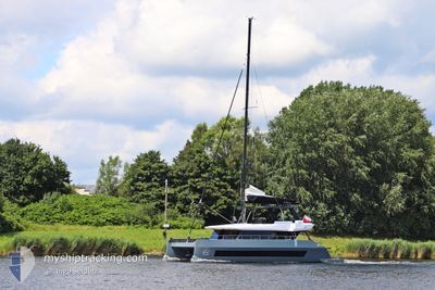
CORAL MOON
Pleasure Craft
Current Trip
| Trip Time | 1 h, 2 mins |
|---|---|
| Trip Distance | 6.59 nm |
| AVG Speed | 5.9 Knots |
| MAX Speed | 7.3 Knots |
| Draught | --- |
| AVG Wind | 17 knots |
| MAX Wind | 17 knots |
| MIN Temp | 26.4°C / 79.52°F |
| MAX Temp | 26.4°C / 79.52°F |
| Position Received | 3 m ago |
Current Position
| Longitude | -64.61801° |
|---|---|
| Latitude | 18.31583° |
| Status | Default |
| Speed | 0.4 Knots |
| Course | --- |
| Area | Caribbean Sea |
| Station | T-AIS |
| Position Received | 3 m ago |
Info
Information
The current position of CORAL MOON is in Caribbean Sea with coordinates 18.31583° / -64.61801° as reported on 2025-02-02 06:03 by AIS to our vessel tracker app. The vessel's current speed is 0.4 Knots and is currently inside the port of NORMAN ISLAND.
The vessel CORAL MOON (MMSI: 338868000) is a Pleasure Craft It's sailing under the flag of [US] USA.
In this page you can find informations about the vessels current position, last detected port calls, and current voyage information. If the vessels is not in coverage by AIS you will find the latest position.
The current position of CORAL MOON is detected by our AIS receivers and we are not responsible for the reliability of the data. The last position was recorded while the vessel was in Coverage by the Ais receivers of our vessel tracking app.
Weather
| Temperature | 25.7°C / 78.26°F |
|---|---|
| Wind Speed | 18 knots |
| Direction | 71° ENE |
| Pressure | 1016.5 hPa |
| Humidity | 75 % |
| Cloud Coverage | 1 % |
Featured Company
Last Port Calls
| Port | Arrival | Departure | Time In Port |
|---|---|---|---|
| 2025-02-01 21:19 | |||
| 2025-02-01 14:56 | 2025-02-01 20:17 | 5 h | |
| 2025-01-27 22:10 | 2025-01-28 17:08 | 18 h | |
| 2025-01-25 20:07 | 2025-01-26 16:41 | 20 h | |
| 2025-01-24 19:23 | 2025-01-25 19:10 | 23 h | |
| 2025-01-17 11:47 | 2025-01-17 13:29 | 1 h | |
| 2025-01-17 03:07 | 2025-01-17 03:26 | 19 m | |
| 2025-01-15 16:06 | 2025-01-15 22:25 | 6 h | |
| 2025-01-11 19:14 | 2025-01-12 13:49 | 18 h | |
| 2025-01-04 14:02 | 2025-01-06 12:17 | 1 d |
Most Visited Ports (Last year)
| Port | Arrivals | |
|---|---|---|
| 4 | ||
| 3 | ||
| 3 | ||
| 2 | ||
| 2 | ||
| 2 |
Last Trips
| Origin | Departure | Destination | Arrival | Distance | |
|---|---|---|---|---|---|
| 2025-02-01 16:17 | 2025-02-01 17:19 | 6.59 nm | |||
| 2025-01-28 13:08 | 2025-02-01 10:56 | 27.85 nm | |||
| 2025-01-26 12:41 | 2025-01-27 18:10 | 14.16 nm | |||
| 2025-01-25 15:10 | 2025-01-25 16:07 | 6.25 nm | |||
| 2025-01-17 09:29 | 2025-01-24 15:23 | 5.81 nm | |||
| 2025-01-16 23:26 | 2025-01-17 07:47 | 7.09 nm | |||
| 2025-01-15 18:25 | 2025-01-16 23:07 | 134.48 nm | |||
| 2025-01-12 09:49 | 2025-01-15 12:06 | 296.76 nm | |||
| 2025-01-06 08:17 | 2025-01-11 15:14 | 80.56 nm | |||
| 2025-01-02 06:11 | 2025-01-04 10:02 | 73.91 nm |
Events
| Time | Event | Details | Position / Dest | Info |
|---|---|---|---|---|
| 2025-02-01 21:26 | STOP Moving |
18.31582 / -64.61796
[VG] NORMAN ISLAND
|
Speed: 0.3 kn Course: 511° |
|
| 2025-02-01 21:19 | PORT ARRIVAL |
|
18.31718 / -64.62101
[VG] NORMAN ISLAND
|
Speed: 4 kn Course: 147° |
| 2025-02-01 21:07 | Change Sea Area | British Virgin Islands part of the Caribbean Sea Puerto Rican part of the Caribbean Sea |
18.33095 / -64.63884
Caribbean Sea
|
Speed: 6.6 kn Course: 138.8° |
| 2025-02-01 20:30 | Change Sea Area | Puerto Rican part of the Caribbean Sea British Virgin Islands part of the Caribbean Sea |
18.37080 / -64.69247
Caribbean Sea
|
Speed: 6 kn Course: 124.7° |
| 2025-02-01 20:17 | START Moving | 0.32 nm, South West of SOPERS HOLE |
18.38363 / -64.70919
|
Speed: 5.6 kn Course: 196.3° |
| 2025-02-01 20:17 | PORT DEPARTURE |
|
18.38363 / -64.70919
|
Speed: Course: 511° |
| 2025-02-01 18:30 | IN Coverage |
18.38622 / -64.70041
Caribbean Sea
[VG] SOPERS HOLE
|
Speed: 0.1 kn Course: 511° |
|
| 2025-02-01 17:27 | OUT of Coverage |
18.38621 / -64.70042
Caribbean Sea
[VG] SOPERS HOLE
|
Speed: 0.1 kn Course: 511° |
|
| 2025-02-01 16:35 | IN Coverage |
18.38542 / -64.70385
Caribbean Sea
[VG] SOPERS HOLE
|
Speed: 0.2 kn Course: 511° |
|
| 2025-02-01 15:08 | OUT of Coverage |
18.38550 / -64.70385
Caribbean Sea
[VG] SOPERS HOLE
|
Speed: 0.3 kn Course: 195.2° |