

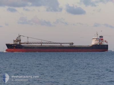
CSL THAMES
Self Discharging Bulk Carrier

Current Trip
| Time Travelled | 1 day |
|---|---|
| Remaining Time | --- |
| Distance Travelled | 414.11 nm |
| Remaining Distance | --- |
| AVG Speed | 10.8 Knots |
| MAX Speed | 12.9 Knots |
| AVG Wind | 10.1 knots |
| MAX Wind | 17.4 knots |
| MIN Temp | 10.7°C / 51.26°F |
| MAX Temp | 16.4°C / 61.52°F |
| Draught | 6.3 m |
| Position Received | Now |
Current Position
| Longitude | 4.94752° |
|---|---|
| Latitude | 58.76731° |
| Status | Under way using engine |
| Speed | 10.6 Knots |
| Course | 359.7° |
| Area | North Sea |
| Station | T-AIS |
| Position Received | Now |
Information
The current position of CSL THAMES is in North Sea with coordinates 58.76731° / 4.94752° as reported on 2025-05-31 18:21 by AIS to our vessel tracker app. The vessel's current speed is 10.6 Knots and is heading at the port of JELSA. The estimated time of arrival as calculated by MyShipTracking vessel tracking app is 2025-06-01 00:00 LT
The vessel CSL THAMES (IMO: 9440447, MMSI: 249605000) is a Self Discharging Bulk Carrier that was built in 2010 ( 15 years old ). It's sailing under the flag of [MT] Malta.
In this page you can find informations about the vessels current position, last detected port calls, and current voyage information. If the vessels is not in coverage by AIS you will find the latest position.
The current position of CSL THAMES is detected by our AIS receivers and we are not responsible for the reliability of the data. The last position was recorded while the vessel was in Coverage by the Ais receivers of our vessel tracking app.
The current draught of CSL THAMES as reported by AIS is 6.3 meters
Weather
| Temperature | 11.1°C / 51.98°F |
|---|---|
| Wind Speed | 15 knots |
| Direction | 149° SSE |
| Pressure | 1012.5 hPa |
| Humidity | 78 % |
| Cloud Coverage | 76 % |


Featured Company
Last Port Calls
| Port | Arrival | Departure | Time In Port |
|---|---|---|---|
| 2025-05-29 08:06 | 2025-05-30 07:46 | 23 h | |
| 2025-05-23 12:41 | 2025-05-24 08:58 | 20 h | |
| 2025-05-19 17:38 | 2025-05-21 03:29 | 1 d | |
| 2025-05-11 03:36 | 2025-05-12 04:19 | 1 d | |
| 2025-05-06 07:52 | 2025-05-07 00:38 | 16 h | |
| 2025-05-01 02:13 | 2025-05-01 21:21 | 19 h | |
| 2025-04-26 02:18 | 2025-04-26 19:10 | 16 h | |
| 2025-04-22 18:32 | 2025-04-23 23:17 | 1 d | |
| 2025-04-19 04:29 | 2025-04-20 08:52 | 1 d | |
| 2025-04-19 04:02 | 2025-04-19 04:12 | 10 m |
Last Trips
| Origin | Departure | Destination | Arrival | Distance | |
|---|---|---|---|---|---|
| 2025-05-24 08:58 | 2025-05-29 08:06 | 904.18 nm | |||
| 2025-05-21 03:29 | 2025-05-23 12:41 | 522.55 nm | |||
| 2025-05-12 04:19 | 2025-05-19 17:38 | 1503.99 nm | |||
| 2025-05-07 00:38 | 2025-05-11 03:36 | 875.77 nm | |||
| 2025-05-01 21:21 | 2025-05-06 07:52 | 858.71 nm | |||
| 2025-04-26 19:10 | 2025-05-01 02:13 | 859.44 nm | |||
| 2025-04-23 23:17 | 2025-04-26 02:18 | 527.93 nm | |||
| 2025-04-20 08:52 | 2025-04-22 18:32 | 690.37 nm | |||
| 2025-04-19 04:12 | 2025-04-19 04:29 | 0.60 nm | |||
| 2025-04-14 02:25 | 2025-04-19 04:02 | 1004.38 nm |
Events
| Time | Event | Details | Position / Dest | Info |
|---|---|---|---|---|
| 2025-05-31 10:33 | Status Changed | Under way using engine Default |
57.23320 / 5.38884
NOJEL
|
Speed: 12.6 kn Course: 349° |
| 2025-05-31 10:29 | Status Changed | Default Under way using engine |
57.21895 / 5.39421
NOJEL
|
Speed: 12.6 kn Course: 350.9° |
| 2025-05-31 09:57 | Status Changed | Under way using engine Default |
57.11032 / 5.42651
NOJEL
|
Speed: 12.6 kn Course: 350° |
| 2025-05-31 09:53 | Status Changed | Default Under way using engine |
57.09582 / 5.43069
NOJEL
|
Speed: 12.6 kn Course: 349.9° |
| 2025-05-31 08:14 | Change Sea Area | Norwegian part of the North Sea Danish part of the North Sea |
56.75463 / 5.54569
North Sea
NOJEL
|
Speed: 12.3 kn Course: 348.3° |
| 2025-05-31 07:20 | Status Changed | Under way using engine Default |
56.57186 / 5.56301
NOJEL
|
Speed: 12.2 kn Course: 359° |
| 2025-05-31 07:17 | Status Changed | Default Under way using engine |
56.56168 / 5.56355
NOJEL
|
Speed: 12.2 kn Course: 358.3° |
| 2025-05-31 07:05 | Status Changed | Under way using engine Default |
56.52054 / 5.56530
NOJEL
|
Speed: 12.2 kn Course: 359° |
| 2025-05-31 07:00 | Status Changed | Default Under way using engine |
56.50510 / 5.56589
NOJEL
|
Speed: 12.2 kn Course: 358.8° |
| 2025-05-31 05:31 | ETA Changed | 2025/05/31 22:00 2025/05/31 23:01 |
56.20115 / 5.58437
NOJEL
|
Speed: 12.2 kn Course: 356.7° |