

DARLEAKAY
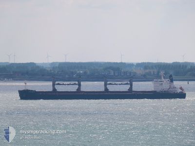
Bulk Carrier
Current Trip
| Time Travelled | 10 days |
|---|---|
| Remaining Time | --- |
| Distance Travelled | 585.22 nm |
| Remaining Distance | --- |
| AVG Speed | 10.5 Knots |
| MAX Speed | 13.4 Knots |
| AVG Wind | 10.6 knots |
| MAX Wind | 24.5 knots |
| MIN Temp | 13.2°C / 55.76°F |
| MAX Temp | 20.3°C / 68.54°F |
| Draught | 7.1 m |
| Position Received | 6 d ago |
Current Position
| Longitude | 131.78374° |
|---|---|
| Latitude | 33.95422° |
| Status | At anchor |
| Speed | 0.1 Knots |
| Course | 143° |
| Area | Inland Sea |
| Station | T-AIS |
| Position Received | 6 d ago |
Information
The current position of DARLEAKAY is in Inland Sea with coordinates 33.95422° / 131.78374° as reported on 2025-05-09 19:54 by AIS to our vessel tracker app. The vessel's current speed is 0.1 Knots
The vessel DARLEAKAY (IMO: 9623647, MMSI: 538005724) is a Bulk Carrier that was built in 2012 ( 13 years old ). It's sailing under the flag of [MH] Marshall Is.
In this page you can find informations about the vessels current position, last detected port calls, and current voyage information. If the vessels is not in coverage by AIS you will find the latest position.
The current position of DARLEAKAY is detected by our AIS receivers and we are not responsible for the reliability of the data. The last position was recorded while the vessel was in Coverage by the Ais receivers of our vessel tracking app.
The current draught of DARLEAKAY as reported by AIS is 7.1 meters
Weather
| Temperature | 16.9°C / 62.42°F |
|---|---|
| Wind Speed | 22 knots |
| Direction | 115° ESE |
| Pressure | 1012.7 hPa |
| Humidity | 91.8 % |
| Cloud Coverage | 100 % |
Featured Company
Last Port Calls
| Port | Arrival | Departure | Time In Port |
|---|---|---|---|
| 2025-05-02 17:42 | 2025-05-06 14:10 | 3 d | |
| 2025-03-12 07:23 | 2025-03-12 07:49 | 25 m | |
| 2025-03-01 04:42 | 2025-03-10 09:23 | 9 d |
Most Visited Ports (Last year)
| Port | Arrivals | |
|---|---|---|
| 3 | ||
| 2 | ||
| 2 | ||
| 2 | ||
| 1 | ||
| 1 |
Last Trips
| Origin | Departure | Destination | Arrival | Distance | |
|---|---|---|---|---|---|
| 2025-03-12 07:49 | 2025-05-02 17:42 | 6167.09 nm | |||
| 2025-03-10 09:23 | 2025-03-12 07:23 | 89.45 nm | |||
| 2025-02-15 22:19 | 2025-03-01 04:42 | 1943.42 nm |
Events
| Time | Event | Details | Position / Dest | Info |
|---|---|---|---|---|
| 2025-05-12 07:14 | STOP Moving | 1.03 nm, South East of UNO |
34.47804 / 133.96744
JPTKY
|
Speed: 0.3 kn Course: 43° |
| 2025-05-11 17:14 | START Moving | 4.4 nm, South West of KUDAMATSU |
33.95165 / 131.78479
JPTKY
|
Speed: 3.6 kn Course: 202° |
| 2025-05-09 20:06 | Status Changed | Default At anchor |
33.95417 / 131.78366
JPTKY
|
Speed: 0.1 kn Course: 143° |
| 2025-05-09 19:54 | Change Sea Area | Japanese part of the Inland Sea Japanese part of the Philippine Sea |
33.95422 / 131.78374
Inland Sea
|
Speed: 0.1 kn Course: 63.4° |
| 2025-05-09 19:54 | Status Changed | At anchor Default |
33.95422 / 131.78374
JPTKY
|
Speed: Course: 140° |
| 2025-05-09 19:54 | IN Coverage |
33.95422 / 131.78374
Inland Sea
|
Speed: 0.1 kn Course: 63.4° |
|
| 2025-05-09 19:54 | OUT of Coverage |
33.95422 / 131.78374
Inland Sea
|
Speed: 0.1 kn Course: 63.4° |
|
| 2025-05-09 19:53 | ETA Changed | 2025/05/09 04:30 2025/05/09 21:00 |
33.95423 / 131.78357
JPTKY
|
Speed: Course: 140° |
| 2025-05-08 15:18 | STOP Moving | 4.41 nm, South West of KUDAMATSU |
33.95285 / 131.78304
JPTKY
|
Speed: 0.2 kn Course: 124° |
| 2025-05-08 02:54 | START Moving |
32.31343 / 132.86440
JPTKY
|
Speed: 6.7 kn Course: 303° |