
DEEP BELUGA
High speed craft
Current Trip
SURVEY
| Time Travelled | 3 days |
|---|---|
| Remaining Time | --- |
| Distance Travelled | 91.14 nm |
| Remaining Distance | --- |
| AVG Speed | 13.8 Knots |
| MAX Speed | 13.8 Knots |
| AVG Wind | 13.2 knots |
| MAX Wind | 21.5 knots |
| MIN Temp | 5.3°C / 41.54°F |
| MAX Temp | 6.2°C / 43.16°F |
| Draught | 0.8 m |
| Position Received | 1 d ago |
Current Position
| Longitude | 5.03906° |
|---|---|
| Latitude | 52.93420° |
| Status | Under way using engine |
| Speed | 2.5 Knots |
| Course | --- |
| Area | North Sea |
| Station | T-AIS |
| Position Received | 1 d ago |
Info
Information
The current position of DEEP BELUGA is in North Sea with coordinates 52.93420° / 5.03906° as reported on 2025-02-06 11:59 by AIS to our vessel tracker app. The vessel's current speed is 2.5 Knots
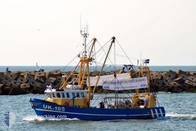
The vessel DEEP BELUGA (MMSI: 244038000) is a High speed craft It's sailing under the flag of [NL] Netherlands.
In this page you can find informations about the vessels current position, last detected port calls, and current voyage information. If the vessels is not in coverage by AIS you will find the latest position.
The current position of DEEP BELUGA is detected by our AIS receivers and we are not responsible for the reliability of the data. The last position was recorded while the vessel was in Coverage by the Ais receivers of our vessel tracking app.
The current draught of DEEP BELUGA as reported by AIS is 0.8 meters
Weather
| Temperature | 5.5°C / 41.9°F |
|---|---|
| Wind Speed | 14 knots |
| Direction | 46° NE |
| Pressure | 1043.8 hPa |
| Humidity | 89.3 % |
| Cloud Coverage | 4 % |
Featured Company
Events
| Time | Event | Details | Position / Dest | Info |
|---|---|---|---|---|
| 2025-02-06 11:59 | OUT of Coverage |
52.93420 / 5.03906
North Sea
|
Speed: 2.5 kn Course: 283.5° |
|
| 2025-02-06 10:41 | IN Coverage |
53.06639 / 4.71523
North Sea
|
Speed: 18.9 kn Course: 202.5° |
|
| 2025-02-06 00:03 | OUT of Coverage |
53.08228 / 4.93705
North Sea
|
Speed: 16.2 kn Course: 51.2° |
|
| 2025-02-05 22:48 | START Moving | 2.8 nm, North East of OUDESCHILD |
53.07621 / 4.90745
SURVEY
|
Speed: 7.5 kn Course: 285.8° |
| 2025-02-05 22:45 | STOP Moving | 2.77 nm, North East of OUDESCHILD |
53.07411 / 4.90959
SURVEY
|
Speed: 0.2 kn Course: 511° |
| 2025-02-05 22:32 | IN Coverage |
53.09591 / 4.96727
North Sea
|
Speed: 16.6 kn Course: 240.7° |
|
| 2025-02-05 20:21 | OUT of Coverage |
53.15884 / 4.93250
North Sea
|
Speed: Course: 511° |
|
| 2025-02-05 20:21 | IN Coverage |
53.15884 / 4.93250
North Sea
|
Speed: Course: 511° |
|
| 2025-02-05 11:48 | OUT of Coverage |
53.22381 / 4.96511
North Sea
|
Speed: 9.1 kn Course: 2.1° |
|
| 2025-02-05 09:50 | IN Coverage |
53.22330 / 4.95451
North Sea
|
Speed: 15.1 kn Course: 82.1° |