
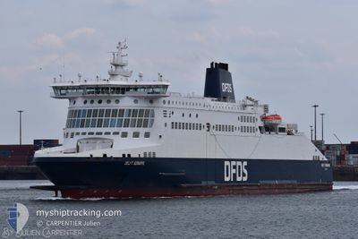
DELFT SEAWAYS
Ro-Ro/Passenger Ship
Current Trip
GBDVR <> FRDNK
| Time Travelled | 3 mins |
|---|---|
| Remaining Time | --- |
| Distance Travelled | --- |
| Remaining Distance | --- |
| AVG Speed | --- |
| MAX Speed | --- |
| AVG Wind | --- |
| MAX Wind | --- |
| MIN Temp | --- |
| MAX Temp | --- |
| Draught | 0 m |
| Position Received | 1 h, 8 m ago |
Current Position
| Longitude | 1.38359° |
|---|---|
| Latitude | 51.11901° |
| Status | Under way using engine |
| Speed | 17.9 Knots |
| Course | 276.9° |
| Area | English Channel |
| Station | T-AIS |
| Position Received | 1 h, 8 m ago |
Information
The current position of DELFT SEAWAYS is in English Channel with coordinates 51.11901° / 1.38359° as reported on 2025-06-07 04:01 by AIS to our vessel tracker app. The vessel's current speed is 17.9 Knots
The vessel DELFT SEAWAYS (IMO: 9293088, MMSI: 235009590) is a Ro-Ro/Passenger Ship that was built in 2006 ( 19 years old ). It's sailing under the flag of [GB] United Kingdom.
In this page you can find informations about the vessels current position, last detected port calls, and current voyage information. If the vessels is not in coverage by AIS you will find the latest position.
The current position of DELFT SEAWAYS is detected by our AIS receivers and we are not responsible for the reliability of the data. The last position was recorded while the vessel was in Coverage by the Ais receivers of our vessel tracking app.
Weather
| Temperature | 10.8°C / 51.44°F |
|---|---|
| Wind Speed | 7 knots |
| Direction | 207° SSW |
| Pressure | 1005.8 hPa |
| Humidity | 97.8 % |
| Cloud Coverage | 100 % |
Featured Company
Last Port Calls
| Port | Arrival | Departure | Time In Port |
|---|---|---|---|
| 2025-06-07 04:10 | 2025-06-07 05:06 | 56 m | |
| 2025-06-06 19:03 | 2025-06-07 02:11 | 7 h | |
| 2025-06-06 16:08 | 2025-06-06 17:02 | 54 m | |
| 2025-06-06 13:01 | 2025-06-06 14:17 | 1 h | |
| 2025-06-06 10:03 | 2025-06-06 11:06 | 1 h | |
| 2025-06-06 06:54 | 2025-06-06 08:12 | 1 h | |
| 2025-06-06 04:10 | 2025-06-06 05:06 | 55 m | |
| 2025-06-05 19:04 | 2025-06-06 02:10 | 7 h | |
| 2025-06-05 16:10 | 2025-06-05 17:18 | 1 h | |
| 2025-06-05 13:07 | 2025-06-05 14:31 | 1 h |
Last Trips
| Origin | Departure | Destination | Arrival | Distance | |
|---|---|---|---|---|---|
| 2025-06-07 04:11 | 2025-06-07 05:10 | 31.69 nm | |||
| 2025-06-06 18:02 | 2025-06-06 21:03 | 34.57 nm | |||
| 2025-06-06 16:17 | 2025-06-06 17:08 | 32.40 nm | |||
| 2025-06-06 12:06 | 2025-06-06 15:01 | 32.72 nm | |||
| 2025-06-06 10:12 | 2025-06-06 11:03 | 31.94 nm | |||
| 2025-06-06 06:06 | 2025-06-06 08:54 | 31.76 nm | |||
| 2025-06-06 04:10 | 2025-06-06 05:10 | 31.36 nm | |||
| 2025-06-05 18:18 | 2025-06-05 21:04 | 34.19 nm | |||
| 2025-06-05 16:31 | 2025-06-05 17:10 | 32.10 nm | |||
| 2025-06-05 12:26 | 2025-06-05 15:07 | 33.18 nm |
Events
| Time | Event | Details | Position / Dest | Info |
|---|---|---|---|---|
| 2025-06-07 05:07 | START Moving | 0.69 nm, East of DOVER |
51.12018 / 1.34656
GBDVR <> FRDNK
|
Speed: 11.8 kn Course: 115° |
| 2025-06-07 05:06 | PORT DEPARTURE |
|
51.12018 / 1.34656
GBDVR <> FRDNK
|
Speed: 0.3 kn Course: 161° |
| 2025-06-07 04:15 | STOP Moving |
51.12568 / 1.33932
[GB] DOVER
|
Speed: 0.1 kn Course: 161° |
|
| 2025-06-07 04:10 | PORT ARRIVAL |
|
51.12381 / 1.33967
[GB] DOVER
|
Speed: 10.9 kn Course: 283° |
| 2025-06-07 04:07 | Status Changed | Default Under way using engine |
51.12120 / 1.34376
GBDVR <> FRDNK
|
Speed: 17.9 kn Course: 276.9° |
| 2025-06-07 04:01 | OUT of Coverage |
51.11901 / 1.38359
English Channel
[GB] DOVER
|
Speed: 17.9 kn Course: 276.9° |
|
| 2025-06-07 03:59 | Change Sea Area | United Kingdom part of the English Channel United Kingdom part of the North Sea |
51.11800 / 1.39771
English Channel
GBDVR <> FRDNK
|
Speed: 17.8 kn Course: 276.4° |
| 2025-06-07 03:23 | Change Sea Area | United Kingdom part of the North Sea French part of the North Sea |
51.07716 / 1.63666
North Sea
GBDVR <> FRDNK
|
Speed: 16.1 kn Course: 291.7° |
| 2025-06-07 02:11 | PORT DEPARTURE |
|
51.04713 / 2.14917
GBDVR <> FRDNK
|
Speed: 16.3 kn Course: 308° |
| 2025-06-07 01:56 | START Moving |
51.01935 / 2.18316
[FR] DUNKERQUE
|
Speed: 5.8 kn Course: 52° |