
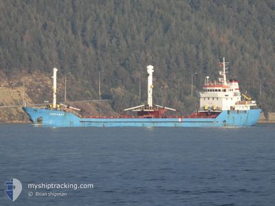
DOGANAY
General Cargo
Current Trip
| Trip Time | 3 days |
|---|---|
| Trip Distance | 645.54 nm |
| AVG Speed | 7.2 Knots |
| MAX Speed | 9.6 Knots |
| Draught | 7.6 m |
| AVG Wind | 12.9 knots |
| MAX Wind | 22 knots |
| MIN Temp | 4.7°C / 40.46°F |
| MAX Temp | 18°C / 64.4°F |
| Position Received | 7 h, 27 m ago |
Current Position
| Longitude | 26.73569° |
|---|---|
| Latitude | 38.77885° |
| Status | Under way using engine |
| Speed | 4 Knots |
| Course | 76° |
| Area | Aegean Sea |
| Station | T-AIS |
| Position Received | 7 h, 27 m ago |
Info
Information
The current position of DOGANAY is in Aegean Sea with coordinates 38.77885° / 26.73569° as reported on 2025-12-16 02:22 by AIS to our vessel tracker app. The vessel's current speed is 4 Knots and is currently inside the port of NEMRUT.
The vessel DOGANAY (IMO: 8876584, MMSI: 518857000) is a General Cargo that was built in 1993 ( 32 years old ). It's sailing under the flag of [CK] Cook Is.
In this page you can find informations about the vessels current position, last detected port calls, and current voyage information. If the vessels is not in coverage by AIS you will find the latest position.
The current position of DOGANAY is detected by our AIS receivers and we are not responsible for the reliability of the data. The last position was recorded while the vessel was in Coverage by the Ais receivers of our vessel tracking app.
The current draught of DOGANAY as reported by AIS is 7.6 meters
Weather
| Temperature | 9.9°C / 49.82°F |
|---|---|
| Wind Speed | 5 knots |
| Direction | 54° NE |
| Pressure | 1024.5 hPa |
| Humidity | 53.1 % |
| Cloud Coverage | --- |
Featured Company
Last Port Calls
| Port | Arrival | Departure | Time In Port |
|---|---|---|---|
| 2025-12-16 07:13 | |||
| 2025-12-10 14:57 | 2025-12-12 19:12 | 2 d | |
| 2025-11-28 16:24 | 2025-12-03 11:40 | 4 d | |
| 2025-11-13 13:20 | 2025-11-17 04:32 | 3 d | |
| 2025-11-10 10:19 | 2025-11-12 02:01 | 1 d | |
| 2025-11-05 13:53 | 2025-11-08 09:45 | 2 d | |
| 2025-10-28 23:02 | 2025-10-30 12:35 | 1 d | |
| 2025-10-23 10:17 | 2025-10-25 20:55 | 2 d | |
| 2025-10-12 14:03 | 2025-10-17 12:41 | 4 d | |
| 2025-10-09 08:17 | 2025-10-09 20:02 | 11 h |
Last Trips
| Origin | Departure | Destination | Arrival | Distance | |
|---|---|---|---|---|---|
| 2025-12-12 19:12 | 2025-12-16 07:13 | 645.54 nm | |||
| 2025-12-03 11:40 | 2025-12-10 14:57 | 353.69 nm | |||
| 2025-11-17 04:32 | 2025-11-28 16:24 | 1094.44 nm | |||
| 2025-11-12 02:01 | 2025-11-13 13:20 | 291.48 nm | |||
| 2025-11-08 09:45 | 2025-11-10 10:19 | 191.85 nm | |||
| 2025-10-30 12:35 | 2025-11-05 13:53 | 551.62 nm | |||
| 2025-10-25 20:55 | 2025-10-28 23:02 | 369.90 nm | |||
| 2025-10-17 12:41 | 2025-10-23 10:17 | 409.34 nm | |||
| 2025-10-09 20:02 | 2025-10-12 14:03 | 517.93 nm | |||
| 2025-09-29 21:50 | 2025-10-09 08:17 | 629.34 nm |
Events
| Time | Event | Details | Position / Dest | Info |
|---|---|---|---|---|
| 2025-12-16 04:22 | STOP Moving |
38.76412 / 26.91680
[TR] NEMRUT
|
Speed: 0.1 kn Course: 198° |
|
| 2025-12-16 04:13 | PORT ARRIVAL |
|
38.76679 / 26.91661
[TR] NEMRUT
|
Speed: 5 kn Course: 102° |
| 2025-12-16 02:29 | Status Changed | Default Under way using engine |
38.77927 / 26.74620
TRNEM
|
Speed: 4 kn Course: 76° |
| 2025-12-16 02:22 | Change Sea Area | Turkish part of the Aegean Sea Greek part of the Aegean Sea |
38.77885 / 26.73569
Aegean Sea
TRNEM
|
Speed: 4 kn Course: 86° |
| 2025-12-16 02:22 | Status Changed | Under way using engine Default |
38.77885 / 26.73569
TRNEM
|
Speed: 4 kn Course: 82° |
| 2025-12-16 02:22 | OUT of Coverage |
38.77885 / 26.73569
Aegean Sea
TRNEM
|
Speed: 4 kn Course: 86° |
|
| 2025-12-16 02:10 | IN Coverage |
38.77885 / 26.73569
Aegean Sea
TRNEM
|
Speed: 4 kn Course: 86° |
|
| 2025-12-15 21:29 | Status Changed | Default Under way using engine |
38.71655 / 26.21232
TRNEM
|
Speed: 5.6 kn Course: 80.8° |
| 2025-12-15 21:24 | OUT of Coverage |
38.71496 / 26.20337
Aegean Sea
TRNEM
|
Speed: 5.6 kn Course: 80.8° |
|
| 2025-12-15 21:16 | Status Changed | Under way using engine Default |
38.71216 / 26.18617
TRNEM
|
Speed: 5.5 kn Course: 88° |