
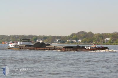
DOMFELS
Cargo
Current Trip
MIENDEN
| Time Travelled | 4 h, 51 mins |
|---|---|
| Remaining Time | --- |
| Distance Travelled | 3.20 nm |
| Remaining Distance | --- |
| AVG Speed | 5.1 Knots |
| MAX Speed | 5.2 Knots |
| AVG Wind | 7 knots |
| MAX Wind | 7 knots |
| MIN Temp | -2.2°C / 28.04°F |
| MAX Temp | -1.7°C / 28.94°F |
| Draught | 1.1 m |
| Position Received | 3 h, 48 m ago |
Current Position
| Longitude | 9.31076° |
|---|---|
| Latitude | 52.38731° |
| Status | Under way using engine |
| Speed | 5.1 Knots |
| Course | 262.5° |
| Area | North Sea |
| Station | T-AIS |
| Position Received | 3 h, 48 m ago |
Info
Information
The current position of DOMFELS is in North Sea with coordinates 52.38731° / 9.31076° as reported on 2026-01-06 16:22 by AIS to our vessel tracker app. The vessel's current speed is 5.1 Knots
The vessel DOMFELS (MMSI: 211684800) is a Cargo It's sailing under the flag of [DE] Germany.
In this page you can find informations about the vessels current position, last detected port calls, and current voyage information. If the vessels is not in coverage by AIS you will find the latest position.
The current position of DOMFELS is detected by our AIS receivers and we are not responsible for the reliability of the data. The last position was recorded while the vessel was in Coverage by the Ais receivers of our vessel tracking app.
The current draught of DOMFELS as reported by AIS is 1.1 meters
Weather
| Temperature | -2.5°C / 27.5°F |
|---|---|
| Wind Speed | 7 knots |
| Direction | 206° SSW |
| Pressure | 1014.7 hPa |
| Humidity | 93.6 % |
| Cloud Coverage | 64 % |
Featured Company
Last Port Calls
| Port | Arrival | Departure | Time In Port |
|---|---|---|---|
| 2026-01-04 20:14 | 2026-01-06 16:20 | 1 d | |
| 2025-12-07 13:33 | 2025-12-07 13:52 | 18 m | |
| 2025-12-04 19:05 | 2025-12-04 19:43 | 38 m | |
| 2025-12-04 14:35 | 2025-12-04 15:57 | 1 h | |
| 2025-12-03 12:30 | 2025-12-04 12:24 | 23 h | |
| 2025-12-03 06:38 | 2025-12-03 08:19 | 1 h | |
| 2025-12-02 14:13 | 2025-12-02 14:25 | 11 m | |
| 2025-11-17 12:54 | 2025-11-18 16:03 | 1 d | |
| 2025-11-02 16:20 | 2025-11-04 13:47 | 1 d | |
| 2025-11-01 05:58 |
Last Trips
| Origin | Departure | Destination | Arrival | Distance | |
|---|---|---|---|---|---|
| 2025-12-07 13:52 | 2026-01-04 20:14 | 209.99 nm | |||
| 2025-12-04 19:43 | 2025-12-07 13:33 | 74.94 nm | |||
| 2025-12-04 15:57 | 2025-12-04 19:05 | 11.92 nm | |||
| 2025-12-04 12:24 | 2025-12-04 14:35 | 22.40 nm | |||
| 2025-12-03 08:19 | 2025-12-03 12:30 | 18.64 nm | |||
| 2025-12-02 14:25 | 2025-12-03 06:38 | 15.04 nm | |||
| 2025-11-18 16:03 | 2025-12-02 14:13 | 219.13 nm | |||
| 2025-11-04 13:47 | 2025-11-17 12:54 | 463.86 nm | |||
| 2025-11-01 05:58 | 2025-11-02 16:20 | 112.71 nm |
Events
| Time | Event | Details | Position / Dest | Info |
|---|---|---|---|---|
| 2026-01-06 16:22 | OUT of Coverage |
52.38731 / 9.31076
North Sea
|
Speed: 5.1 kn Course: 262.5° |
|
| 2026-01-06 16:16 | Status Changed | Under way using engine Default |
52.38803 / 9.32432
MIENDEN
|
Speed: 5 kn Course: 266° |
| 2026-01-06 16:12 | Status Changed | Default Under way using engine |
52.38848 / 9.33387
MIENDEN
|
Speed: 4.8 kn Course: 266.7° |
| 2026-01-06 15:20 | Status Changed | Under way using engine Default |
52.39743 / 9.45098
MIENDEN
|
Speed: 4.3 kn Course: -1° |
| 2026-01-06 15:20 | PORT DEPARTURE |
|
52.39743 / 9.45098
MIENDEN
|
Speed: 4.3 kn Course: -1° |
| 2026-01-06 15:14 | Status Changed | Default Under way using engine |
52.40068 / 9.46416
[DE] KOLENFELD
|
Speed: 3 kn Course: 245.5° |
| 2026-01-06 15:12 | IN Coverage |
52.40138 / 9.46679
North Sea
[DE] KOLENFELD
|
Speed: 3 kn Course: 245.5° |
|
| 2026-01-05 05:58 | Status Changed | Default Moored |
52.40091 / 9.46655
[DE] KOLENFELD
|
Speed: Course: 511° |
| 2026-01-05 05:07 | OUT of Coverage |
52.40091 / 9.46655
North Sea
[DE] KOLENFELD
|
Speed: Course: 90.7° |
|
| 2026-01-05 02:49 | IN Coverage |
52.40091 / 9.46655
North Sea
[DE] KOLENFELD
|
Speed: Course: 90.7° |