

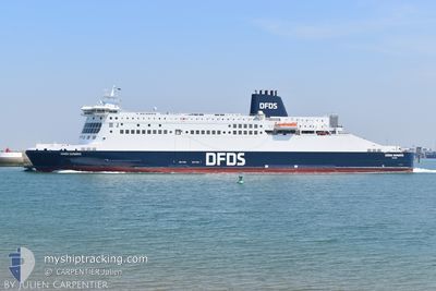
DOVER SEAWAYS
Ro-Ro/Passenger Ship

Current Trip
| Trip Time | 1 h, 40 mins |
|---|---|
| Trip Distance | 32.39 nm |
| AVG Speed | 19.7 Knots |
| MAX Speed | 21.4 Knots |
| Draught | 6.3 m |
| AVG Wind | 13.8 knots |
| MAX Wind | 17.2 knots |
| MIN Temp | 12.7°C / 54.86°F |
| MAX Temp | 13.6°C / 56.48°F |
| Position Received | 2 m ago |
Current Position
| Longitude | 2.18909° |
|---|---|
| Latitude | 51.02006° |
| Status | Under way using engine |
| Speed | |
| Course | 68° |
| Area | North Sea |
| Station | T-AIS |
| Position Received | 2 m ago |
Information
The current position of DOVER SEAWAYS is in North Sea with coordinates 51.02006° / 2.18909° as reported on 2025-06-07 04:38 by AIS to our vessel tracker app. The vessel's current speed is 0 Knots and is currently inside the port of DUNKERQUE.
The vessel DOVER SEAWAYS (IMO: 9318345, MMSI: 235010500) is a Ro-Ro/Passenger Ship that was built in 2006 ( 19 years old ). It's sailing under the flag of [GB] United Kingdom.
In this page you can find informations about the vessels current position, last detected port calls, and current voyage information. If the vessels is not in coverage by AIS you will find the latest position.
The current position of DOVER SEAWAYS is detected by our AIS receivers and we are not responsible for the reliability of the data. The last position was recorded while the vessel was in Coverage by the Ais receivers of our vessel tracking app.
The current draught of DOVER SEAWAYS as reported by AIS is 6.3 meters
Weather
| Temperature | 12.2°C / 53.96°F |
|---|---|
| Wind Speed | 11 knots |
| Direction | 223° SW |
| Pressure | 1006.8 hPa |
| Humidity | 95 % |
| Cloud Coverage | 100 % |


Featured Company
Last Port Calls
| Port | Arrival | Departure | Time In Port |
|---|---|---|---|
| 2025-06-07 00:42 | |||
| 2025-06-06 20:59 | 2025-06-06 22:02 | 1 h | |
| 2025-06-06 18:57 | 2025-06-06 20:14 | 1 h | |
| 2025-06-06 15:03 | 2025-06-06 16:02 | 59 m | |
| 2025-06-06 12:51 | 2025-06-06 14:11 | 1 h | |
| 2025-06-06 09:02 | 2025-06-06 10:06 | 1 h | |
| 2025-06-06 00:51 | 2025-06-06 08:09 | 7 h | |
| 2025-06-05 21:10 | 2025-06-05 22:02 | 52 m | |
| 2025-06-05 19:05 | 2025-06-05 20:26 | 1 h | |
| 2025-06-05 15:10 | 2025-06-05 16:26 | 1 h |
Last Trips
| Origin | Departure | Destination | Arrival | Distance | |
|---|---|---|---|---|---|
| 2025-06-06 22:02 | 2025-06-07 00:42 | 32.39 nm | |||
| 2025-06-06 20:14 | 2025-06-06 20:59 | 31.35 nm | |||
| 2025-06-06 16:02 | 2025-06-06 18:57 | 32.25 nm | |||
| 2025-06-06 14:11 | 2025-06-06 15:03 | 32.22 nm | |||
| 2025-06-06 10:06 | 2025-06-06 12:51 | 31.53 nm | |||
| 2025-06-06 08:09 | 2025-06-06 09:02 | 31.94 nm | |||
| 2025-06-05 22:02 | 2025-06-06 00:51 | 32.02 nm | |||
| 2025-06-05 20:26 | 2025-06-05 21:10 | 31.82 nm | |||
| 2025-06-05 16:26 | 2025-06-05 19:05 | 31.95 nm | |||
| 2025-06-05 14:22 | 2025-06-05 15:10 | 32.42 nm |
Events
| Time | Event | Details | Position / Dest | Info |
|---|---|---|---|---|
| 2025-06-06 23:01 | STOP Moving |
51.01993 / 2.18852
[FR] DUNKERQUE
|
Speed: 0.2 kn Course: 68° |
|
| 2025-06-06 22:58 | ETA Changed | 2025/06/07 08:15 2025/06/06 23:15 |
51.01982 / 2.18757
[FR] DUNKERQUE
|
Speed: 1.1 kn Course: 66° |
| 2025-06-06 22:46 | Status Changed | Under way using engine Default |
51.03060 / 2.16897
[FR] DUNKERQUE
|
Speed: 17.6 kn Course: 120° |
| 2025-06-06 22:42 | PORT ARRIVAL |
|
51.04365 / 2.15688
[FR] DUNKERQUE
|
Speed: 18.2 kn Course: 106° |
| 2025-06-06 22:35 | Status Changed | Default Under way using engine |
51.04892 / 2.09395
DOVER<=>DUNKERQUE
|
Speed: 19.3 kn Course: 68.7° |
| 2025-06-06 22:20 | Status Changed | Under way using engine Default |
51.03759 / 1.96406
DOVER<=>DUNKERQUE
|
Speed: 21 kn Course: 86° |
| 2025-06-06 22:19 | Status Changed | Default Under way using engine |
51.03753 / 1.95293
DOVER<=>DUNKERQUE
|
Speed: 21.1 kn Course: 90.1° |
| 2025-06-06 21:47 | Change Sea Area | French part of the North Sea United Kingdom part of the North Sea |
51.07879 / 1.67284
North Sea
DOVER<=>DUNKERQUE
|
Speed: 19.9 kn Course: 126.1° |
| 2025-06-06 21:16 | ETA Changed | 2025/06/06 23:15 2025/06/06 20:15 |
51.12841 / 1.45499
DOVER<=>DUNKERQUE
|
Speed: 15.6 kn Course: 83.5° |
| 2025-06-06 21:11 | Change Sea Area | United Kingdom part of the North Sea United Kingdom part of the English Channel |
51.12669 / 1.41610
North Sea
DOVER<=>DUNKERQUE
|
Speed: 18 kn Course: 81.4° |