

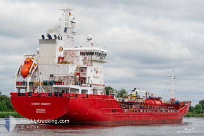
DUZGIT DIGNITY
Oil/Chemical Tanker

Current Trip
| Time Travelled | 1 day |
|---|---|
| Remaining Time | --- |
| Distance Travelled | 502.07 nm |
| Remaining Distance | --- |
| AVG Speed | 13.1 Knots |
| MAX Speed | 13.8 Knots |
| AVG Wind | 6.8 knots |
| MAX Wind | 13.4 knots |
| MIN Temp | 21.6°C / 70.88°F |
| MAX Temp | 23.7°C / 74.66°F |
| Draught | 5.5 m |
| Position Received | Now |
Current Position
| Longitude | 10.27927° |
|---|---|
| Latitude | 37.72998° |
| Status | Under way using engine |
| Speed | 13.3 Knots |
| Course | 109.2° |
| Area | Mediterranean Sea - Western Basin |
| Station | T-AIS |
| Position Received | Now |
Information
The current position of DUZGIT DIGNITY is in Mediterranean Sea - Western Basin with coordinates 37.72998° / 10.27927° as reported on 2025-06-08 19:55 by AIS to our vessel tracker app. The vessel's current speed is 13.3 Knots and is heading at the port of KORFEZ. The estimated time of arrival as calculated by MyShipTracking vessel tracking app is 2025-06-12 15:00 LT
The vessel DUZGIT DIGNITY (IMO: 9581019, MMSI: 271043776) is a Oil/Chemical Tanker that was built in 2014 ( 11 years old ). It's sailing under the flag of [TR] Turkey.
In this page you can find informations about the vessels current position, last detected port calls, and current voyage information. If the vessels is not in coverage by AIS you will find the latest position.
The current position of DUZGIT DIGNITY is detected by our AIS receivers and we are not responsible for the reliability of the data. The last position was recorded while the vessel was in Coverage by the Ais receivers of our vessel tracking app.
The current draught of DUZGIT DIGNITY as reported by AIS is 5.5 meters
Weather
| Temperature | 22.9°C / 73.22°F |
|---|---|
| Wind Speed | 11 knots |
| Direction | 269° W |
| Pressure | 1016.5 hPa |
| Humidity | 81.3 % |
| Cloud Coverage | --- |


Featured Company
Last Port Calls
| Port | Arrival | Departure | Time In Port |
|---|---|---|---|
| 2025-06-06 06:02 | 2025-06-07 07:41 | 1 d | |
| 2025-06-03 07:12 | 2025-06-05 03:12 | 1 d | |
| 2025-05-31 19:18 | 2025-06-02 06:42 | 1 d | |
| 2025-05-28 05:04 | 2025-05-28 20:57 | 15 h | |
| 2025-05-28 03:36 | 2025-05-28 03:43 | 6 m | |
| 2025-05-27 11:17 | 2025-05-27 23:05 | 11 h | |
| 2025-05-26 12:20 | 2025-05-27 03:29 | 15 h | |
| 2025-05-24 08:21 | 2025-05-25 11:29 | 1 d | |
| 2025-05-14 17:23 | 2025-05-16 15:56 | 1 d | |
| 2025-05-08 22:11 | 2025-05-10 03:25 | 1 d |
Last Trips
| Origin | Departure | Destination | Arrival | Distance | |
|---|---|---|---|---|---|
| 2025-06-05 03:12 | 2025-06-06 06:02 | 320.39 nm | |||
| 2025-06-02 06:42 | 2025-06-03 07:12 | 0.89 nm | |||
| 2025-05-28 20:57 | 2025-05-31 19:18 | 595.90 nm | |||
| 2025-05-28 03:43 | 2025-05-28 05:04 | 12.01 nm | |||
| 2025-05-27 23:05 | 2025-05-28 03:36 | 0.29 nm | |||
| 2025-05-27 03:29 | 2025-05-27 11:17 | 0.38 nm | |||
| 2025-05-25 11:29 | 2025-05-26 12:20 | 233.63 nm | |||
| 2025-05-16 15:56 | 2025-05-24 08:21 | 2149.99 nm | |||
| 2025-05-10 03:25 | 2025-05-14 17:23 | 800.59 nm | |||
| 2025-05-03 20:27 | 2025-05-08 22:11 | 821.00 nm |
Events
| Time | Event | Details | Position / Dest | Info |
|---|---|---|---|---|
| 2025-06-08 19:22 | Status Changed | Under way using engine Default |
37.76632 / 10.12917
TRTUT
|
Speed: 13.5 kn Course: 107° |
| 2025-06-08 18:31 | Status Changed | Default Under way using engine |
37.82226 / 9.89134
TRTUT
|
Speed: 13.7 kn Course: 106.6° |
| 2025-06-08 16:56 | Status Changed | Under way using engine Default |
37.92487 / 9.45551
TRTUT
|
Speed: 13.7 kn Course: 107° |
| 2025-06-08 16:51 | Status Changed | Default Under way using engine |
37.93063 / 9.43089
TRTUT
|
Speed: 13.5 kn Course: 105.1° |
| 2025-06-08 16:27 | Status Changed | Under way using engine Default |
37.95436 / 9.32414
TRTUT
|
Speed: 13.3 kn Course: 106° |
| 2025-06-08 16:23 | Status Changed | Default Under way using engine |
37.95948 / 9.30216
TRTUT
|
Speed: 13.3 kn Course: 105.7° |
| 2025-06-08 12:26 | Change Sea Area | Tunisian part of the Mediterranean Sea - Western Basin Italian part of the Mediterranean Sea - Western Basin |
38.07866 / 8.19721
Mediterranean Sea - Western Basin
TRTUT
|
Speed: 13.1 kn Course: 96.1° |
| 2025-06-08 11:48 | Status Changed | Under way using engine Default |
38.09628 / 8.02403
TRTUT
|
Speed: 12.8 kn Course: 97° |
| 2025-06-08 11:45 | IN Coverage |
38.09628 / 8.02403
Mediterranean Sea - Western Basin
TRTUT
|
Speed: 12.9 kn Course: 97.5° |
|
| 2025-06-08 09:40 | OUT of Coverage |
38.14267 / 7.45893
Mediterranean Sea - Western Basin
TRTUT
|
Speed: 12.7 kn Course: 94.6° |