

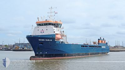
EEMS DUBLIN
General Cargo

Current Trip
| Time Travelled | 6 days |
|---|---|
| Remaining Time | --- |
| Distance Travelled | 36.69 nm |
| Remaining Distance | --- |
| AVG Speed | 8.3 Knots |
| MAX Speed | 10 Knots |
| AVG Wind | 9.5 knots |
| MAX Wind | 17.6 knots |
| MIN Temp | 6.9°C / 44.42°F |
| MAX Temp | 16.7°C / 62.06°F |
| Draught | 4.4 m |
| Position Received | 5 d ago |
Current Position
| Longitude | -58.37858° |
|---|---|
| Latitude | 49.15553° |
| Status | Under way using engine |
| Speed | 8.1 Knots |
| Course | 237.5° |
| Area | Gulf of St-Lawrence |
| Station | T-AIS |
| Position Received | 5 d ago |
Information
The current position of EEMS DUBLIN is in Gulf of St-Lawrence with coordinates 49.15553° / -58.37858° as reported on 2025-06-03 07:42 by AIS to our vessel tracker app. The vessel's current speed is 8.1 Knots
The vessel EEMS DUBLIN (IMO: 9613642, MMSI: 246788000) is a General Cargo that was built in 2012 ( 13 years old ). It's sailing under the flag of [NL] Netherlands.
In this page you can find informations about the vessels current position, last detected port calls, and current voyage information. If the vessels is not in coverage by AIS you will find the latest position.
The current position of EEMS DUBLIN is detected by our AIS receivers and we are not responsible for the reliability of the data. The last position was recorded while the vessel was in Coverage by the Ais receivers of our vessel tracking app.
The current draught of EEMS DUBLIN as reported by AIS is 4.4 meters
Weather
| Temperature | 9.3°C / 48.74°F |
|---|---|
| Wind Speed | 8 knots |
| Direction | 38° NE |
| Pressure | 1002.2 hPa |
| Humidity | 98.9 % |
| Cloud Coverage | 100 % |


Featured Company
Last Port Calls
| Port | Arrival | Departure | Time In Port |
|---|---|---|---|
| 2025-06-01 08:44 | 2025-06-01 16:11 | 7 h | |
| 2025-05-27 07:10 | 2025-05-27 12:19 | 5 h | |
| 2025-05-22 09:23 | 2025-05-23 10:14 | 1 d | |
| 2025-05-08 02:43 | 2025-05-09 17:17 | 1 d | |
| 2025-05-08 01:00 | 2025-05-08 02:05 | 1 h | |
| 2025-04-29 17:23 | 2025-05-07 13:36 | 7 d | |
| 2025-04-26 12:38 | 2025-04-27 20:10 | 1 d | |
| 2025-04-24 04:01 | 2025-04-24 22:51 | 18 h | |
| 2025-04-20 11:02 | 2025-04-22 20:06 | 2 d | |
| 2025-04-08 20:48 | 2025-04-11 15:59 | 2 d |
Last Trips
| Origin | Departure | Destination | Arrival | Distance | |
|---|---|---|---|---|---|
| 2025-05-27 12:19 | 2025-06-01 08:44 | 81.71 nm | |||
| 2025-05-23 10:14 | 2025-05-27 07:10 | 75.98 nm | |||
| 2025-05-09 17:17 | 2025-05-22 09:23 | 2761.43 nm | |||
| 2025-05-08 02:05 | 2025-05-08 02:43 | 5.48 nm | |||
| 2025-05-07 13:36 | 2025-05-08 01:00 | 111.44 nm | |||
| 2025-04-27 20:10 | 2025-04-29 17:23 | 441.92 nm | |||
| 2025-04-24 22:51 | 2025-04-26 12:38 | 293.10 nm | |||
| 2025-04-22 20:06 | 2025-04-24 04:01 | 325.14 nm | |||
| 2025-04-11 15:59 | 2025-04-20 11:02 | 1976.23 nm | |||
| 2025-04-06 16:57 | 2025-04-08 20:48 | 521.84 nm |
Events
| Time | Event | Details | Position / Dest | Info |
|---|---|---|---|---|
| 2025-06-03 08:33 | STOP Moving | 20.72 nm, West of CORNER BROOK |
49.08798 / -58.43153
CORNER BROOK
|
Speed: Course: 215° |
| 2025-06-03 08:06 | Status Changed | Default Under way using engine |
49.11900 / -58.43968
CORNER BROOK
|
Speed: 8.1 kn Course: 237.5° |
| 2025-06-03 07:42 | OUT of Coverage |
49.15553 / -58.37858
Gulf of St-Lawrence
|
Speed: 8.1 kn Course: 237.5° |
|
| 2025-06-03 07:05 | Status Changed | Under way using engine Default |
49.09215 / -58.30140
CORNER BROOK
|
Speed: Course: 237° |
| 2025-06-03 07:05 | START Moving | 16.16 nm, North West of CORNER BROOK |
49.09215 / -58.30140
CORNER BROOK
|
Speed: 8.9 kn Course: 47.8° |
| 2025-06-03 07:05 | IN Coverage |
49.09657 / -58.29638
Gulf of St-Lawrence
|
Speed: 9.6 kn Course: 28.1° |
|
| 2025-06-02 07:27 | STOP Moving | 16.56 nm, North West of CORNER BROOK |
49.08437 / -58.31892
CORNER BROOK
|
Speed: Course: 216° |
| 2025-06-02 07:14 | Status Changed | Default Under way using engine |
49.08769 / -58.31237
CORNER BROOK
|
Speed: 6.9 kn Course: 245.1° |
| 2025-06-02 07:11 | OUT of Coverage |
49.09142 / -58.30412
Gulf of St-Lawrence
|
Speed: 6.9 kn Course: 245.1° |
|
| 2025-06-02 06:59 | Status Changed | Under way using engine Default |
49.08223 / -58.27745
CORNER BROOK
|
Speed: 7.6 kn Course: 63° |