
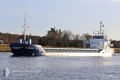
ELSBORG
General Cargo
Current Trip
| Time Travelled | 19 h, 29 mins |
|---|---|
| Remaining Time | 2 days |
| Distance Travelled | 199.64 nm |
| Remaining Distance | 539.15 nm |
| AVG Speed | 10.6 Knots |
| MAX Speed | 11.9 Knots |
| AVG Wind | 5.6 knots |
| MAX Wind | 16 knots |
| MIN Temp | -5.5°C / 22.1°F |
| MAX Temp | 1.3°C / 34.34°F |
| Draught | 5.5 m |
| Position Received | 1 m ago |
Current Position
| Longitude | 12.00423° |
|---|---|
| Latitude | 57.06023° |
| Status | Under way using engine |
| Speed | 10.9 Knots |
| Course | 340.1° |
| Area | Kattegat |
| Station | T-AIS |
| Position Received | 1 m ago |
Info
Information
The current position of ELSBORG is in Kattegat with coordinates 57.06023° / 12.00423° as reported on 2026-01-06 14:36 by AIS to our vessel tracker app. The vessel's current speed is 10.9 Knots and is heading at the port of LEITH. The estimated time of arrival as calculated by MyShipTracking vessel tracking app is 2026-01-08 14:38 LT
The vessel ELSBORG (IMO: 9411771, MMSI: 244847000) is a General Cargo that was built in 2010 ( 16 years old ). It's sailing under the flag of [NL] Netherlands.
In this page you can find informations about the vessels current position, last detected port calls, and current voyage information. If the vessels is not in coverage by AIS you will find the latest position.
The current position of ELSBORG is detected by our AIS receivers and we are not responsible for the reliability of the data. The last position was recorded while the vessel was in Coverage by the Ais receivers of our vessel tracking app.
The current draught of ELSBORG as reported by AIS is 5.5 meters
Weather
| Temperature | -1.4°C / 29.48°F |
|---|---|
| Wind Speed | 6 knots |
| Direction | 120° ESE |
| Pressure | 1011.5 hPa |
| Humidity | 72.1 % |
| Cloud Coverage | 93 % |
Featured Company
Last Port Calls
| Port | Arrival | Departure | Time In Port |
|---|---|---|---|
| 2025-12-31 18:00 | 2026-01-05 20:08 | 5 d | |
| 2025-12-24 01:37 | 2025-12-30 08:50 | 6 d | |
| 2025-12-16 20:56 | 2025-12-19 05:16 | 2 d | |
| 2025-12-09 12:08 | 2025-12-10 13:03 | 1 d | |
| 2025-12-08 18:33 | 2025-12-09 02:48 | 8 h | |
| 2025-12-04 20:13 | 2025-12-05 17:45 | 21 h | |
| 2025-11-28 11:13 | 2025-12-03 11:41 | 5 d | |
| 2025-11-17 13:14 | 2025-11-18 19:06 | 1 d | |
| 2025-11-12 03:29 | 2025-11-12 19:35 | 16 h | |
| 2025-11-09 00:42 | 2025-11-11 14:33 | 2 d |
Last Trips
| Origin | Departure | Destination | Arrival | Distance | |
|---|---|---|---|---|---|
| 2025-12-30 08:50 | 2025-12-31 18:00 | 313.82 nm | |||
| 2025-12-19 05:16 | 2025-12-24 01:37 | 1119.95 nm | |||
| 2025-12-10 13:03 | 2025-12-16 20:56 | 944.75 nm | |||
| 2025-12-09 02:48 | 2025-12-09 12:08 | 100.73 nm | |||
| 2025-12-05 17:45 | 2025-12-08 18:33 | 565.84 nm | |||
| 2025-12-03 11:41 | 2025-12-04 20:13 | 100.68 nm | |||
| 2025-11-18 19:06 | 2025-11-28 11:13 | 1443.45 nm | |||
| 2025-11-12 19:35 | 2025-11-17 13:14 | 943.56 nm | |||
| 2025-11-11 14:33 | 2025-11-12 03:29 | 108.68 nm | |||
| 2025-11-07 16:07 | 2025-11-09 00:42 | 301.90 nm |
Events
| Time | Event | Details | Position / Dest | Info |
|---|---|---|---|---|
| 2026-01-06 07:07 | Change Sea Area | Swedish part of the Kattegat Danish part of the Kattegat |
55.81985 / 12.72047
Kattegat
LEITH
|
Speed: 10.8 kn Course: 7.8° |
| 2026-01-06 05:16 | Change Sea Area | Danish part of the Kattegat Swedish part of the Kattegat |
55.48951 / 12.71172
Kattegat
LEITH
|
Speed: 10.1 kn Course: 5° |
| 2026-01-06 04:22 | Change Sea Area | Swedish part of the Kattegat Swedish part of the Baltic Sea |
55.34241 / 12.69166
Kattegat
LEITH
|
Speed: 9.9 kn Course: 7.1° |
| 2026-01-06 01:28 | Change Sea Area | Swedish part of the Baltic Sea German part of the Baltic Sea |
55.02186 / 13.25873
Baltic Sea
LEITH
|
Speed: 9.8 kn Course: 320.8° |
| 2026-01-06 01:03 | Status Changed | Under way using engine Default |
54.96762 / 13.33580
LEITH
|
Speed: 10.1 kn Course: 319° |
| 2026-01-06 00:56 | Status Changed | Default Under way using engine |
54.95382 / 13.35644
LEITH
|
Speed: 10.1 kn Course: 311.4° |
| 2026-01-06 00:53 | Draught Changed | 5.5 3.4 |
54.94455 / 13.37228
LEITH
|
Speed: 10.1 kn Course: 311.4° |
| 2026-01-06 00:53 | Destination Changed | LEITH VIEROW |
54.94455 / 13.37228
LEITH
|
Speed: 10.1 kn Course: 311.4° |
| 2026-01-06 00:53 | ETA Changed | 2026/01/08 22:00 2025/12/31 20:00 |
54.94455 / 13.37228
LEITH
|
Speed: 10.1 kn Course: 311.4° |
| 2026-01-06 00:47 | Status Changed | Under way using engine Default |
54.93635 / 13.38908
VIEROW
|
Speed: 10.1 kn Course: 307° |