

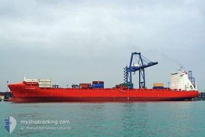
EM KEA
Container Ship

Current Trip
| Time Travelled | 3 days |
|---|---|
| Remaining Time | --- |
| Distance Travelled | 1406.20 nm |
| Remaining Distance | --- |
| AVG Speed | 15.8 Knots |
| MAX Speed | 19.6 Knots |
| AVG Wind | 11.9 knots |
| MAX Wind | 19.8 knots |
| MIN Temp | 11.4°C / 52.52°F |
| MAX Temp | 21.5°C / 70.7°F |
| Draught | 9.9 m |
| Position Received | 2 d ago |
Current Position
| Longitude | -7.36745° |
|---|---|
| Latitude | 49.68183° |
| Status | Under way using engine |
| Speed | 18 Knots |
| Course | 265.2° |
| Area | Celtic Sea |
| Station | T-AIS |
| Position Received | 2 d ago |
Information
The current position of EM KEA is in Celtic Sea with coordinates 49.68183° / -7.36745° as reported on 2025-05-20 16:34 by AIS to our vessel tracker app. The vessel's current speed is 18 Knots and is heading at the port of MONTREAL. The estimated time of arrival as calculated by MyShipTracking vessel tracking app is 2025-05-27 04:00 LT
The vessel EM KEA (IMO: 9334351, MMSI: 636015646) is a Container Ship that was built in 2007 ( 18 years old ). It's sailing under the flag of [LR] Liberia.
In this page you can find informations about the vessels current position, last detected port calls, and current voyage information. If the vessels is not in coverage by AIS you will find the latest position.
The current position of EM KEA is detected by our AIS receivers and we are not responsible for the reliability of the data. The last position was recorded while the vessel was in Coverage by the Ais receivers of our vessel tracking app.
The current draught of EM KEA as reported by AIS is 9.9 meters
Weather
| Temperature | 15.6°C / 60.08°F |
|---|---|
| Wind Speed | 19 knots |
| Direction | 200° SSW |
| Pressure | 1025.7 hPa |
| Humidity | 92.2 % |
| Cloud Coverage | 78 % |


Featured Company
Last Port Calls
| Port | Arrival | Departure | Time In Port |
|---|---|---|---|
| 2025-05-18 12:32 | 2025-05-19 14:27 | 1 d | |
| 2025-05-15 23:16 | 2025-05-16 22:32 | 23 h | |
| 2025-05-14 03:22 | 2025-05-15 01:49 | 22 h | |
| 2025-05-03 11:23 | 2025-05-04 01:52 | 14 h | |
| 2025-04-27 14:20 | 2025-04-30 09:22 | 2 d | |
| 2025-04-14 12:37 | 2025-04-15 02:52 | 14 h | |
| 2025-04-12 05:24 | 2025-04-13 04:39 | 23 h | |
| 2025-04-07 04:34 | 2025-04-08 14:02 | 1 d | |
| 2025-03-22 06:28 | 2025-03-23 00:52 | 18 h | |
| 2025-03-17 05:22 | 2025-03-19 06:08 | 2 d |
Most Visited Ports (Last year)
| Port | Arrivals | |
|---|---|---|
| 11 | ||
| 11 | ||
| 11 | ||
| 11 | ||
| 10 | ||
| 1 |
Last Trips
| Origin | Departure | Destination | Arrival | Distance | |
|---|---|---|---|---|---|
| 2025-05-16 22:32 | 2025-05-18 12:32 | 137.32 nm | |||
| 2025-05-15 01:49 | 2025-05-15 23:16 | 259.44 nm | |||
| 2025-05-04 01:52 | 2025-05-14 03:22 | 3252.06 nm | |||
| 2025-04-30 09:22 | 2025-05-03 11:23 | 964.29 nm | |||
| 2025-04-15 02:52 | 2025-04-27 14:20 | 4158.78 nm | |||
| 2025-04-13 04:39 | 2025-04-14 12:37 | 132.88 nm | |||
| 2025-04-08 14:02 | 2025-04-12 05:24 | 270.63 nm | |||
| 2025-03-23 00:52 | 2025-04-07 04:34 | 3126.66 nm | |||
| 2025-03-19 06:08 | 2025-03-22 06:28 | 966.57 nm | |||
| 2025-03-08 14:30 | 2025-03-17 05:22 | 3299.98 nm |
Events
| Time | Event | Details | Position / Dest | Info |
|---|---|---|---|---|
| 2025-05-20 16:40 | Status Changed | Default Under way using engine |
49.67932 / -7.41406
CAMTR
|
Speed: 18 kn Course: 265.2° |
| 2025-05-20 16:34 | OUT of Coverage |
49.68183 / -7.36745
Celtic Sea
CAMTR
|
Speed: 18 kn Course: 265.2° |
|
| 2025-05-20 16:17 | Status Changed | Under way using engine Default |
49.68930 / -7.23441
CAMTR
|
Speed: 17.9 kn Course: 265° |
| 2025-05-20 16:08 | Status Changed | Default Under way using engine |
49.69344 / -7.16268
CAMTR
|
Speed: 17.9 kn Course: 265.9° |
| 2025-05-20 16:02 | Status Changed | Under way using engine Default |
49.69556 / -7.12218
CAMTR
|
Speed: 17.9 kn Course: 265° |
| 2025-05-20 15:53 | IN Coverage |
49.69556 / -7.12218
Celtic Sea
CAMTR
|
Speed: 17.9 kn Course: 265.9° |
|
| 2025-05-20 15:04 | Status Changed | Default Under way using engine |
49.72056 / -6.67678
CAMTR
|
Speed: 18 kn Course: 264.1° |
| 2025-05-20 14:59 | OUT of Coverage |
49.72315 / -6.63230
Celtic Sea
CAMTR
|
Speed: 18 kn Course: 264.1° |
|
| 2025-05-20 14:43 | Status Changed | Under way using engine Default |
49.73019 / -6.51176
CAMTR
|
Speed: 17.8 kn Course: 268° |
| 2025-05-20 13:45 | Status Changed | Default Under way using engine |
49.73709 / -6.06292
CAMTR
|
Speed: 17.8 kn Course: 269.1° |