
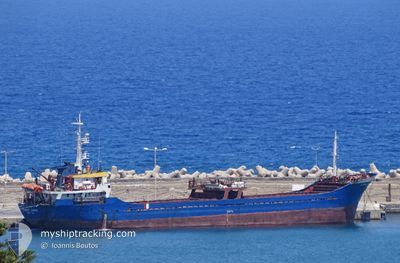
EMINE ANNE
General Cargo
Current Trip
TRDIL
| Time Travelled | 6 h, 3 mins |
|---|---|
| Remaining Time | --- |
| Distance Travelled | 1.20 nm |
| Remaining Distance | --- |
| AVG Speed | --- |
| MAX Speed | --- |
| AVG Wind | 5.4 knots |
| MAX Wind | 7 knots |
| MIN Temp | 14.7°C / 58.46°F |
| MAX Temp | 16°C / 60.8°F |
| Draught | 2.6 m |
| Position Received | 2 h, 41 m ago |
Current Position
| Longitude | 22.96356° |
|---|---|
| Latitude | 39.34170° |
| Status | At anchor |
| Speed | 0.3 Knots |
| Course | 104° |
| Area | Aegean Sea |
| Station | T-AIS |
| Position Received | 2 h, 41 m ago |
Info
Information
The current position of EMINE ANNE is in Aegean Sea with coordinates 39.34170° / 22.96356° as reported on 2026-01-07 18:37 by AIS to our vessel tracker app. The vessel's current speed is 0.3 Knots
The vessel EMINE ANNE (IMO: 9145360, MMSI: 577397000) is a General Cargo that was built in 1996 ( 30 years old ). It's sailing under the flag of [VU] Vanuatu.
In this page you can find informations about the vessels current position, last detected port calls, and current voyage information. If the vessels is not in coverage by AIS you will find the latest position.
The current position of EMINE ANNE is detected by our AIS receivers and we are not responsible for the reliability of the data. The last position was recorded while the vessel was in Coverage by the Ais receivers of our vessel tracking app.
The current draught of EMINE ANNE as reported by AIS is 2.6 meters
Weather
| Temperature | 14.7°C / 58.46°F |
|---|---|
| Wind Speed | 5 knots |
| Direction | 139° SE |
| Pressure | 1004.9 hPa |
| Humidity | 82 % |
| Cloud Coverage | 100 % |
Featured Company
Last Port Calls
| Port | Arrival | Departure | Time In Port |
|---|---|---|---|
| 2026-01-05 08:04 | 2026-01-07 17:16 | 2 d | |
| 2025-12-28 12:23 | 2025-12-31 01:48 | 2 d | |
| 2025-12-20 16:18 | 2025-12-24 12:32 | 3 d | |
| 2025-11-27 05:04 | 2025-11-30 15:37 | 3 d | |
| 2025-11-19 22:10 | 2025-11-21 16:36 | 1 d | |
| 2025-11-16 10:20 | 2025-11-17 06:41 | 20 h | |
| 2025-11-02 00:40 | 2025-11-03 12:31 | 1 d |
Most Visited Ports (Last year)
| Port | Arrivals | |
|---|---|---|
| 6 | ||
| 5 | ||
| 5 | ||
| 4 | ||
| 3 | ||
| 3 |
Last Trips
| Origin | Departure | Destination | Arrival | Distance | |
|---|---|---|---|---|---|
| 2025-12-31 01:48 | 2026-01-05 08:04 | 355.88 nm | |||
| 2025-12-24 12:32 | 2025-12-28 12:23 | 358.40 nm | |||
| 2025-11-30 15:37 | 2025-12-20 16:18 | 1426.41 nm | |||
| 2025-11-21 16:36 | 2025-11-27 05:04 | 732.28 nm | |||
| 2025-11-17 06:41 | 2025-11-19 22:10 | 58.40 nm | |||
| 2025-11-03 12:31 | 2025-11-16 10:20 | 608.12 nm | |||
| 2025-10-29 02:44 | 2025-11-02 00:40 | 284.97 nm |
Events
| Time | Event | Details | Position / Dest | Info |
|---|---|---|---|---|
| 2026-01-07 18:43 | Status Changed | Default At anchor |
39.34226 / 22.96411
TRDIL
|
Speed: 0.3 kn Course: 104° |
| 2026-01-07 18:37 | Status Changed | At anchor Default |
39.34170 / 22.96356
TRDIL
|
Speed: 0.4 kn Course: 109° |
| 2026-01-07 18:37 | OUT of Coverage |
39.34170 / 22.96356
Aegean Sea
|
Speed: 0.3 kn Course: 243.2° |
|
| 2026-01-07 18:19 | IN Coverage |
39.34170 / 22.96356
Aegean Sea
|
Speed: 0.3 kn Course: 243.2° |
|
| 2026-01-07 15:32 | STOP Moving | 1.03 nm, South East of VOLOS |
39.34167 / 22.96333
TRDIL
|
Speed: Course: -1° |
| 2026-01-07 15:16 | PORT DEPARTURE |
|
39.34446 / 22.95928
TRDIL
|
Speed: 4.9 kn Course: 126° |
| 2026-01-07 15:05 | START Moving |
39.35110 / 22.94103
[GR] VOLOS
|
Speed: 3.8 kn Course: 108° |
|
| 2026-01-07 05:06 | Status Changed | Default Moored |
39.35801 / 22.94024
[GR] VOLOS
|
Speed: Course: 174° |
| 2026-01-07 05:03 | Status Changed | Moored Default |
39.35799 / 22.94025
[GR] VOLOS
|
Speed: Course: 177° |
| 2026-01-07 05:03 | OUT of Coverage |
39.35799 / 22.94025
Aegean Sea
[GR] VOLOS
|
Speed: Course: 112.3° |