
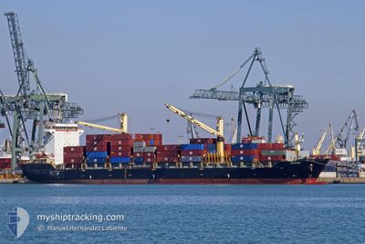
EMORA
Container Ship
Current Trip
| Trip Time | 4 days |
|---|---|
| Trip Distance | 991.70 nm |
| AVG Speed | 13.2 Knots |
| MAX Speed | 18.3 Knots |
| Draught | 9.7 m |
| AVG Wind | 9.8 knots |
| MAX Wind | 27 knots |
| MIN Temp | 24.1°C / 75.38°F |
| MAX Temp | 29.3°C / 84.74°F |
| Position Received | 4 d ago |
Current Position
| Longitude | 121.71375° |
|---|---|
| Latitude | 11.89801° |
| Status | Under way using engine |
| Speed | 16 Knots |
| Course | 227° |
| Area | Philippine Sea |
| Station | T-AIS |
| Position Received | 4 d ago |
Info
Information
The current position of EMORA is in Philippine Sea with coordinates 11.89801° / 121.71375° as reported on 2025-01-29 11:24 by AIS to our vessel tracker app. The vessel's current speed is 16 Knots and is currently inside the port of GENERAL SANTOS.
The vessel EMORA (IMO: 9362700, MMSI: 356298000) is a Container Ship that was built in 2007 ( 18 years old ). It's sailing under the flag of [PA] Panama.
In this page you can find informations about the vessels current position, last detected port calls, and current voyage information. If the vessels is not in coverage by AIS you will find the latest position.
The current position of EMORA is detected by our AIS receivers and we are not responsible for the reliability of the data. The last position was recorded while the vessel was in Coverage by the Ais receivers of our vessel tracking app.
The current draught of EMORA as reported by AIS is 9.7 meters
Weather
| Temperature | 24.5°C / 76.1°F |
|---|---|
| Wind Speed | 4 knots |
| Direction | 32° NNE |
| Pressure | 1009.2 hPa |
| Humidity | 82.4 % |
| Cloud Coverage | 100 % |
Featured Company
Last Port Calls
| Port | Arrival | Departure | Time In Port |
|---|---|---|---|
| 2025-02-02 07:25 | |||
| 2025-01-28 09:45 | 2025-01-29 03:03 | 17 h | |
| 2025-01-25 08:33 | 2025-01-26 13:42 | 1 d | |
| 2025-01-20 04:41 | 2025-01-21 21:33 | 1 d | |
| 2025-01-13 12:34 | 2025-01-14 11:17 | 22 h | |
| 2025-01-06 07:45 | 2025-01-07 08:29 | 1 d | |
| 2024-12-26 06:57 | 2024-12-27 09:21 | 1 d | |
| 2024-12-21 20:01 | 2024-12-22 23:21 | 1 d | |
| 2024-12-11 08:23 | 2024-12-12 08:55 | 1 d | |
| 2024-12-06 02:36 | 2024-12-07 16:20 | 1 d |
Most Visited Ports (Last year)
| Port | Arrivals | |
|---|---|---|
| 27 | ||
| 26 | ||
| 1 |
Last Trips
| Origin | Departure | Destination | Arrival | Distance | |
|---|---|---|---|---|---|
| 2025-01-29 11:03 | 2025-02-02 15:25 | 991.70 nm | |||
| 2025-01-26 21:42 | 2025-01-28 17:45 | 634.33 nm | |||
| 2025-01-22 05:33 | 2025-01-25 16:33 | 1181.00 nm | |||
| 2025-01-14 19:17 | 2025-01-20 12:41 | 1510.67 nm | |||
| 2025-01-07 16:29 | 2025-01-13 20:34 | 1343.12 nm | |||
| 2024-12-27 17:21 | 2025-01-06 15:45 | 1873.97 nm | |||
| 2024-12-23 07:21 | 2024-12-26 14:57 | 1195.17 nm | |||
| 2024-12-12 16:55 | 2024-12-22 04:01 | 1827.98 nm | |||
| 2024-12-08 00:20 | 2024-12-11 16:23 | 1183.31 nm | |||
| 2024-11-30 21:15 | 2024-12-06 10:36 | 1532.59 nm |
Events
| Time | Event | Details | Position / Dest | Info |
|---|---|---|---|---|
| 2025-02-02 08:17 | STOP Moving |
6.09413 / 125.15990
[PH] GENERAL SANTOS
|
Speed: 0.1 kn Course: 58° |
|
| 2025-02-02 07:25 | PORT ARRIVAL |
|
6.06473 / 125.17561
[PH] GENERAL SANTOS
|
Speed: 6.5 kn Course: 356° |
| 2025-02-02 06:37 | START Moving | 7.32 nm, South of GENERAL SANTOS |
5.96133 / 125.15480
TWKSG-PHBTG
|
Speed: 3.2 kn Course: 341° |
| 2025-02-02 05:45 | STOP Moving | 7.18 nm, South of GENERAL SANTOS |
5.96274 / 125.16388
TWKSG-PHBTG
|
Speed: 0.3 kn Course: 20° |
| 2025-02-01 18:57 | START Moving | 5.86 nm, North of DAVAO |
7.21231 / 125.65565
TWKSG-PHBTG
|
Speed: 3.8 kn Course: 65° |
| 2025-01-31 12:09 | STOP Moving | 5.79 nm, North of DAVAO |
7.21076 / 125.65222
TWKSG-PHBTG
|
Speed: 0.1 kn Course: 319° |
| 2025-01-31 11:49 | START Moving | 5.64 nm, North of DAVAO |
7.20868 / 125.66472
TWKSG-PHBTG
|
Speed: 5.1 kn Course: 270° |
| 2025-01-31 11:29 | STOP Moving | 5.75 nm, North of DAVAO |
7.21025 / 125.66813
TWKSG-PHBTG
|
Speed: 0.3 kn Course: 250° |
| 2025-01-29 11:46 | Status Changed | Default Under way using engine |
11.80576 / 121.65527
TWKSG-PHBTG
|
Speed: 16 kn Course: 227° |
| 2025-01-29 11:24 | OUT of Coverage |
11.89801 / 121.71375
Philippine Sea
|
Speed: 16 kn Course: 227° |