
ERNE
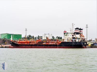
Oil/Chemical Tanker
Current Trip
| Trip Time | 2 days |
|---|---|
| Trip Distance | 181.28 nm |
| AVG Speed | 7.9 Knots |
| MAX Speed | 11.2 Knots |
| Draught | 7.9 m |
| AVG Wind | 9 knots |
| MAX Wind | 19 knots |
| MIN Temp | 5.5°C / 41.9°F |
| MAX Temp | 11.3°C / 52.34°F |
| Position Received | Now |
Current Position
| Longitude | 0.26650° |
|---|---|
| Latitude | 51.46358° |
| Status | Moored |
| Speed | |
| Course | 122° |
| Area | North Sea |
| Station | T-AIS |
| Position Received | Now |
Info
Information
The current position of ERNE is in North Sea with coordinates 51.46358° / 0.26650° as reported on 2025-03-20 22:21 by AIS to our vessel tracker app. The vessel's current speed is 0 Knots and is currently inside the port of PURFLEET.
The vessel ERNE (IMO: 9393072, MMSI: 249706000) is a Oil/Chemical Tanker that was built in 2009 ( 16 years old ). It's sailing under the flag of [MT] Malta.
In this page you can find informations about the vessels current position, last detected port calls, and current voyage information. If the vessels is not in coverage by AIS you will find the latest position.
The current position of ERNE is detected by our AIS receivers and we are not responsible for the reliability of the data. The last position was recorded while the vessel was in Coverage by the Ais receivers of our vessel tracking app.
The current draught of ERNE as reported by AIS is 7.9 meters
Weather
| Temperature | 10.8°C / 51.44°F |
|---|---|
| Wind Speed | 5 knots |
| Direction | 102° ESE |
| Pressure | 1016.9 hPa |
| Humidity | 78.2 % |
| Cloud Coverage | 33 % |
Featured Company
Last Port Calls
| Port | Arrival | Departure | Time In Port |
|---|---|---|---|
| 2025-03-19 23:23 | |||
| 2025-03-16 15:07 | 2025-03-17 20:14 | 1 d | |
| 2025-03-05 22:35 | 2025-03-07 16:32 | 1 d | |
| 2025-03-01 17:18 | 2025-03-02 16:56 | 23 h | |
| 2025-02-24 18:07 | 2025-02-27 07:53 | 2 d | |
| 2025-02-14 09:46 | 2025-02-15 11:46 | 1 d | |
| 2025-02-12 19:47 | 2025-02-12 20:21 | 34 m | |
| 2025-02-10 20:37 | 2025-02-12 18:46 | 1 d | |
| 2025-02-10 18:59 | 2025-02-10 19:25 | 25 m | |
| 2025-01-29 12:21 | 2025-02-09 13:37 | 11 d |
Last Trips
| Origin | Departure | Destination | Arrival | Distance | |
|---|---|---|---|---|---|
| 2025-03-17 20:14 | 2025-03-19 23:23 | 181.28 nm | |||
| 2025-03-07 16:32 | 2025-03-16 15:07 | 305.99 nm | |||
| 2025-03-02 16:56 | 2025-03-05 22:35 | 207.64 nm | |||
| 2025-02-27 07:53 | 2025-03-01 17:18 | 154.38 nm | |||
| 2025-02-15 11:46 | 2025-02-24 18:07 | 503.81 nm | |||
| 2025-02-12 20:21 | 2025-02-14 09:46 | 326.06 nm | |||
| 2025-02-12 18:46 | 2025-02-12 19:47 | 4.34 nm | |||
| 2025-02-10 19:25 | 2025-02-10 20:37 | 8.13 nm | |||
| 2025-02-09 13:37 | 2025-02-10 18:59 | 75.58 nm | |||
| 2025-01-04 20:02 | 2025-01-29 12:21 | 994.04 nm |
Events
| Time | Event | Details | Position / Dest | Info |
|---|---|---|---|---|
| 2025-03-19 23:42 | Status Changed | Moored Under way using engine |
51.46358 / .26654
[GB] PURFLEET
|
Speed: Course: 124° |
| 2025-03-19 23:23 | PORT ARRIVAL |
|
51.46311 / .26610
[GB] PURFLEET
|
Speed: 0.3 kn Course: 123° |
| 2025-03-19 23:16 | STOP Moving | 0.51 nm, South East of PURFLEET |
51.46266 / .26549
GBTHS
|
Speed: 0.3 kn Course: 120° |
| 2025-03-19 20:03 | START Moving | 4.88 nm, North East of SHEERNESS |
51.49716 / .83375
GBTHS
|
Speed: 3.4 kn Course: 261° |
| 2025-03-19 15:46 | STOP Moving | 4.98 nm, North East of SHEERNESS |
51.49875 / .83519
GBTHS
|
Speed: 0.3 kn Course: 218° |
| 2025-03-19 12:19 | START Moving | 5.48 nm, North of RAMSGATE |
51.41699 / 1.41993
GBTHS
|
Speed: 4.3 kn Course: 83° |
| 2025-03-19 12:19 | Status Changed | Under way using engine At anchor |
51.41692 / 1.41908
GBTHS
|
Speed: 4.3 kn Course: 82° |
| 2025-03-18 09:42 | STOP Moving | 5.48 nm, North of RAMSGATE |
51.41682 / 1.41696
GBTHS
|
Speed: 0.3 kn Course: 73° |
| 2025-03-18 09:40 | Status Changed | At anchor Under way using engine |
51.41702 / 1.41551
GBTHS
|
Speed: 2 kn Course: 88° |
| 2025-03-18 03:22 | Detected in Sea | United Kingdom part of the North Sea |
51.82417 / 2.49872
North Sea
GBTHS
|
Speed: 8 kn Course: 222.1° |