

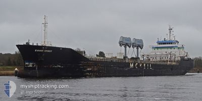
EVANS SPIRIT
General Cargo
Current Trip
| Time Travelled | 1 day |
|---|---|
| Remaining Time | --- |
| Distance Travelled | 308.95 nm |
| Remaining Distance | --- |
| AVG Speed | 9.3 Knots |
| MAX Speed | 14.4 Knots |
| AVG Wind | 9.6 knots |
| MAX Wind | 17 knots |
| MIN Temp | 13.6°C / 56.48°F |
| MAX Temp | 25.5°C / 77.9°F |
| Draught | 5.1 m |
| Position Received | Now |
Current Position
| Longitude | -82.45033° |
|---|---|
| Latitude | 43.32932° |
| Status | Under way using engine |
| Speed | 13.6 Knots |
| Course | 353.9° |
| Area | Gulf of St-Lawrence |
| Station | T-AIS |
| Position Received | Now |
Information
The current position of EVANS SPIRIT is in Gulf of St-Lawrence with coordinates 43.32932° / -82.45033° as reported on 2025-06-05 19:28 by AIS to our vessel tracker app. The vessel's current speed is 13.6 Knots and is heading at the port of THUNDER BAY. The estimated time of arrival as calculated by MyShipTracking vessel tracking app is 2025-06-07 08:00 LT
The vessel EVANS SPIRIT (IMO: 9327774, MMSI: 316014170) is a General Cargo that was built in 2007 ( 18 years old ). It's sailing under the flag of [CA] Canada.
In this page you can find informations about the vessels current position, last detected port calls, and current voyage information. If the vessels is not in coverage by AIS you will find the latest position.
The current position of EVANS SPIRIT is detected by our AIS receivers and we are not responsible for the reliability of the data. The last position was recorded while the vessel was in Coverage by the Ais receivers of our vessel tracking app.
The current draught of EVANS SPIRIT as reported by AIS is 5.1 meters
Weather
| Temperature | 14.8°C / 58.64°F |
|---|---|
| Wind Speed | 9 knots |
| Direction | 39° NE |
| Pressure | 1018.5 hPa |
| Humidity | 81.5 % |
| Cloud Coverage | 100 % |
Featured Company
Last Port Calls
| Port | Arrival | Departure | Time In Port |
|---|---|---|---|
| 2025-06-04 07:29 | 2025-06-04 08:26 | 57 m | |
| 2025-06-01 08:28 | 2025-06-04 05:01 | 2 d | |
| 2025-05-30 21:16 | 2025-05-30 22:05 | 49 m | |
| 2025-05-27 14:36 | 2025-05-28 16:08 | 1 d | |
| 2025-05-23 00:25 | 2025-05-25 15:34 | 2 d | |
| 2025-05-21 15:13 | 2025-05-21 15:59 | 46 m | |
| 2025-05-20 05:59 | 2025-05-20 10:01 | 4 h | |
| 2025-05-17 08:20 | 2025-05-19 19:36 | 2 d | |
| 2025-05-15 14:15 | 2025-05-15 17:54 | 3 h | |
| 2025-05-08 23:32 | 2025-05-15 11:24 | 6 d |
Most Visited Ports (Last year)
| Port | Arrivals | |
|---|---|---|
| 32 | ||
| 28 | ||
| 12 | ||
| 11 | ||
| 9 | ||
| 7 |
Last Trips
| Origin | Departure | Destination | Arrival | Distance | |
|---|---|---|---|---|---|
| 2025-06-04 05:01 | 2025-06-04 07:29 | 27.08 nm | |||
| 2025-05-30 22:05 | 2025-06-01 08:28 | 314.05 nm | |||
| 2025-05-28 16:08 | 2025-05-30 21:16 | 605.97 nm | |||
| 2025-05-25 15:34 | 2025-05-27 14:36 | 598.59 nm | |||
| 2025-05-21 15:59 | 2025-05-23 00:25 | 295.48 nm | |||
| 2025-05-20 10:01 | 2025-05-21 15:13 | 232.11 nm | |||
| 2025-05-19 19:36 | 2025-05-20 05:59 | 112.31 nm | |||
| 2025-05-15 17:54 | 2025-05-17 08:20 | 344.90 nm | |||
| 2025-05-15 11:24 | 2025-05-15 14:15 | 28.24 nm | |||
| 2025-05-07 11:32 | 2025-05-08 23:32 | 315.39 nm |
Events
| Time | Event | Details | Position / Dest | Info |
|---|---|---|---|---|
| 2025-06-05 12:17 | Draught Changed | 5.1 7.7 |
42.25230 / -83.11941
CATHU
|
Speed: 10.3 kn Course: 29.7° |
| 2025-06-05 07:06 | Destination Changed | CATHU CAHAM |
41.88925 / -82.19562
CATHU
|
Speed: 14.1 kn Course: 248.5° |
| 2025-06-05 07:06 | ETA Changed | 2025/06/07 12:00 2025/06/01 05:00 |
41.88925 / -82.19562
CATHU
|
Speed: 14.1 kn Course: 248.5° |
| 2025-06-05 06:23 | Status Changed | Under way using engine Default |
41.94850 / -81.98783
CAHAM
|
Speed: 14.3 kn Course: 249° |
| 2025-06-05 06:20 | IN Coverage |
41.94850 / -81.98783
Gulf of St-Lawrence
|
Speed: 14.3 kn Course: 249.1° |
|
| 2025-06-05 02:30 | OUT of Coverage |
42.28164 / -80.82614
Gulf of St-Lawrence
|
Speed: 14.2 kn Course: 249.4° |
|
| 2025-06-04 20:23 | START Moving | 0.83 nm, North of PORT COLBORNE |
42.89515 / -79.24694
CAHAM
|
Speed: 3.1 kn Course: 191° |
| 2025-06-04 20:13 | STOP Moving | 1.08 nm, North of PORT COLBORNE |
42.89930 / -79.24596
CAHAM
|
Speed: 0.1 kn Course: 189° |
| 2025-06-04 17:48 | START Moving | 5.72 nm, South East of DALHOUSIE |
43.11902 / -79.19479
CAHAM
|
Speed: 3.3 kn Course: 192° |
| 2025-06-04 15:26 | STOP Moving | 4.95 nm, South East of DALHOUSIE |
43.13693 / -79.19259
CAHAM
|
Speed: Course: 182° |