
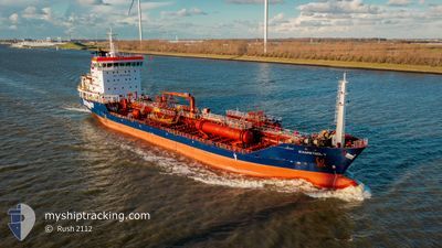
EVIAPETROL V
Oil/Chemical Tanker
Current Trip
| Time Travelled | 7 days |
|---|---|
| Remaining Time | --- |
| Distance Travelled | 949.30 nm |
| Remaining Distance | --- |
| AVG Speed | 8.8 Knots |
| MAX Speed | 13.9 Knots |
| AVG Wind | 17 knots |
| MAX Wind | 27 knots |
| MIN Temp | -1°C / 30.2°F |
| MAX Temp | 9.7°C / 49.46°F |
| Draught | 6.8 m |
| Position Received | 3 m ago |
Current Position
| Longitude | 28.74159° |
|---|---|
| Latitude | 40.95160° |
| Status | At anchor |
| Speed | 1.2 Knots |
| Course | 340° |
| Area | Sea of Marmara |
| Station | T-AIS |
| Position Received | 3 m ago |
Info
Information
The current position of EVIAPETROL V is in Sea of Marmara with coordinates 40.95160° / 28.74159° as reported on 2025-02-12 10:29 by AIS to our vessel tracker app. The vessel's current speed is 1.2 Knots and is heading at the port of VILLAGARCIA. The estimated time of arrival as calculated by MyShipTracking vessel tracking app is 2025-02-21 01:00 LT
The vessel EVIAPETROL V (IMO: 9358503, MMSI: 241344000) is a Oil/Chemical Tanker that was built in 2007 ( 18 years old ). It's sailing under the flag of [GR] Greece.
In this page you can find informations about the vessels current position, last detected port calls, and current voyage information. If the vessels is not in coverage by AIS you will find the latest position.
The current position of EVIAPETROL V is detected by our AIS receivers and we are not responsible for the reliability of the data. The last position was recorded while the vessel was in Coverage by the Ais receivers of our vessel tracking app.
The current draught of EVIAPETROL V as reported by AIS is 6.8 meters
Weather
| Temperature | 5.4°C / 41.72°F |
|---|---|
| Wind Speed | 12 knots |
| Direction | 17° NNE |
| Pressure | 1029.6 hPa |
| Humidity | 74.9 % |
| Cloud Coverage | 99 % |
Featured Company
Last Port Calls
| Port | Arrival | Departure | Time In Port |
|---|---|---|---|
| 2025-02-03 09:14 | 2025-02-05 07:24 | 1 d | |
| 2025-01-28 11:03 | 2025-01-30 00:06 | 1 d | |
| 2025-01-25 08:20 | 2025-01-27 08:37 | 2 d | |
| 2025-01-20 02:08 | 2025-01-21 06:51 | 1 d | |
| 2025-01-14 22:01 | 2025-01-16 07:21 | 1 d | |
| 2025-01-09 09:36 | 2025-01-12 10:01 | 3 d | |
| 2025-01-05 12:58 | 2025-01-07 03:44 | 1 d | |
| 2025-01-02 13:28 | |||
| 2025-01-01 14:25 | 2025-01-02 12:51 | 22 h | |
| 2024-12-16 12:46 | 2024-12-17 13:46 | 1 d |
Most Visited Ports (Last year)
| Port | Arrivals | |
|---|---|---|
| 7 | ||
| 6 | ||
| 5 | ||
| 4 | ||
| 3 | ||
| 2 |
Last Trips
| Origin | Departure | Destination | Arrival | Distance | |
|---|---|---|---|---|---|
| 2025-01-30 00:06 | 2025-02-03 09:14 | 1147.25 nm | |||
| 2025-01-27 08:37 | 2025-01-28 11:03 | 255.51 nm | |||
| 2025-01-21 06:51 | 2025-01-25 08:20 | 997.21 nm | |||
| 2025-01-16 07:21 | 2025-01-20 02:08 | 987.75 nm | |||
| 2025-01-12 10:01 | 2025-01-14 22:01 | 741.21 nm | |||
| 2025-01-07 03:44 | 2025-01-09 09:36 | 634.60 nm | |||
| 2025-01-02 12:51 | 2025-01-02 13:28 | 6.63 nm | |||
| 2024-12-17 13:46 | 2025-01-01 14:25 | 927.45 nm | |||
| 2024-12-12 15:35 | 2024-12-16 12:46 | 266.11 nm | |||
| 2024-12-08 14:40 | 2024-12-09 16:55 | 265.16 nm |
Events
| Time | Event | Details | Position / Dest | Info |
|---|---|---|---|---|
| 2025-02-12 10:27 | Status Changed | At anchor Under way using engine |
40.95213 / 28.74147
ESVIL
|
Speed: 0.4 kn Course: 343° |
| 2025-02-12 10:24 | STOP Moving | 3.09 nm, East of AMBARLI |
40.95224 / 28.74160
ESVIL
|
Speed: 0.3 kn Course: 321° |
| 2025-02-12 10:14 | Status Changed | Under way using engine At anchor |
40.94150 / 28.74935
ESVIL
|
Speed: 8.5 kn Course: 304.8° |
| 2025-02-12 07:41 | Change Sea Area | Turkish part of the Sea of Marmara Turkish part of the Black Sea |
41.23372 / 29.12790
Sea of Marmara
ESVIL
|
Speed: 8.1 kn Course: 181.5° |
| 2025-02-12 06:57 | START Moving | 6.21 nm, North West of RUMELI FENERI |
41.27283 / 28.98752
ESVIL
|
Speed: 4.1 kn Course: 71° |
| 2025-02-12 06:53 | Status Changed | At anchor Default |
41.27161 / 28.98605
ESVIL
|
Speed: 0.7 kn Course: 332° |
| 2025-02-12 06:44 | Status Changed | Default At anchor |
41.27101 / 28.98722
ESVIL
|
Speed: 0.2 kn Course: 338° |
| 2025-02-12 04:20 | Status Changed | At anchor Default |
41.27049 / 28.98776
ESVIL
|
Speed: 0.1 kn Course: 313° |
| 2025-02-12 04:11 | Status Changed | Default At anchor |
41.27072 / 28.98800
ESVIL
|
Speed: 0.1 kn Course: 324° |
| 2025-02-11 22:17 | STOP Moving | 6.14 nm, North West of RUMELI FENERI |
41.27052 / 28.98781
ESVIL
|
Speed: 0.2 kn Course: 310° |