
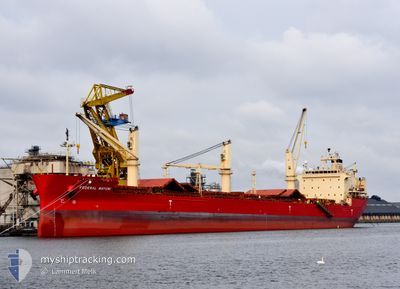
FEDERAL MAYUMI
Bulk Carrier
Current Trip
| Time Travelled | 1 day |
|---|---|
| Remaining Time | --- |
| Distance Travelled | 388.86 nm |
| Remaining Distance | --- |
| AVG Speed | 10.9 Knots |
| MAX Speed | 15.8 Knots |
| AVG Wind | 4.6 knots |
| MAX Wind | 13.6 knots |
| MIN Temp | -15.5°C / 4.1°F |
| MAX Temp | -5.9°C / 21.38°F |
| Draught | 10.5 m |
| Position Received | 21 h, 14 m ago |
Current Position
| Longitude | -70.63259° |
|---|---|
| Latitude | 47.17493° |
| Status | Under way using engine |
| Speed | 12 Knots |
| Course | 45.8° |
| Area | Gulf of St-Lawrence |
| Station | T-AIS |
| Position Received | 21 h, 14 m ago |
Info
Information
The current position of FEDERAL MAYUMI is in Gulf of St-Lawrence with coordinates 47.17493° / -70.63259° as reported on 2025-02-09 08:41 by AIS to our vessel tracker app. The vessel's current speed is 12 Knots and is heading at the port of BELFAST. The estimated time of arrival as calculated by MyShipTracking vessel tracking app is 2025-02-18 12:00 LT
The vessel FEDERAL MAYUMI (IMO: 9529578, MMSI: 538004646) is a Bulk Carrier that was built in 2012 ( 13 years old ). It's sailing under the flag of [MH] Marshall Is.
In this page you can find informations about the vessels current position, last detected port calls, and current voyage information. If the vessels is not in coverage by AIS you will find the latest position.
The current position of FEDERAL MAYUMI is detected by our AIS receivers and we are not responsible for the reliability of the data. The last position was recorded while the vessel was in Coverage by the Ais receivers of our vessel tracking app.
The current draught of FEDERAL MAYUMI as reported by AIS is 10.5 meters
Weather
| Temperature | -12.4°C / 9.68°F |
|---|---|
| Wind Speed | 14 knots |
| Direction | 351° N |
| Pressure | 1020.3 hPa |
| Humidity | 67.2 % |
| Cloud Coverage | 100 % |
Featured Company
Last Trips
| Origin | Departure | Destination | Arrival | Distance | |
|---|---|---|---|---|---|
| 2025-01-23 21:19 | 2025-02-02 08:00 | 505.02 nm | |||
| 2024-12-19 19:55 | 2025-01-20 16:09 | 6729.06 nm | |||
| 2024-12-14 08:38 | 2024-12-17 03:36 | 172.78 nm | |||
| 2024-12-02 00:20 | 2024-12-11 12:23 | 2289.30 nm |
Events
| Time | Event | Details | Position / Dest | Info |
|---|---|---|---|---|
| 2025-02-09 08:46 | Status Changed | Default Under way using engine |
47.18843 / -70.61555
GBBEL
|
Speed: 12 kn Course: 45.8° |
| 2025-02-09 08:41 | OUT of Coverage |
47.17493 / -70.63259
Gulf of St-Lawrence
GBBEL
|
Speed: 12 kn Course: 45.8° |
|
| 2025-02-09 08:33 | Status Changed | Under way using engine Default |
47.15675 / -70.65959
GBBEL
|
Speed: 11.7 kn Course: 33° |
| 2025-02-09 08:26 | Status Changed | Default Under way using engine |
47.13848 / -70.67802
GBBEL
|
Speed: 11.6 kn Course: 34.3° |
| 2025-02-09 06:23 | Status Changed | Under way using engine Default |
46.85426 / -71.00655
GBBEL
|
Speed: 10.6 kn Course: 73° |
| 2025-02-09 06:06 | Status Changed | Default Under way using engine |
46.84178 / -71.07628
GBBEL
|
Speed: 10.8 kn Course: 90.9° |
| 2025-02-09 04:02 | Status Changed | Under way using engine Default |
46.70387 / -71.49846
GBBEL
|
Speed: 13.9 kn Course: 66° |
| 2025-02-09 03:55 | IN Coverage |
46.70573 / -71.48694
Gulf of St-Lawrence
GBBEL
|
Speed: 13.1 kn Course: 77.1° |
|
| 2025-02-08 22:03 | Status Changed | Default Under way using engine |
46.12823 / -72.95605
GBBEL
|
Speed: 11.3 kn Course: 29.1° |
| 2025-02-08 21:59 | OUT of Coverage |
46.11770 / -72.96155
Gulf of St-Lawrence
GBBEL
|
Speed: 11.3 kn Course: 29.1° |