
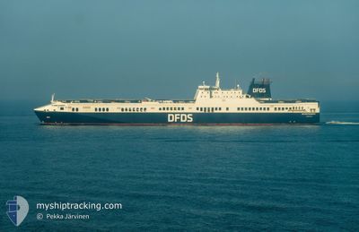
FICARIA SEAWAYS
Ro-Ro Cargo
Current Trip
| Time Travelled | 1 day |
|---|---|
| Remaining Time | 1 h, 26 mins |
| Distance Travelled | 470.04 nm |
| Remaining Distance | 33.79 nm |
| AVG Speed | 18.7 Knots |
| MAX Speed | 21.5 Knots |
| AVG Wind | 17.8 knots |
| MAX Wind | 30 knots |
| MIN Temp | 2.5°C / 36.5°F |
| MAX Temp | 8°C / 46.4°F |
| Draught | 6.6 m |
| Position Received | Now |
Current Position
| Longitude | 0.45225° |
|---|---|
| Latitude | 53.70254° |
| Status | Under way using engine |
| Speed | 19.7 Knots |
| Course | 224.5° |
| Area | North Sea |
| Station | T-AIS |
| Position Received | Now |
Info
Information
The current position of FICARIA SEAWAYS is in North Sea with coordinates 53.70254° / 0.45225° as reported on 2025-02-04 19:53 by AIS to our vessel tracker app. The vessel's current speed is 19.7 Knots and is heading at the port of IMMINGHAM. The estimated time of arrival as calculated by MyShipTracking vessel tracking app is 2025-02-04 21:20 LT
The vessel FICARIA SEAWAYS (IMO: 9320568, MMSI: 220464000) is a Ro-Ro Cargo that was built in 2006 ( 19 years old ). It's sailing under the flag of [DK] Denmark.
In this page you can find informations about the vessels current position, last detected port calls, and current voyage information. If the vessels is not in coverage by AIS you will find the latest position.
The current position of FICARIA SEAWAYS is detected by our AIS receivers and we are not responsible for the reliability of the data. The last position was recorded while the vessel was in Coverage by the Ais receivers of our vessel tracking app.
The current draught of FICARIA SEAWAYS as reported by AIS is 6.6 meters
Weather
| Temperature | 7.8°C / 46.04°F |
|---|---|
| Wind Speed | 20 knots |
| Direction | 238° WSW |
| Pressure | 1018.3 hPa |
| Humidity | 77.8 % |
| Cloud Coverage | 100 % |
Featured Company
Last Port Calls
| Port | Arrival | Departure | Time In Port |
|---|---|---|---|
| 2025-02-02 15:20 | 2025-02-03 19:28 | 1 d | |
| 2025-02-01 05:01 | 2025-02-01 12:51 | 7 h | |
| 2025-01-30 22:53 | 2025-01-31 02:41 | 3 h | |
| 2025-01-30 07:32 | 2025-01-30 16:21 | 8 h | |
| 2025-01-28 22:17 | 2025-01-29 06:06 | 7 h | |
| 2025-01-26 19:13 | 2025-01-27 19:44 | 1 d | |
| 2025-01-25 09:08 | 2025-01-25 17:24 | 8 h | |
| 2025-01-23 23:18 | 2025-01-24 03:37 | 4 h | |
| 2025-01-23 07:30 | 2025-01-23 17:22 | 9 h | |
| 2025-01-21 22:15 | 2025-01-22 05:49 | 7 h |
Last Trips
| Origin | Departure | Destination | Arrival | Distance | |
|---|---|---|---|---|---|
| 2025-02-01 12:51 | 2025-02-02 16:20 | 499.26 nm | |||
| 2025-01-31 03:41 | 2025-02-01 05:01 | 489.13 nm | |||
| 2025-01-30 17:21 | 2025-01-30 23:53 | 116.14 nm | |||
| 2025-01-29 06:06 | 2025-01-30 08:32 | 501.00 nm | |||
| 2025-01-27 20:44 | 2025-01-28 22:17 | 502.03 nm | |||
| 2025-01-25 17:24 | 2025-01-26 20:13 | 499.88 nm | |||
| 2025-01-24 04:37 | 2025-01-25 09:08 | 537.97 nm | |||
| 2025-01-23 18:22 | 2025-01-24 00:18 | 115.27 nm | |||
| 2025-01-22 05:49 | 2025-01-23 08:30 | 499.53 nm | |||
| 2025-01-20 19:46 | 2025-01-21 22:15 | 501.41 nm |
Events
| Time | Event | Details | Position / Dest | Info |
|---|---|---|---|---|
| 2025-02-04 19:25 | Change Sea Area | United Kingdom part of the North Sea Dutch part of the North Sea |
53.76871 / .67323
North Sea
|
Speed: 18.9 kn Course: 247.5° |
| 2025-02-04 19:23 | Status Changed | Under way using engine Default |
53.77320 / .69119
GB IMM
|
Speed: 19 kn Course: 244° |
| 2025-02-04 19:12 | IN Coverage |
53.76871 / .67323
North Sea
|
Speed: 18.9 kn Course: 247.5° |
|
| 2025-02-04 11:10 | Status Changed | Default Under way using engine |
55.30306 / 4.32462
GB IMM
|
Speed: 19.2 kn Course: 229.4° |
| 2025-02-04 11:09 | OUT of Coverage |
55.30759 / 4.33375
North Sea
|
Speed: 19.2 kn Course: 229.4° |
|
| 2025-02-04 11:08 | Change Sea Area | Dutch part of the North Sea German part of the North Sea |
55.30973 / 4.33813
North Sea
|
Speed: 19.1 kn Course: 228° |
| 2025-02-04 10:22 | Change Sea Area | German part of the North Sea Danish part of the North Sea |
55.46672 / 4.66470
North Sea
|
Speed: 19.1 kn Course: 233.1° |
| 2025-02-04 01:59 | Change Sea Area | Danish part of the North Sea Danish part of the Skaggerak |
57.25328 / 8.36955
North Sea
|
Speed: 19.7 kn Course: 221.7° |
| 2025-02-03 21:17 | Change Sea Area | Danish part of the Skaggerak Danish part of the Kattegat |
57.80773 / 10.93532
Skaggerak
|
Speed: 20.1 kn Course: 299.4° |
| 2025-02-03 20:59 | Change Sea Area | Danish part of the Kattegat Swedish part of the Kattegat |
57.75952 / 11.09794
Kattegat
|
Speed: 19.8 kn Course: 299.4° |